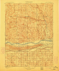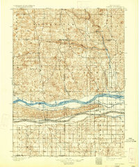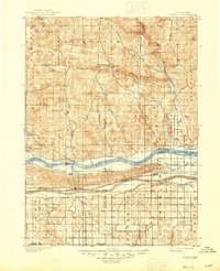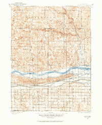
1901 Map of Paxton
USGS Topo · Published 1901About this map
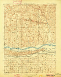
The North Platte River and South Platte River converge toward the east in this turn-of-the-century survey, defining a landscape of intensive water management and early Nebraska ranching. The Union Pacific railroad tracks run parallel to the southern river branch, anchoring the settlements of Paxton and Hershey. Between these rivers, the land is etched with a complex network of irrigation infrastructure, including the Sutherland and Paxton Canal, the Nichols Canal, and the Southside Canal, reflecting the massive effort to harness surface water for agriculture in the high plains.
Find a feature on this map
32 named features on this map. Tap any name to fly to it.
Don’t see what you’re looking for? This feature index may not catch every label — zoom into the map to look around manually.
Map Details
Editions of this 1901 Paxton Map
4 editions found