Loading...
Loading map...1901 Map of Paxton
USGS Topo · Published 1946About this map
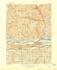
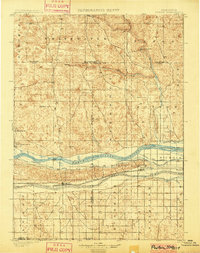
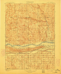
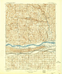
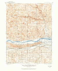
Paxton and the surrounding Nebraska ranchlands are defined here by the critical water infrastructure of the late 19th century. Surveyed in 1898, this landscape shows the convergence of the North Platte River and the South Platte River, a geography that dictated the development of the region's transport and agriculture. The Union Pacific railroad tracks run parallel to the southern river branch, anchoring settlements like Sutherland and Hershey.
Find a feature on this map
30 named features on this map. Tap any name to fly to it.
Don’t see what you’re looking for? This feature index may not catch every label — zoom into the map to look around manually.
Map Details
Date Portrayed1901
Date Published1946
PublisherU.S. Geological Survey
Map TypeTopographic
Scale1:125,000
Physical Dimensions16.9 x 20.8 inches
Editions of this 1901 Paxton Map
4 editions found
Historical Maps of Sutherland Through Time
Featured Locations
Source Details
SourceU.S. Geological Survey
CopyrightPublic Domain