1940s Maps of Blaine County, Nebraska
Explore 4 historic maps of Blaine County from the 1940s. These maps offer a rare glimpse into what life looked like during the 1940s — showing old roads, neighborhoods, homes, and landmarks that have changed or disappeared over time.
Whether you're researching your family's past, planning a metal detecting trip, or studying how Blaine County's landscape evolved across the 1940s, these high-resolution maps are a powerful tool for exploring the history of this region.
- Focus on a specific era: All maps on this page are from the 1940s, giving you a focused view of this time period.
- See what’s changed: Compare century-old streets, trails, and buildings to today's modern landscape using overlays and satellite layers.
- Research with precision: Use these maps for genealogy, historical research, land use analysis, or educational projects.
- View, download, or print: Maps are fully viewable online in high resolution, and can be downloaded or printed for your own records.
Start exploring Blaine County's history through authentic maps from the 1940s. This is your window into the past.
Blaine County, NE maps
(4)- 1948 Map of Linscott, 1970 Print
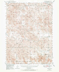 1948 Linscott1970 Print · USGSCuster County ranching communities were still defined by their local one-room schoolhouses in the late 1940s. Genealogists can trace family homesteads near landmarks like Linscott, Sand Valley Sch, and the remote Yucca Hill Sch.
 - 1948 Map of Halsey, 1973 Print
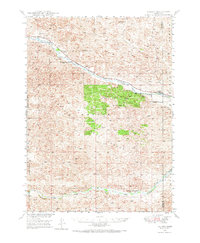 1948 Halsey1973 Print · USGSThomas and Blaine counties appear in the late 1940s as a landscape of forest plantations and river valleys. Researchers can trace the ranching economy and forest infrastructure via Halsey, the Scott Lookout Tower, and the Rose Hill Sch.
 - 1949 Map of Purdum, 1967 Print
 1949 Purdum1967 Print · USGSThe Nebraska Sandhills come into focus in the late 1940s as a region of remote ranching outposts and high prairie rivers. Researchers can locate dozens of historic family lands like the McMullen Ranch and Atkinson Ranch, or trace the rural school system through West Purdum Sch and Compton Sch.
 - 1949 Map of Koshopah, 1976 Print
 1949 Koshopah1976 Print · USGSThe Nebraska Sandhills ranching country is captured here during the post-war era, showing the intersection of three counties. Genealogists can trace family holdings and local landmarks like White Ranch, Koshopah, and the many rural schools including Pixley Sch.
End of results
Showing maps 1-4 of 4
Top cities of Blaine County
Frequently asked questions
- What are the different types of historical maps available for Blaine County?
- What is the oldest map of Blaine County?
- Where can I purchase historical maps of Blaine County for my home or office?
- Where can I download high-res historical maps of Blaine County?
- Are there historical topographic maps available for Blaine County?
- Is there historical aerial imagery available for Blaine County?
- Where are historical maps of Blaine County sourced from?