1960s Maps of Dakota County, Nebraska
Explore 9 historic maps of Dakota County from the 1960s. These maps offer a rare glimpse into what life looked like during the 1960s — showing old roads, neighborhoods, homes, and landmarks that have changed or disappeared over time.
Whether you're researching your family's past, planning a metal detecting trip, or studying how Dakota County's landscape evolved across the 1960s, these high-resolution maps are a powerful tool for exploring the history of this region.
- Focus on a specific era: All maps on this page are from the 1960s, giving you a focused view of this time period.
- See what’s changed: Compare century-old streets, trails, and buildings to today's modern landscape using overlays and satellite layers.
- Research with precision: Use these maps for genealogy, historical research, land use analysis, or educational projects.
- View, download, or print: Maps are fully viewable online in high resolution, and can be downloaded or printed for your own records.
Start exploring Dakota County's history through authentic maps from the 1960s. This is your window into the past.
Dakota County, NE maps
(9)- 1963 Map of Sioux City South, 1964 Print
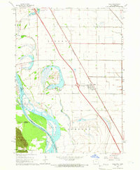
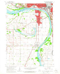 1963 Sioux City South1964 Print · USGSThe tri-state river junction between Nebraska, Iowa, and South Dakota hums with mid-century activity along the Missouri and Big Sioux Rivers. Genealogists can trace old family roots at Salem Ch, St Michaels Cem, or the rural Hileman Sch.4 unique versions available
 - 1963 Map of Jefferson, 1964 Print
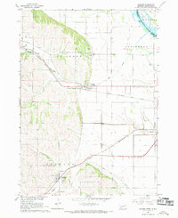
 1963 Jefferson1964 Print · USGSThe borderlands of South Dakota, Iowa, and Nebraska are captured in the early sixties as the interstate system arrived. Genealogists can trace family footprints at Civil Bend Cem, Montagne Sch, and the old rail line of the Milwaukee Road.4 unique versions available
 - 1964 Map of Ponca, 1966 Print
 1964 Ponca1966 Print · USGSThe Missouri River bluffs of Northeast Nebraska are captured here in the mid-1960s, showing the intersection of river life and upland farming. Researchers can find country schools like Allard Sch and landmarks including Lookout Hill and Ponca Cem.2 unique versions available
 - 1964 Map of Homer, 1966 Print
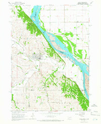
 1964 Homer1966 Print · USGSNear the Missouri River in the mid-1960s, this area of Dakota County reveals a landscape shaped by the Winnebago reservation and the rail lines. Genealogists and local historians can trace the community of Homer alongside St Cornelius Cem, Omaha Valley Cem, and the old Combs Sch.2 unique versions available
 - 1964 Map of Salix, 1966 Print
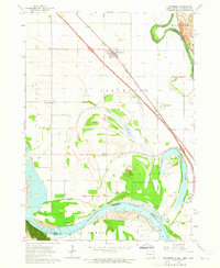
 1964 Salix1966 Print · USGSThe Missouri River bottomlands of Woodbury County are captured here in the mid-sixties as the Interstate era reached the region. Researchers can trace family history at St Josephs Cem or explore the river-driven geography of Browns Lake and the Winnebago Indian Reservation Boundary.2 unique versions available
 - 1967 Map of Waterbury, 1969 Print
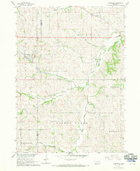 1967 Waterbury1969 Print · USGSDixon and Dakota Counties are shown in the late sixties as the local rail and agricultural networks remained central to rural life. Family historians can trace the exact locations of rural schools and cemeteries, including Way Sch, St Johns Ch, and Woods Cem.
 - 1967 Map of Jackson, 1969 Print
 1967 Jackson1969 Print · USGSThe tri-state border region of Nebraska, South Dakota, and Iowa is captured in the late sixties, where the Big Sioux meets the Missouri River. Trace rail history and family sites through Jackson and Hubbard, including St Johns Cem.2 unique versions available
 - 1967 Map of Emerson SE, 1969 Print
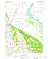
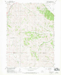 1967 Emerson SE1969 Print · USGSDakota and Thurston counties are captured here in the late sixties, showing the rural landscape bordering the Winnebago Indian Reservation. Researchers can locate numerous local burial sites like Taylor Cem and trace the original Chicago and North Western rail line.
 - 1967 Map of Emerson, 1969 Print
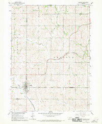 1967 Emerson1969 Print · USGSEmerson and the surrounding tri-county borderlands of Nebraska are captured here in the late sixties, showing the intersection of rail transit and reservation boundaries. Researchers can trace the Chicago and North Western line or locate local landmarks like Nacora and Jopp Cem.2 unique versions available
End of results
Showing maps 1-9 of 9
Top cities of Dakota County
Frequently asked questions
- What are the different types of historical maps available for Dakota County?
- What is the oldest map of Dakota County?
- Where can I purchase historical maps of Dakota County for my home or office?
- Where can I download high-res historical maps of Dakota County?
- Are there historical topographic maps available for Dakota County?
- Is there historical aerial imagery available for Dakota County?
- Where are historical maps of Dakota County sourced from?