Old Maps of Crawford, Nebraska for Genealogy
Trace your family roots with 10 historic maps of Crawford. These high-res maps reveal old neighborhoods, homesites, landmarks, and streets — helping you uncover where your ancestors lived and how the area evolved over time.
- Explore historic neighborhoods: Identify where your relatives may have lived in the 1800s or 1900s.
- Compare maps over time: Trace the changes in streets, buildings, and landmarks for multi-generational research.
- Perfect for genealogy & ancestry research: Used by family historians and researchers to map out lineage and migration.
These maps are an incredible resource for exploring your personal connection to Crawford's past.
Crawford, NE maps
(10)- 1955 Map of Alliance, 1966 Print
 1955 Alliance1966 Print · USGSThe Nebraska panhandle comes into sharp focus during the mid-fifties, showing a landscape defined by the Niobrara River and the expanding Sand Hills. Researchers can trace the grounds of Fort Robinson, locate Saint Marys Church, or follow the Chicago Burlington and Quincy rail line through Hemingford.3 unique versions available
 - 1957 Map of Alliance
 1957 Alliance1957 Print · USGSNorthwest Nebraska in the mid-fifties is captured here as a landscape of rail hubs, sprawling cattle ranches, and the eastern edge of the dunes. Genealogists and historians can trace rail lines through Alliance and Chadron or locate landmarks like Saint Marys Church and the Agate Spring Fossil Beds.
 - 1958 Map of Alliance
 1958 Alliance1958 Print · USGSNorthwestern Nebraska in the late fifties shows a landscape shaped by the legacy of the high plains frontier and modern agricultural expansion. Genealogists and historians can trace rail-line settlements and landmarks like Fort Robinson and the Agate Spring Fossil Beds.
 - 1980 Map of Crawford, 1981 Print
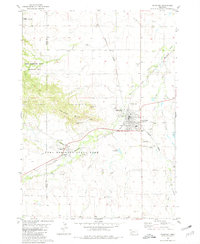 1980 Crawford1981 Print · USGSCrawford served as a vital rail and river junction in the Nebraska panhandle during the early eighties. Researchers can trace the layout of Fort Robinson State Park, locate the St John Cem, and explore landmarks like Lovers Leap Butte.
 - 1986 Map of Crawford
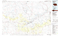 1986 Crawford1986 Print · USGSThe Nebraska Panhandle in the mid-eighties shows a high-plains landscape defined by its rugged geology and major rail corridors. Genealogists and historians can trace the paths of the Burlington Northern railroad through settlements like Orella, Glen, and Harrison.2 unique versions available
 - 2011 Map of Crawford, 2011 Print
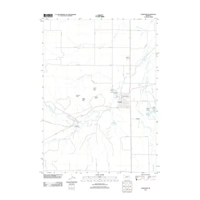 2011 Crawford2011 Print · USGSCovers Crawford, including Bowen Precinct, Sioux County, and other nearby areas
 - 2014 Map of Crawford, 2014 Print
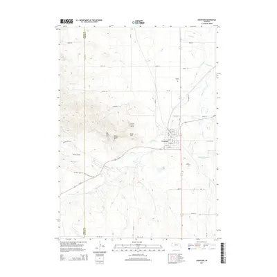 2014 Crawford2014 Print · USGSCovers Crawford, including Bowen Precinct, Sioux County, and other nearby areas
 - 2017 Map of Crawford, 2017 Print
 2017 Crawford2017 Print · USGSCovers Crawford, including Bowen Precinct, Sioux County, and other nearby areas
 - 2021 Map of Crawford, 2021 Print
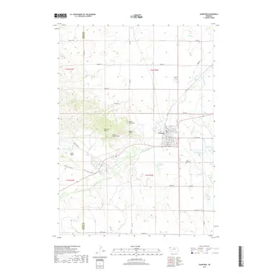
 2021 Crawford2021 Print · USGSCovers Crawford, including Bowen Precinct, Sioux County, and other nearby areas
 - 2023 Map of Crawford, 2023 Print
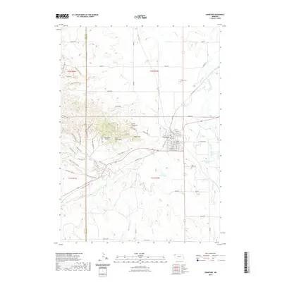
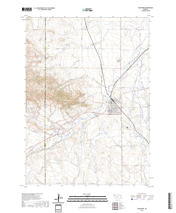 2023 Crawford2023 Print · USGSThe Nebraska panhandle town of Crawford is captured here as it appeared in 2023, surrounded by dramatic landmarks like Red Cloud Buttes and Saddle Rock. Local historians can trace family roots at Crawford Cem and Saint John Cem or follow the path of Smiley Canyon Creek.
End of results
Showing maps 1-10 of 10
Top cities near Crawford
Frequently asked questions
- What are the different types of historical maps available for Crawford?
- What is the oldest map of Crawford?
- Where can I purchase historical maps of Crawford for my home or office?
- Where can I download high-res historical maps of Crawford?
- Are there historical topographic maps available for Crawford?
- Is there historical aerial imagery available for Crawford?
- Where are historical maps of Crawford sourced from?