1960s Maps of Dixon County, Nebraska
Explore 16 historic maps of Dixon County from the 1960s. These maps offer a rare glimpse into what life looked like during the 1960s — showing old roads, neighborhoods, homes, and landmarks that have changed or disappeared over time.
Whether you're researching your family's past, planning a metal detecting trip, or studying how Dixon County's landscape evolved across the 1960s, these high-resolution maps are a powerful tool for exploring the history of this region.
- Focus on a specific era: All maps on this page are from the 1960s, giving you a focused view of this time period.
- See what’s changed: Compare century-old streets, trails, and buildings to today's modern landscape using overlays and satellite layers.
- Research with precision: Use these maps for genealogy, historical research, land use analysis, or educational projects.
- View, download, or print: Maps are fully viewable online in high resolution, and can be downloaded or printed for your own records.
Start exploring Dixon County's history through authentic maps from the 1960s. This is your window into the past.
Dixon County, NE maps
(16)- 1963 Map of Elk Point, 1964 Print
 1963 Elk Point1964 Print · USGSThe tri-state borderlands of South Dakota, Nebraska, and Iowa are captured in the early sixties as the modern interstate began to parallel the historic Milwaukee Road. Researchers can locate numerous country schoolhouses like Woodland Sch and Pleasant View Sch or trace the family plots at St Joseph Cem.3 unique versions available
 - 1964 Map of Martinsburg SW, 1965 Print
 1964 Martinsburg SW1965 Print · USGSDixon County's rural townships are captured in the mid-1960s, showing a landscape of family farms and small school districts. Genealogists can locate specific landmarks like St Patricks Cem, Happy Corner Sch, and the Townhall in DAILY township.
 - 1964 Map of Burbank, 1966 Print
 1964 Burbank1966 Print · USGSThe Missouri River valley at the South Dakota and Nebraska border is captured here in the mid-1960s, showing the intersection of river transport and rail. Researchers can trace family history at Ionia Cem or locate the South Bend Sch and Lembke Landing.
 - 1964 Map of Maskell, 1966 Print
 1964 Maskell1966 Print · USGSNorthern Dixon County and the Missouri River bluffs are captured in the 1960s, showing a landscape of upland farms and river bottomlands. Researchers can trace rural lineages through Maskell, Newcastle, and local burial sites like Maskell Cem.
 - 1964 Map of Ponca, 1966 Print
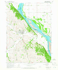 1964 Ponca1966 Print · USGSThe Missouri River bluffs of Northeast Nebraska are captured here in the mid-1960s, showing the intersection of river life and upland farming. Researchers can find country schools like Allard Sch and landmarks including Lookout Hill and Ponca Cem.2 unique versions available
 - 1964 Map of Martinsburg, 1966 Print
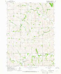 1964 Martinsburg1966 Print · USGSMartinsburg and the rolling farm country of Dixon County appear here in the mid-1960s, showing a landscape of well-established rural townships. Researchers can trace family history through numerous landmarks like St Pauls Ch, Silver Ridge Cem, and South Creek Sch.
 - 1967 Map of Waterbury, 1969 Print
 1967 Waterbury1969 Print · USGSDixon and Dakota Counties are shown in the late sixties as the local rail and agricultural networks remained central to rural life. Family historians can trace the exact locations of rural schools and cemeteries, including Way Sch, St Johns Ch, and Woods Cem.
 - 1967 Map of Allen, 1969 Print
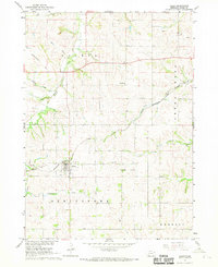 1967 Allen1969 Print · USGSDixon County farmland surrounds the village of Allen in the late 1960s, showing a landscape of rural schools and rail-dependent industry. Researchers can trace family landmarks like the Springbank Cem, Springbank Ch, and the Harmony Hill Sch.
 - 1967 Map of Wakefield SW, 1969 Print
 1967 Wakefield SW1969 Print · USGSDixon and Wayne Counties were defined by a robust rail-and-water network in the late sixties. Genealogists and local historians can locate rural landmarks like Cozy Nest Sch, Immanuel Ch, and the Wakefield Cem along Logan Creek.
 - 1967 Map of Wakefield, 1969 Print
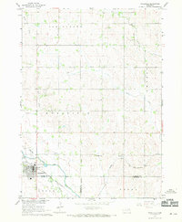 1967 Wakefield1969 Print · USGSWakefield and the surrounding farm townships were at a transition point in the late 1960s as railroad and water infrastructure shifted. Researchers can trace the Chicago and North Western rail line and the Indian Reservation Boundary near Logan Creek.
 - 1967 Map of Concord, 1969 Print
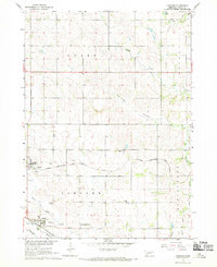 1967 Concord1969 Print · USGSDixon County farmland is mapped here in the late sixties, showing the rural structure of the Nebraska plains. You can trace early burial sites at St Annes Cem and Concord Cem, or follow the rail lines of the Chicago and North Western.
 - 1967 Map of Emerson, 1969 Print
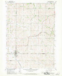 1967 Emerson1969 Print · USGSEmerson and the surrounding tri-county borderlands of Nebraska are captured here in the late sixties, showing the intersection of rail transit and reservation boundaries. Researchers can trace the Chicago and North Western line or locate local landmarks like Nacora and Jopp Cem.2 unique versions available
 - 1968 Map of Obert, 1970 Print
 1968 Obert1970 Print · USGSNear the border of Cedar and Dixon counties in the late sixties, this survey captures the rural landscape centered on the village of Obert. Genealogists and local historians can locate the Brookey Bottom Sch, Sunny Lea Sch, and family burial sites at Lime Creek Cem.2 unique versions available
 - 1968 Map of Meckling, 1971 Print
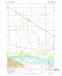 1968 Meckling1971 Print · USGSThe Missouri River bottomlands in the late sixties are anchored by the settlement of Meckling and the prominent Goat Island. Trace local family history through the sites of Bergen Ch, Norway Sch, and multiple country cemeteries.
 - 1968 Map of Coleridge SE, 1971 Print
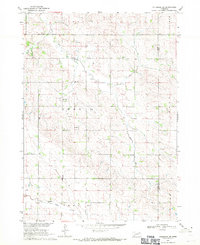 1968 Coleridge SE1971 Print · USGSNortheastern Nebraska's agricultural landscape is documented here in the late sixties, showing the rural community structure of Cedar and Dixon counties. Genealogists and historians can locate former neighborhood hubs like Mayflower Sch, Branch Sch, and St Peter Sch.
 - 1969 Map of Vermillion, 1971 Print
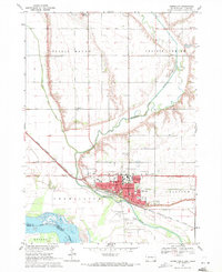 1969 Vermillion1971 Print · USGSThe university campus and Missouri River floodplain meet in this late-sixties portrait of Vermillion. Genealogists and historians can trace local landmarks like Spirit Mound, Bluff View Cemetery, and the University of South Dakota.2 unique versions available
End of results
Showing maps 1-16 of 16
Top cities of Dixon County
Frequently asked questions
- What are the different types of historical maps available for Dixon County?
- What is the oldest map of Dixon County?
- Where can I purchase historical maps of Dixon County for my home or office?
- Where can I download high-res historical maps of Dixon County?
- Are there historical topographic maps available for Dixon County?
- Is there historical aerial imagery available for Dixon County?
- Where are historical maps of Dixon County sourced from?