Old Maps of Ames, Nebraska
Explore 10 old maps of Ames, spanning from 1899 to today. These high-resolution historic maps reveal how streets, neighborhoods, landmarks, and natural features evolved over time — perfect for genealogy, metal detecting, research, and local history exploration.
What you can do with these maps:
- See how Ames changed over time: Compare historical maps to modern-day views to trace roads, homesites, rail lines & more.
- View detailed metadata: Each map includes creators, publishers, year, scale, and archive source.
- Overlay maps with satellite & LiDAR: Visualize the past alongside modern tools to explore terrain & human change.
- Trusted historical sources: Maps sourced from the USGS, Library of Congress, and other archives.
- Access maps your way: View online, download high-res files, or order prints for personal or research use.
Start exploring old maps of Ames to uncover forgotten places, hidden landmarks, and the deep history beneath your feet.
Ames, NE maps
(10)- 1899 Map of Wahoo
 1899 Wahoo1899 Print · USGSSaunders County and its neighbors thrive as a booming rail hub in the 1890s, where the Platte River meets a dense web of iron tracks. Trace the early development of prairie towns like Wahoo, Valparaiso, and the Bohemian settlement at Prague.3 unique versions available
 - 1955 Map of Fremont, 1966 Print
 1955 Fremont1966 Print · USGSEastern Nebraska and the Missouri River border are captured during the mid-fifties, just as the interstate system began to emerge. Researchers can trace the development of Omaha, locate the sprawling Offutt Air Force Base, or study the river-bound ecology of the De Soto National Wildlife Refuge.3 unique versions available
 - 1957 Map of Fremont
 1957 Fremont1957 Print · USGSEastern Nebraska and western Iowa thrive along the Platte and Missouri rivers during the mid-fifties. Genealogists can locate small rural schools like Fairview School and tracing the paths of the Union Pacific through towns like Albion and Humphrey.
 - 1958 Map of Fremont
 1958 Fremont1958 Print · USGSEastern Nebraska in the late fifties is captured here as a thriving corridor of river-valley commerce and rail transport. Researchers can trace the development of Omaha and Fremont or locate local landmarks like Midland College and Offutt Air Force Base.
 - 1968 Map of Malmo NW, 1971 Print
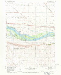 1968 Malmo NW1971 Print · USGSThe Platte River valley near the Saunders and Dodge County line is shown here in the late sixties as a landscape of river islands and rail corridors. Researchers can identify old rural burial sites like St Marys Cem and historic schoolhouses such as School No 91.
 - 1982 Map of Fremont
 1982 Fremont1982 Print · USGSEastern Nebraska in the early eighties exhibits a landscape of industrious rail towns and river-fed agriculture. Genealogists and historians can trace the development of Fremont, locate the National Cem, and find landmarks like the Todd Valley.2 unique versions available
 - 2011 Map of Malmo NW, 2011 Print
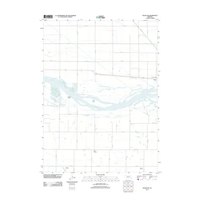 2011 Malmo NW2011 Print · USGSCovers Ames, including Dodge County, Saunders County, and other nearby areas
 - 2014 Map of Malmo NW, 2014 Print
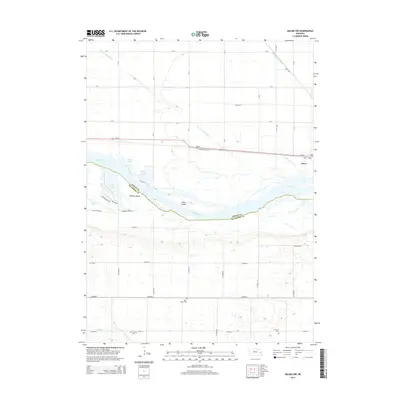 2014 Malmo NW2014 Print · USGSCovers Ames, including Dodge County, Saunders County, and other nearby areas
 - 2017 Map of Malmo NW, 2017 Print
 2017 Malmo NW2017 Print · USGSCovers Ames, including Dodge County, Saunders County, and other nearby areas
 - 2021 Map of Malmo NW, 2021 Print
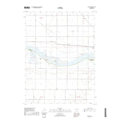
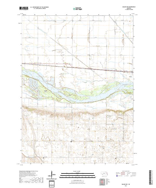 2021 Malmo NW2021 Print · USGSThe Platte River valley in eastern Nebraska is shown here as it appeared in 2021, featuring a landscape of intricate river islands and managed drainage. Genealogists and local historians can locate Saint Marys Cem, trace the Fremont Bluffs Trl, and find the path of the Old Lincoln Hwy.
End of results
Showing maps 1-10 of 10
Top cities near Ames
- Fremont historical maps
- Wahoo historical maps
- North Bend historical maps
- Yutan historical maps
- Webster historical maps
- Scribner historical maps
See more
Frequently asked questions
- What are the different types of historical maps available for Ames?
- What is the oldest map of Ames?
- Where can I purchase historical maps of Ames for my home or office?
- Where can I download high-res historical maps of Ames?
- Are there historical topographic maps available for Ames?
- Is there historical aerial imagery available for Ames?
- Where are historical maps of Ames sourced from?