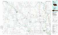
Old Maps of Dodge County, Nebraska
Explore 88 old maps of Dodge County, spanning from 1893 to today. These high-resolution historic maps reveal how streets, neighborhoods, landmarks, and natural features evolved over time — perfect for genealogy, metal detecting, research, and local history exploration.
What you can do with these maps:
- See how Dodge County changed over time: Compare historical maps to modern-day views to trace roads, homesites, rail lines & more.
- View detailed metadata: Each map includes creators, publishers, year, scale, and archive source.
- Overlay maps with satellite & LiDAR: Visualize the past alongside modern tools to explore terrain & human change.
- Trusted historical sources: Maps sourced from the USGS, Library of Congress, and other archives.
- Access maps your way: View online, download high-res files, or order prints for personal or research use.
Start exploring old maps of Dodge County to uncover forgotten places, hidden landmarks, and the deep history beneath your feet.
Dodge County, NE maps
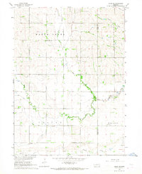
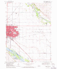
(88)- 1893 Map of Fremont, 1960 Print
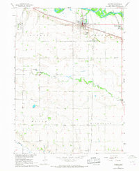
 1893 Fremont1960 Print · USGSEastern Nebraska was a nexus of river navigation and rail expansion in the 1890s as the prairie gave way to organized township grids. Genealogists and historians can trace early settlements and transportation corridors through Fort Calhoun, the growth of Fremont, and the junctions of the Union Pacific R.R..
 - 1896 Map of Fremont
 1896 Fremont1896 Print · USGSThe rail-driven growth of eastern Nebraska is captured here in the late nineteenth century as steam power connected the prairie. Researchers can trace ancestral roots through dozens of established settlements like Fontanelle, Gretna, and Papillion, or follow the historic routes of the Union Pacific R.R. and the Elkhorn River.5 unique versions available
 - 1899 Map of Wahoo
 1899 Wahoo1899 Print · USGSSaunders County and its neighbors thrive as a booming rail hub in the 1890s, where the Platte River meets a dense web of iron tracks. Trace the early development of prairie towns like Wahoo, Valparaiso, and the Bohemian settlement at Prague.3 unique versions available
 - 1955 Map of Fremont, 1966 Print
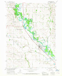
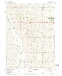
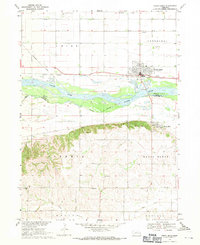
 1955 Fremont1966 Print · USGSEastern Nebraska and the Missouri River border are captured during the mid-fifties, just as the interstate system began to emerge. Researchers can trace the development of Omaha, locate the sprawling Offutt Air Force Base, or study the river-bound ecology of the De Soto National Wildlife Refuge.3 unique versions available
 - 1957 Map of Fremont
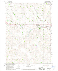
 1957 Fremont1957 Print · USGSEastern Nebraska and western Iowa thrive along the Platte and Missouri rivers during the mid-fifties. Genealogists can locate small rural schools like Fairview School and tracing the paths of the Union Pacific through towns like Albion and Humphrey.
 - 1958 Map of Fremont
 1958 Fremont1958 Print · USGSEastern Nebraska in the late fifties is captured here as a thriving corridor of river-valley commerce and rail transport. Researchers can trace the development of Omaha and Fremont or locate local landmarks like Midland College and Offutt Air Force Base.
 - 1966 Map of Scribner SW, 1967 Print
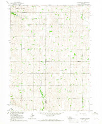
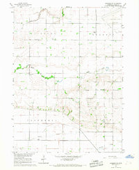 1966 Scribner SW1967 Print · USGSDodge County's agricultural landscape is captured in the mid-sixties, organized by the townships of Ridgeley and Everett. Researchers can trace rural life through numerous district schools and local landmarks like Scribner State Airfield and St Marys Cem.
 - 1966 Map of Uehling, 1967 Print
 1966 Uehling1967 Print · USGSDodge and Cuming counties are shown here in the mid-sixties during a period of significant agricultural and rail activity. Genealogists and local historians can locate several numbered schoolhouses like School No 83 and historic rural churches such as St Johns Ch.
 - 1966 Map of Webster, 1967 Print
 1966 Webster1967 Print · USGSDodge County agricultural life is captured in the mid-1960s, showing a landscape defined by small townships and creek drainage. Trace family roots and local history at Webster, Clyde, St Matthews Ch, and the grounds of Webster Cem.
 - 1966 Map of Nickerson, 1967 Print
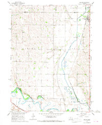
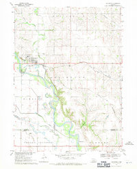
 1966 Nickerson1967 Print · USGSThe Elkhorn River valley in the mid-1960s was a critical junction of rail and water, where the Chicago and North Western and Chicago Burlington and Quincy railroads meet. Genealogists can locate family landmarks like Hartung Cem, Immanuel Ch, and several rural schools.
 - 1966 Map of Hooper, 1967 Print
 1966 Hooper1967 Print · USGSDodge County agricultural life and transportation networks are well-documented here in the mid-sixties. Researchers can trace family history through landmarks like St Rose of Lima Cem, Bellevue Sch, and the Scribner Air Force Base.
 - 1966 Map of Snyder, 1967 Print
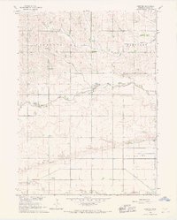
 1966 Snyder1967 Print · USGSDodge County during the mid-sixties reveals a well-ordered agricultural landscape organized by township lines and prairie creeks. Researchers can trace local heritage through the Bohemian Ch, School No 29, and the lingering path of an Old Railroad Grade.
 - 1966 Map of Scribner, 1967 Print
 1966 Scribner1967 Print · USGSDodge County and the Elkhorn River valley are seen here in the mid-1960s, showing a landscape defined by riverside settlements and the rail corridor. Genealogists can trace rural life through numbered schoolhouses like School No 24, Trinity Ch, and the Scribner Municipal Cem.
 - 1966 Map of Nickerson NW, 1967 Print
 1966 Nickerson NW1967 Print · USGSThe rural borderlands of Dodge, Burt, and Washington counties are captured here in the mid-1960s, showing a landscape of established family farms. Genealogists can trace localized history through numerous country burial sites like Argo Cem and Logan Cem, alongside early district schools such as School No 68.
 - 1966 Map of Dodge SW, 1968 Print
 1966 Dodge SW1968 Print · USGSAgricultural life in eastern Nebraska comes into focus in the mid-1960s, showing a landscape defined by local schools and meandering creek forks. Researchers can trace rural community centers like Purple Cane Ch, St Patricks Cem, and School No 11 across the section lines.
 - 1966 Map of Dodge, 1968 Print
 1966 Dodge1968 Print · USGSNortheastern Nebraska farming country is documented here in the mid-sixties, centered on the communities of Dodge and Howells. Genealogists can locate family landmarks like SS Peter & Paul Cem, Tabor Cem, and Sacred Heart Ch.
 - 1968 Map of Malmo NW, 1971 Print
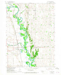
 1968 Malmo NW1971 Print · USGSThe Platte River valley near the Saunders and Dodge County line is shown here in the late sixties as a landscape of river islands and rail corridors. Researchers can identify old rural burial sites like St Marys Cem and historic schoolhouses such as School No 91.
 - 1968 Map of Fremont West, 1971 Print
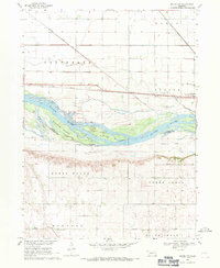
 1968 Fremont West1971 Print · USGSMid-century Nebraska life unfolds along the Platte River during the late sixties, where recreation lakes and heavy rail lines meet. Genealogists can locate family burial sites at Pohocco Cem and Wiegand Cem or trace early school districts at Beebe Sch.2 unique versions available
 - 1968 Map of Fremont East, 1971 Print
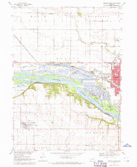
 1968 Fremont East1971 Print · USGSThe rail and river networks of eastern Nebraska converged here in the late sixties, showing a period of significant civic and industrial growth. Researchers can trace family roots through numerous neighborhood landmarks like St Patricks Sch, Midland College, and Ruwe Park.3 unique versions available
 - 1968 Map of North Bend, 1971 Print
 1968 North Bend1971 Print · USGSDodge and Saunders Counties are seen here in the late sixties as the Platte River valley transitioned toward modern agriculture. Locate ancestral landmarks like Sacred Heart Ch, Prairie Hill Sch, and the riverside town of North Bend.
 - 1968 Map of Arlington, 1971 Print
 1968 Arlington1971 Print · USGSThe village of Arlington and the fertile Elkhorn River valley are captured here in the late sixties as the local rail and water networks shaped the region. Genealogists can locate family sites near Arlington Cem, School No 43, and along the banks of Rawhide Creek.2 unique versions available
 - 1968 Map of Rogers, 1971 Print
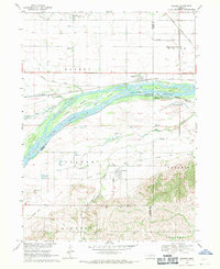 1968 Rogers1971 Print · USGSThe Platte River valley in the late sixties is shown here in meticulous detail, capturing the river's many islands and the surrounding rail-side towns. Genealogists and local historians can trace rural roots at Dawson Cem, St Marys Cem, and numerous school sites like School No 4.
 - 1982 Map of Fremont
 1982 Fremont1982 Print · USGSEastern Nebraska in the early eighties exhibits a landscape of industrious rail towns and river-fed agriculture. Genealogists and historians can trace the development of Fremont, locate the National Cem, and find landmarks like the Todd Valley.2 unique versions available
 - 1986 Map of Blair
 1986 Blair1986 Print · USGSEastern Nebraska and the Iowa borderlands are captured here in the mid-eighties, showing the established river-and-rail network. Genealogists and historians can trace the foundations of Blair, West Point, and Tekamah, or locate smaller sites like Fontanelle and Scribner.2 unique versions available
 - 2011 Map of Webster, 2011 Print
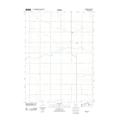 2011 Webster2011 Print · USGSCovers Dodge County, including Webster, United States, and other nearby areas
Showing maps 1-25 of 88
Top cities of Dodge County
- Fremont historical maps
- North Bend historical maps
- Webster historical maps
- Scribner historical maps
- Hooper historical maps
- Dodge historical maps
See more
Frequently asked questions
- What are the different types of historical maps available for Dodge County?
- What is the oldest map of Dodge County?
- Where can I purchase historical maps of Dodge County for my home or office?
- Where can I download high-res historical maps of Dodge County?
- Are there historical topographic maps available for Dodge County?
- Is there historical aerial imagery available for Dodge County?
- Where are historical maps of Dodge County sourced from?