2020s Maps of Dodge County, Nebraska
Explore 16 historic maps of Dodge County from the 2020s. These maps offer a rare glimpse into what life looked like during the 2020s — showing old roads, neighborhoods, homes, and landmarks that have changed or disappeared over time.
Whether you're researching your family's past, planning a metal detecting trip, or studying how Dodge County's landscape evolved across the 2020s, these high-resolution maps are a powerful tool for exploring the history of this region.
- Focus on a specific era: All maps on this page are from the 2020s, giving you a focused view of this time period.
- See what’s changed: Compare century-old streets, trails, and buildings to today's modern landscape using overlays and satellite layers.
- Research with precision: Use these maps for genealogy, historical research, land use analysis, or educational projects.
- View, download, or print: Maps are fully viewable online in high resolution, and can be downloaded or printed for your own records.
Start exploring Dodge County's history through authentic maps from the 2020s. This is your window into the past.
Dodge County, NE maps
(16)- 2021 Map of Scribner SW, 2021 Print
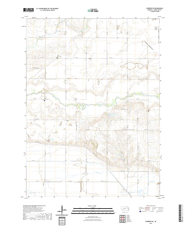 2021 Scribner SW2021 Print · USGSDodge County, Nebraska, is captured here in the early 2020s, showing a managed prairie landscape defined by creek drainage and rural cemeteries. Researchers can locate Saint Marys Cem, Maple Grove Cem, and Scribner State Airport.
 - 2021 Map of Fremont West, 2021 Print
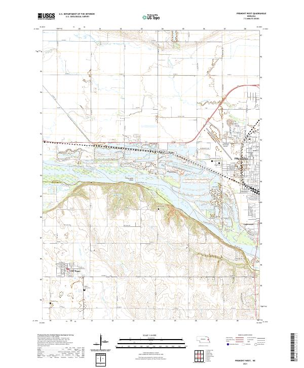 2021 Fremont West2021 Print · USGSThe Platte River valley near Fremont and Cedar Bluffs comes to life in this recent survey. Genealogists can trace family burial sites at Calvary Cem and Wiegand Cem, or explore riverside developments like Bricks Bay.
 - 2021 Map of Webster, 2021 Print
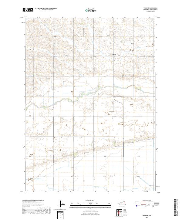 2021 Webster2021 Print · USGSDodge County farmland in the early 2020s is defined by a grid of rural section roads and the winding paths of several creeks. Researchers can trace family history at Webster Cem or follow the water through Maple Creek, Silver Cr, and Rawhide Cr.
 - 2021 Map of Nickerson, 2021 Print
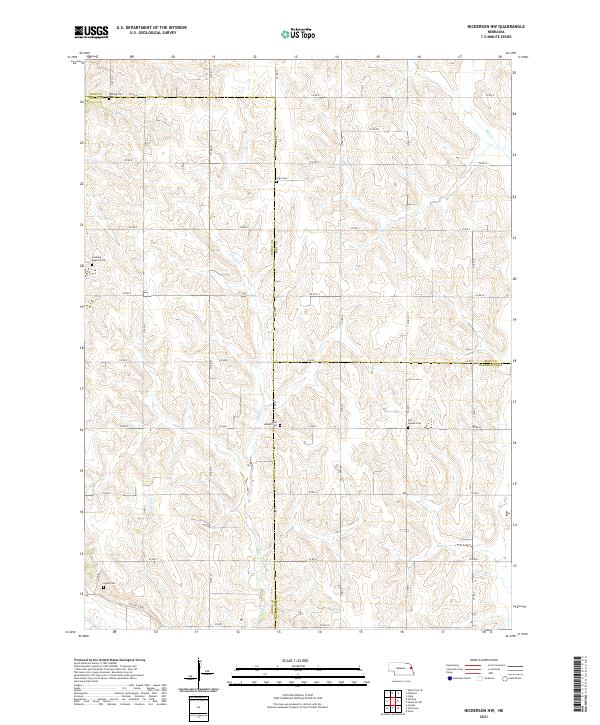
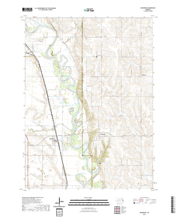 2021 Nickerson2021 Print · USGSEastern Nebraska farm country and the winding river bottom are captured here during the 2020s. Genealogists can locate family sites near Fontanelle, Telbasta, and Immanuel Cem while tracing the banks of the Elkhorn River.
 - 2021 Map of Uehling, 2021 Print
 2021 Uehling2021 Print · USGSIn the fertile corridor between the Elkhorn River and Logan Creek, this modern survey shows the village of Uehling and the surrounding farm lands. Family historians and researchers can trace local landmarks like Saint Johns Cem and the distinctive route of the Logan Creek Dredge.
 - 2021 Map of Hooper, 2021 Print
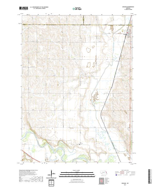
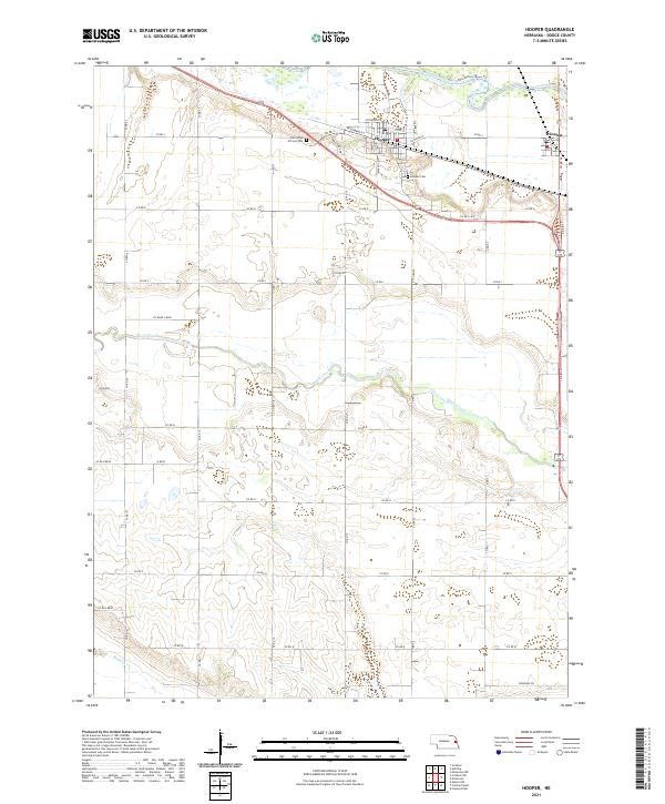 2021 Hooper2021 Print · USGSDodge County's river valleys and rural townships are captured here in the early twenty-first century. Researchers can trace family history at Saint Rose of Lima Cem or follow the paths of Maple Creek and the Elkhorn River.
 - 2021 Map of North Bend, 2021 Print
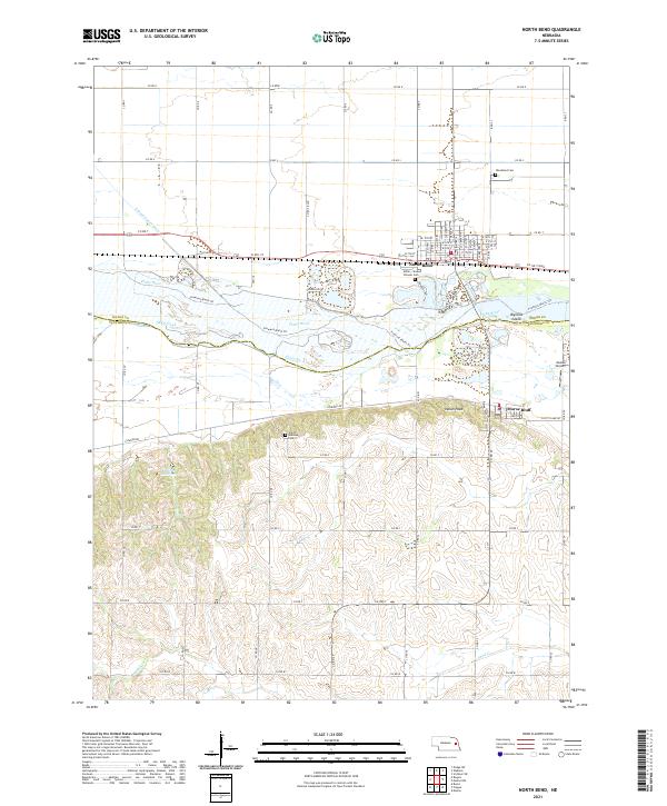 2021 North Bend2021 Print · USGSThe Platte River valley near North Bend and Morse Bluff is captured here in the early 2020s. Genealogists can locate family markers at the Czech National Cem or Millar - Sloss Pioneer Cem and trace the path of the Fremont Bluffs Trl.
 - 2021 Map of Rogers, 2021 Print
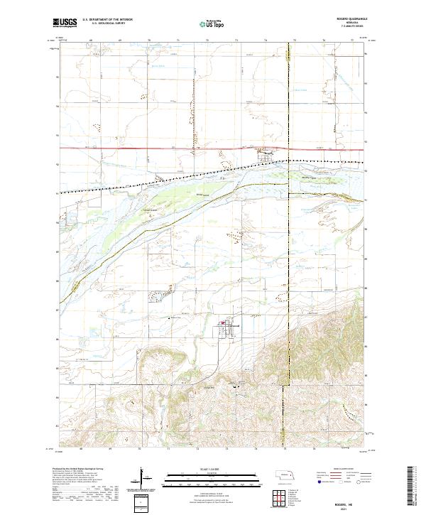 2021 Rogers2021 Print · USGSThe river valley near Rogers and Linwood comes into focus in this recent survey of the Platte River corridor. Genealogists and local historians can trace family plots at Dawson Cem or locate old island landmarks like School Island.
 - 2021 Map of Malmo NW, 2021 Print
 2021 Malmo NW2021 Print · USGSThe Platte River valley in eastern Nebraska is shown here as it appeared in 2021, featuring a landscape of intricate river islands and managed drainage. Genealogists and local historians can locate Saint Marys Cem, trace the Fremont Bluffs Trl, and find the path of the Old Lincoln Hwy.
 - 2021 Map of Dodge SW, 2021 Print
 2021 Dodge SW2021 Print · USGSThe Colfax and Dodge county line comes alive in this 2021 survey of Nebraska's rolling farmland and drainage networks. Researchers can trace the path of the Kasal Canal or locate local burials at Saint Patricks Cem and the banks of Maple Cr.
 - 2021 Map of Scribner, 2021 Print
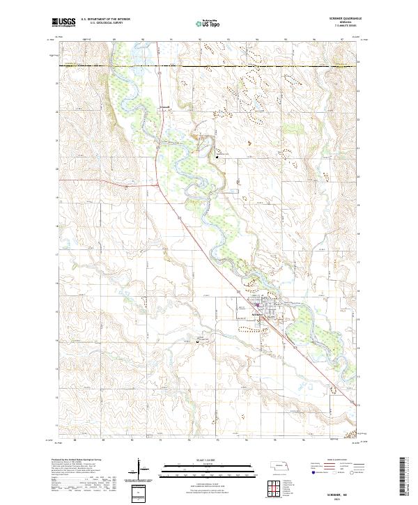 2021 Scribner2021 Print · USGSDodge County's river valley comes into sharp focus during this recent survey, showcasing the meandering path of the Elkhorn River. Genealogists and researchers can trace the streets of Scribner or locate local burials at Manhattan Cem and the Scribner Municipal Cem.
 - 2021 Map of Nickerson NW, 2021 Print
 2021 Nickerson NW2021 Print · USGSEastern Nebraska farm country is captured here during the 2020s, showing the intersection of three counties. Genealogists can locate family burial sites at Argo Cem, Logan Cem, and the Swaburg Baptist Cem.
 - 2021 Map of Arlington, 2021 Print
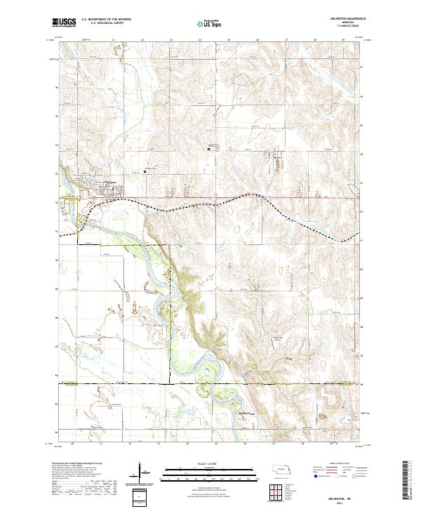 2021 Arlington2021 Print · USGSThe village of Arlington is documented here as it appeared in the early 2020s, centered at the crossroads of agricultural and riparian networks. Researchers can locate the Arlington Cem, trace the winding Rawhide Cr, and identify local landmarks like the Sibbernsen Airport.
 - 2021 Map of Snyder, 2021 Print
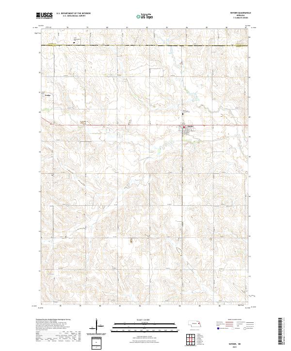 2021 Snyder2021 Print · USGSDodge County agricultural life in the early 2020s is centered on the village of Snyder and the nearby creek bottoms. Genealogists and local historians can trace family plots at Saint Leos Catholic Cemetery and Saint Wenceslaus Cemetery.
 - 2021 Map of Fremont East, 2021 Print
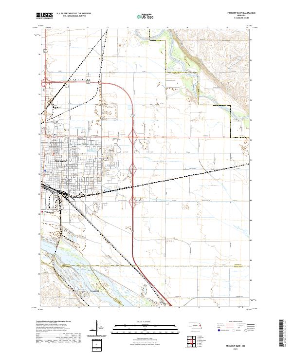 2021 Fremont East2021 Print · USGSFremont and the surrounding river bottoms are captured here in the early 2020s, showcasing the intersection of Nebraska's rail and water networks. Genealogists and local historians can trace the development of Fremont and Woodcliff, or locate landmarks like the Dodge County Courthouse and Midland College.
 - 2021 Map of Dodge, 2021 Print
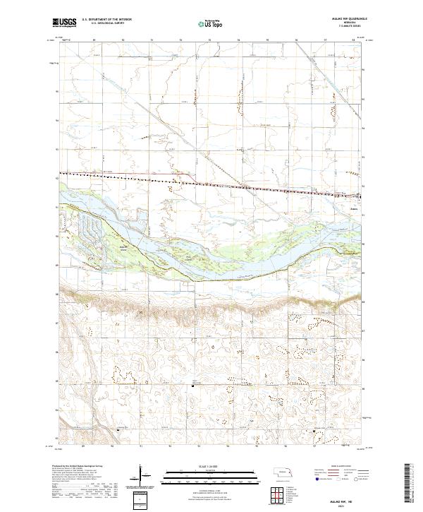
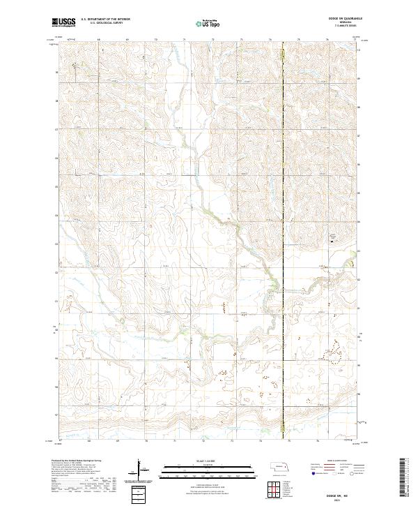
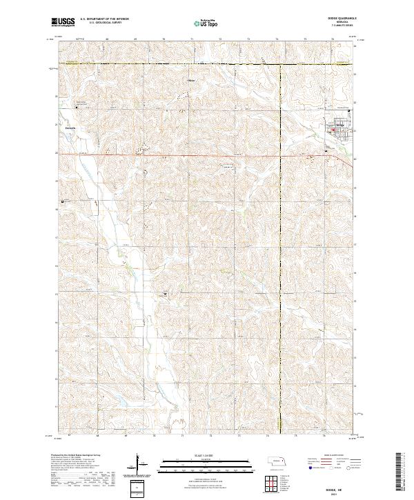 2021 Dodge2021 Print · USGSThe tri-county borderlands of Cuming, Colfax, and Dodge counties appear here in the early twenty-first century. Genealogists can trace family footprints across rural landscapes punctuated by Saints Peter and Paul Cem, Olean, and the streets of Dodge.
End of results
Showing maps 1-16 of 16
Top cities of Dodge County
- Fremont historical maps
- North Bend historical maps
- Webster historical maps
- Scribner historical maps
- Hooper historical maps
- Dodge historical maps
See more
Frequently asked questions
- What are the different types of historical maps available for Dodge County?
- What is the oldest map of Dodge County?
- Where can I purchase historical maps of Dodge County for my home or office?
- Where can I download high-res historical maps of Dodge County?
- Are there historical topographic maps available for Dodge County?
- Is there historical aerial imagery available for Dodge County?
- Where are historical maps of Dodge County sourced from?