
1966 Map of Dodge SW
USGS Topo · Published 1968About this map
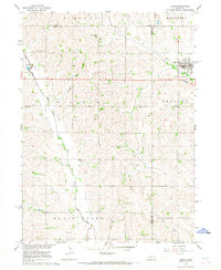
Pleasant Valley and the fertile bottomlands of the East Fork Maple Creek characterize this agricultural landscape in eastern Nebraska during the mid-1960s. The map reveals a high concentration of rural infrastructure, including multiple educational sites such as School No 11, School No 79, and School No 18, which served the surrounding farming community. Religious life is centered at Bethlehem Chapel and St Patricks Ch, the latter of which is situated near the St Patricks Cem.
Find a feature on this map
21 named features on this map. Tap any name to fly to it.
Don’t see what you’re looking for? This feature index may not catch every label — zoom into the map to look around manually.
Map Details
Editions of this 1966 Dodge SW Map
This is the sole edition of this map. No revisions or reprints were ever made.
Other maps of this area

1899 · Wahoo
USGS Topo · 1:125,000

1899 · David City
USGS Topo · 1:125,000

1955 · Fremont
USGS Topo · 1:250,000

1957 · Fremont
USGS Topo · 1:250,000

1958 · Fremont
USGS Topo · 1:250,000

1966 · Webster
USGS Topo · 1:24,000

1966 · Snyder
USGS Topo · 1:24,000

1966 · Clarkson
USGS Topo · 1:24,000
1966 · Dodge
USGS Topo · 1:24,000
1966 · Clarkson SE
USGS Topo · 1:24,000