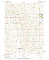
1966 Map of Dodge
USGS Topo · Published 1968About this map
The rural landscape of northeastern Nebraska is defined by the winding course of the East Fork Maple Creek and its many tributaries. This 1960s study of the area surrounding Dodge and Howells reveals a traditional Midwestern township structure, dominated by family farms and religious centers. Notable markers of local heritage include the SS Peter & Paul Cem and Sacred Heart Ch near Olean, alongside St Marys Ch and Tabor Cem further south. An Old Railroad Grade north of Dodge provides evidence of shifting transportation patterns as the rail network gave way to the developing county road system. The map also identifies local public institutions such as School No 32 and Holsten Park, offering a clear view of the communal hubs that supported these farming communities during the mid-twentieth century.
Find a feature on this map
25 named features on this map. Tap any name to fly to it.
Don’t see what you’re looking for? This feature index may not catch every label — zoom into the map to look around manually.
Map Details
Editions of this 1966 Dodge Map
This is the sole edition of this map. No revisions or reprints were ever made.
Other maps of this area

1955 · Fremont
USGS Topo · 1:250,000

1957 · Fremont
USGS Topo · 1:250,000

1958 · Fremont
USGS Topo · 1:250,000

1966 · Monterey
USGS Topo · 1:24,000

1966 · Webster
USGS Topo · 1:24,000

1966 · Snyder
USGS Topo · 1:24,000

1966 · Aloys
USGS Topo · 1:24,000

1966 · Clarkson
USGS Topo · 1:24,000
1966 · Stanton SE
USGS Topo · 1:24,000

1966 · Dodge SW
USGS Topo · 1:24,000