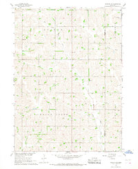
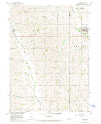
1966 Map of Stanton SE
USGS Topo · Published 1968About this map
The East Fork Maple Creek and Pebble Creek basins define the agricultural landscape of eastern Stanton and Cuming Counties in the mid-1960s. This survey, conducted for the development of the Missouri River Basin, reveals a rural community structured around localized school districts and country parishes. Small social hubs are anchored by St Johns Ch, St Henry Ch, and the adjacent Cem, reflecting the importance of religious life for the farming families of the Haymow and Bismarck areas. The map provides a precise look at the educational network of the time, documenting the locations of School No 32, School No 45, School No 51, and School No 58. These numbered schools and local bridges like BR 1527 offer a detailed record of the early infrastructure before significant rural consolidation altered the Nebraska plains.
Find a feature on this map
19 named features on this map. Tap any name to fly to it.
Don’t see what you’re looking for? This feature index may not catch every label — zoom into the map to look around manually.
Map Details
Editions of this 1966 Stanton SE Map
This is the sole edition of this map. No revisions or reprints were ever made.
Other maps of this area

1955 · Fremont
USGS Topo · 1:250,000

1957 · Fremont
USGS Topo · 1:250,000

1958 · Fremont
USGS Topo · 1:250,000

1963 · Wisner
USGS Topo · 1:24,000
1963 · Stanton NE
USGS Topo · 1:24,000
1963 · Stanton
USGS Topo · 1:24,000

1966 · Aloys
USGS Topo · 1:24,000

1966 · Clarkson
USGS Topo · 1:24,000
1966 · Stanton SW
USGS Topo · 1:24,000
1966 · Dodge
USGS Topo · 1:24,000