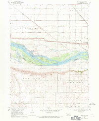
1968 Map of Malmo NW
USGS Topo · Published 1971About this map
Bobkies Island and Pole Island sit within the complex channel of the Platte River during the late 1960s, marking the boundary between Dodge Co and Saunders Co. The landscape is a study in flood-plain management and transportation, featuring the Central Cutoff Ditch and an Old Railroad Grade that runs parallel to the river's south bank. To the north, the Union Pacific railroad services the small community of Ames, while the bluffs to the south provide a higher elevation for local landmarks.
Find a feature on this map
29 named features on this map. Tap any name to fly to it.
Don’t see what you’re looking for? This feature index may not catch every label — zoom into the map to look around manually.
Map Details
Editions of this 1968 Malmo NW Map
This is the sole edition of this map. No revisions or reprints were ever made.
Other maps of this area

1899 · Wahoo
USGS Topo · 1:125,000

1955 · Fremont
USGS Topo · 1:250,000

1957 · Fremont
USGS Topo · 1:250,000

1958 · Fremont
USGS Topo · 1:250,000

1966 · Scribner SW
USGS Topo · 1:24,000

1966 · Webster
USGS Topo · 1:24,000

1966 · Hooper
USGS Topo · 1:24,000
1968 · Fremont West
USGS Topo · 1:24,000
1968 · North Bend
USGS Topo · 1:24,000
1969 · Malmo
USGS Topo · 1:24,000