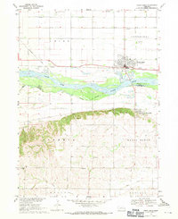
1968 Map of North Bend
USGS Topo · Published 1971About this map
The Platte River corridor dominates this late 1960s study, dividing the agricultural plains of Union and Cotterell from the more varied elevations of Bohemia and Morse Bluff. The town of North Bend serves as the primary hub, situated along the Union Pacific rail line and north of the river's Indefinite Boundary. The map reveals a deeply established rural infrastructure south of the water, where landmarks like Indian Peak rise above a landscape dotted with localized institutions such as Sacred Heart Ch and several numbered schoolhouses. This era captures the region prior to significant modern development, emphasizing the relationship between the river's shifting channels and the rigid section-line roads. Genealogy researchers will find several burial grounds noted, including Woodland Cem and the more remote Killian Cem, which provide clues to early family settlement patterns.
Find a feature on this map
29 named features on this map. Tap any name to fly to it.
Don’t see what you’re looking for? This feature index may not catch every label — zoom into the map to look around manually.
Map Details
Editions of this 1968 North Bend Map
This is the sole edition of this map. No revisions or reprints were ever made.
Other maps of this area

1899 · Wahoo
USGS Topo · 1:125,000

1955 · Fremont
USGS Topo · 1:250,000

1957 · Fremont
USGS Topo · 1:250,000

1958 · Fremont
USGS Topo · 1:250,000

1966 · Scribner SW
USGS Topo · 1:24,000

1966 · Webster
USGS Topo · 1:24,000

1966 · Dodge SW
USGS Topo · 1:24,000

1968 · Bruno
USGS Topo · 1:24,000
1968 · Malmo NW
USGS Topo · 1:24,000
1968 · Rogers
USGS Topo · 1:24,000