1900s (20th Century) Maps of Virginia, Nebraska
Explore 6 historic maps of Virginia from the 1900s (20th Century). These maps offer a rare glimpse into what life looked like during the 1900s — showing old roads, neighborhoods, homes, and landmarks that have changed or disappeared over time.
Whether you're researching your family's past, planning a metal detecting trip, or studying how Virginia's landscape evolved across the 1900s, these high-resolution maps are a powerful tool for exploring the history of this region.
- Focus on a specific era: All maps on this page are from the 1900s, giving you a focused view of this time period.
- See what’s changed: Compare century-old streets, trails, and buildings to today's modern landscape using overlays and satellite layers.
- Research with precision: Use these maps for genealogy, historical research, land use analysis, or educational projects.
- View, download, or print: Maps are fully viewable online in high resolution, and can be downloaded or printed for your own records.
Start exploring Virginia's history through authentic maps from the 1900s. This is your window into the past.
Virginia, NE maps
(6)- 1955 Map of Lincoln, 1967 Print
 1955 Lincoln1967 Print · USGSSoutheast Nebraska in the mid-fifties presents a landscape of thriving railroad towns and the expanding footprint of the capital city. Researchers can trace the legacy of the pioneer era at the Homestead National Monument of America or locate mid-century military infrastructure like Lincoln Air Force Base.5 unique versions available
 - 1957 Map of Lincoln
 1957 Lincoln1957 Print · USGSSoutheastern Nebraska at mid-century shows a landscape of thriving rail towns and expanding infrastructure centered on Lincoln. Researchers can trace the path of the Chicago Burlington and Quincy railroad through communities like Weeping Water, Fairmont, and Seward.
 - 1958 Map of Lincoln
 1958 Lincoln1958 Print · USGSSoutheast Nebraska at the end of the 1950s shows a region defined by agricultural trade and the expansion of the state capital. Genealogists can trace family footprints across the Blue Valley and locate landmarks like the Lincoln AFB or the U.S. Veterans Hospital.
 - 1965 Map of Lewiston, 1966 Print
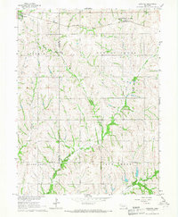 1965 Lewiston1966 Print · USGSThe rolling prairie of southeastern Nebraska is captured here in the mid-1960s, showing the agricultural heart of Gage and Pawnee counties. Researchers can trace family history at Lewiston Cem and Pleasant Hill Ch or follow the paths of the Chicago Rock Island and Pacific railroad.
 - 1970 Map of Wymore NE, 1972 Print
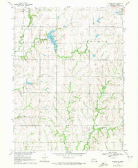 1970 Wymore NE1972 Print · USGSGage County's agricultural and recreational landscape comes into focus during the early 1970s. Researchers can trace family history through Stark Cem, locate the Old Railroad Grade, and explore the shoreline of Rockford Lake.
 - 1986 Map of Beatrice
 1986 Beatrice1986 Print · USGSSoutheast Nebraska and the Kansas borderlands appear in the mid-1980s as a thriving agricultural region centered on the Big Blue River. Researchers can trace historic rail routes like the Burlington Northern through hubs such as Beatrice and Pawnee City.2 unique versions available
End of results
Showing maps 1-6 of 6
Top cities near Virginia
- Beatrice historical maps
- Wymore historical maps
- Adams historical maps
- Sterling historical maps
- Rockford historical maps
- Blue Springs historical maps
See more
Frequently asked questions
- What are the different types of historical maps available for Virginia?
- What is the oldest map of Virginia?
- Where can I purchase historical maps of Virginia for my home or office?
- Where can I download high-res historical maps of Virginia?
- Are there historical topographic maps available for Virginia?
- Is there historical aerial imagery available for Virginia?
- Where are historical maps of Virginia sourced from?