2020s Maps of Greeley County, Nebraska
Explore 15 historic maps of Greeley County from the 2020s. These maps offer a rare glimpse into what life looked like during the 2020s — showing old roads, neighborhoods, homes, and landmarks that have changed or disappeared over time.
Whether you're researching your family's past, planning a metal detecting trip, or studying how Greeley County's landscape evolved across the 2020s, these high-resolution maps are a powerful tool for exploring the history of this region.
- Focus on a specific era: All maps on this page are from the 2020s, giving you a focused view of this time period.
- See what’s changed: Compare century-old streets, trails, and buildings to today's modern landscape using overlays and satellite layers.
- Research with precision: Use these maps for genealogy, historical research, land use analysis, or educational projects.
- View, download, or print: Maps are fully viewable online in high resolution, and can be downloaded or printed for your own records.
Start exploring Greeley County's history through authentic maps from the 2020s. This is your window into the past.
Greeley County, NE maps
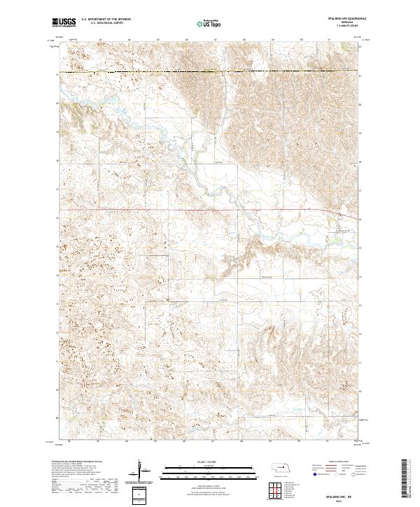
(15)- 2021 Map of Spalding, 2021 Print
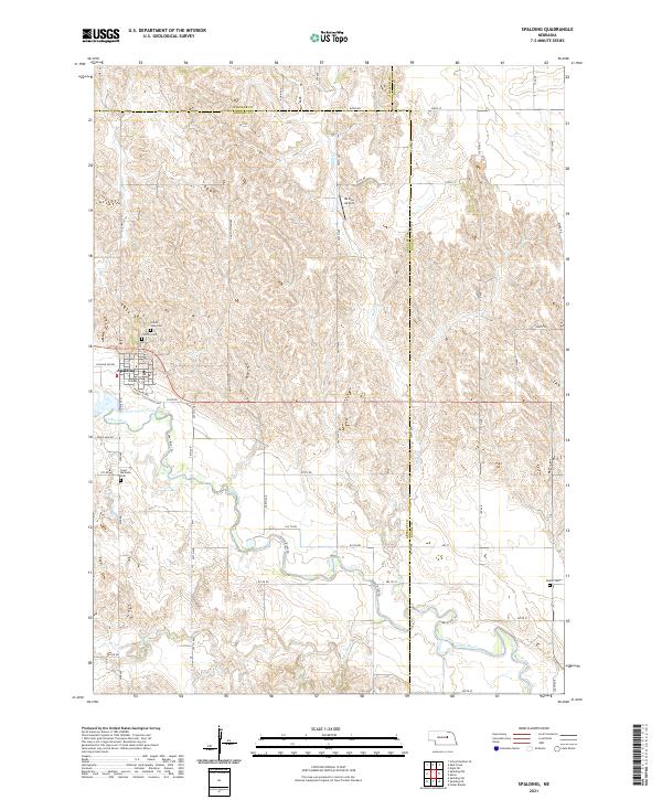 2021 Spalding2021 Print · USGSThe village of Spalding and the surrounding Nebraska plains are captured here in the early 2020s as the Cedar River winds through the landscape. Genealogists can locate several local burial sites including Grand View Cem and the remote Dublin Cem.
 - 2021 Map of Scotia, 2021 Print
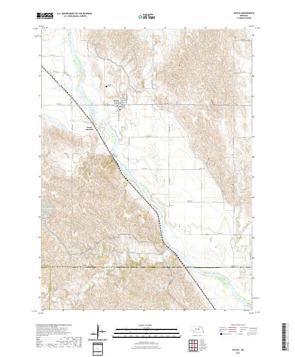 2021 Scotia2021 Print · USGSCentral Nebraska at the start of the 2020s shows the enduring layout of the North Loup River valley. Researchers can trace family history at Mount Hope Cem or follow historical routes like Deadwood Trl and the Ord-North Loup Canal.
 - 2021 Map of Greeley NW, 2021 Print
 2021 Greeley NW2021 Print · USGSGreeley and Wheeler counties meet in this 2021 survey of the Nebraska sandhills borderlands. Family historians and local researchers can trace the rural landscape through the Amity Cem, the waters of Walker Reservoir, and Belfast Rd.
 - 2021 Map of Ord SE, 2021 Print
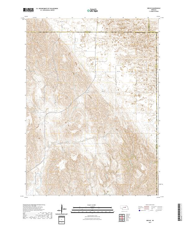
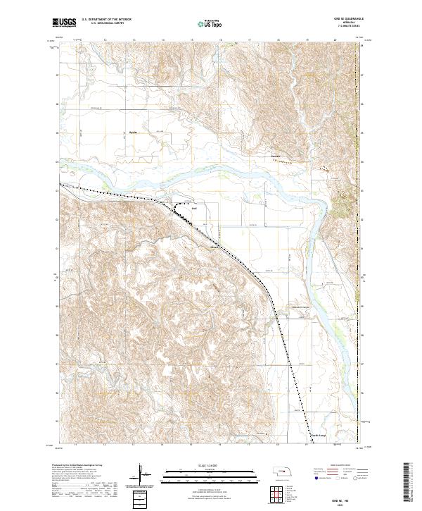 2021 Ord SE2021 Print · USGSThe North Loup River valley and its complex irrigation systems define this Nebraska landscape in the early 2020s. Researchers can trace historical settlement patterns from the hub of Ord to smaller points like Spelts, Sumter, and Olean.
 - 2021 Map of Spalding SW, 2021 Print
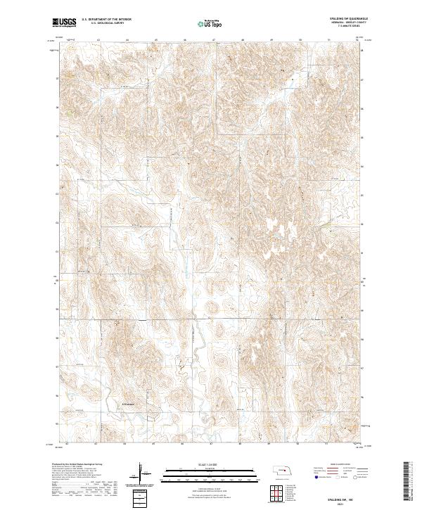 2021 Spalding SW2021 Print · USGSGreeley County in the early twenty-first century is captured here as a landscape of structured agricultural sections and winding prairie creeks. Genealogists and local historians can trace the area around O'Connor or follow the paths of Spring Cr and Troy Cr.
 - 2021 Map of Spalding SE, 2021 Print
 2021 Spalding SE2021 Print · USGSThe Greeley and Boone County line runs through this dissected central Nebraska landscape as it appeared in the early 2020s. Genealogists and local researchers can trace family plots at Enfield Cemetery and follow the routes of W P A Rd and the Cedar River.
 - 2021 Map of Wolbach NE, 2021 Print
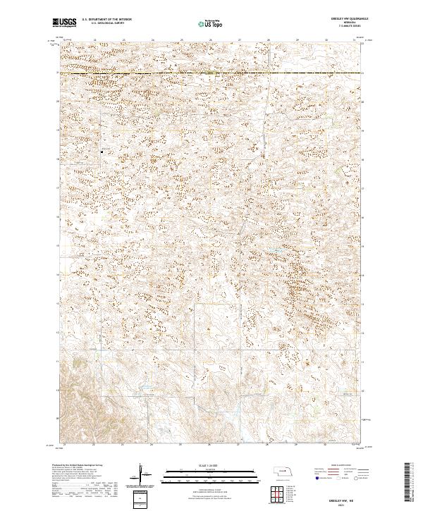
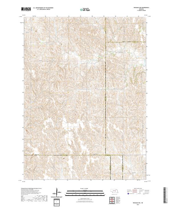 2021 Wolbach NE2021 Print · USGSCentral Nebraska's rural landscape is captured here at a point where five different counties converge among the high plains drainages. Genealogists and historians can trace local travel routes like Greeley Ave and legacy landmarks such as W P A Rd and S Br Timber Cr.
 - 2021 Map of Horace, 2021 Print
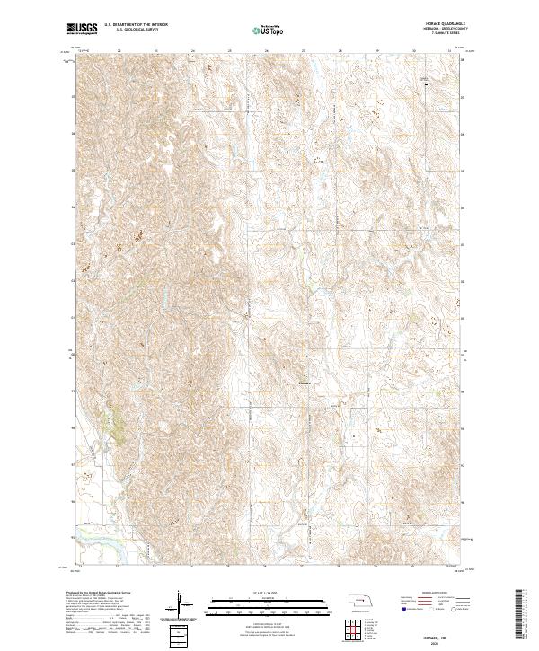 2021 Horace2021 Print · USGSGreeley County agricultural life and the valley of the North Loup River are documented in this recent survey. Local researchers can locate the Pleasant Hill Cem, the crossroads at Horace, and the winding course of Wallace Cr.
 - 2021 Map of North Loup, 2021 Print
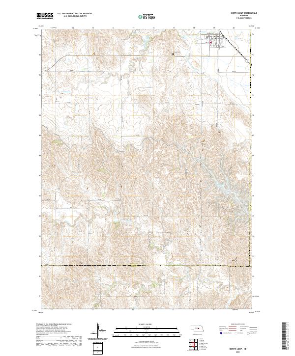 2021 North Loup2021 Print · USGSIn the Nebraska loess hills during the early 2020s, this area shows the enduring layout of North Loup and its nearby waterways. Genealogists and researchers can trace local landmarks like Hillside Cem and the sprawling Davis Creek Reservoir.
 - 2021 Map of Wolbach, 2021 Print
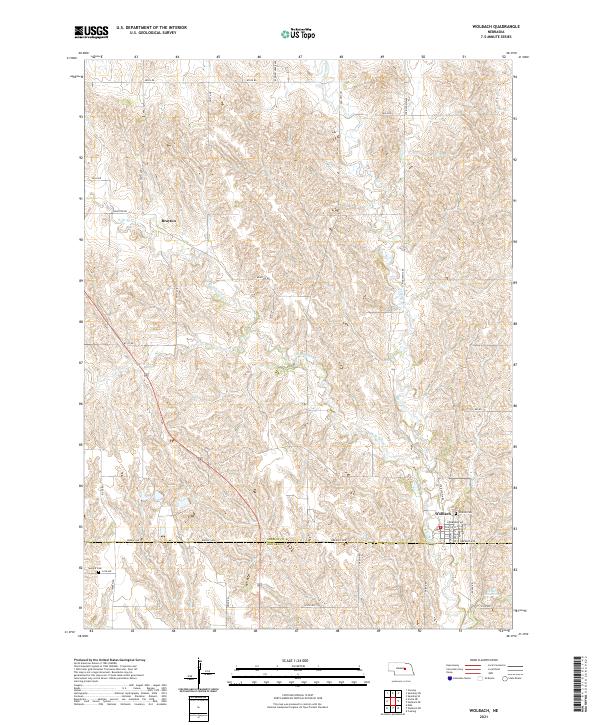 2021 Wolbach2021 Print · USGSThe rural landscape of Greeley and Howard counties is captured here in the early twenty-first century. Genealogists and local historians can locate Wolbach and the outlying Brayton settlement, alongside landmarks like Hillside Cem and Summit Cem.
 - 2021 Map of Greeley, 2021 Print
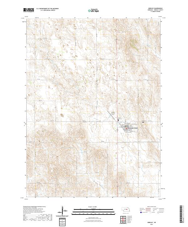 2021 Greeley2021 Print · USGSGreeley and the surrounding Nebraska plains are shown in this recent survey, capturing the region's orderly agricultural grid. Researchers can locate the Greeley County Courthouse, trace the Boston Valley, or find family sites at Sacred Heart Cem.
 - 2021 Map of Scotia NE, 2021 Print
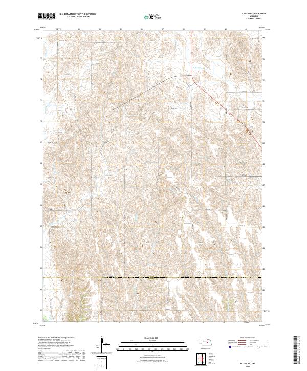 2021 Scotia NE2021 Print · USGSGreeley and Howard counties appear in this recent survey, showcasing a landscape of high Nebraska ridges and deep creek drainages. Genealogists and historians can trace modern property access via Deadwood Trail and landmarks like Munson Creek or Salem Road.
 - 2021 Map of Spalding NW, 2021 Print
 2021 Spalding NW2021 Print · USGSGreeley County and the surrounding Nebraska Sandhills are mapped in detail here during the early twenty-first century. Genealogists and researchers can trace land tracts along Cedar River and identify family properties near College Inn Rd.
 - 2021 Map of Ord NE, 2021 Print
 2021 Ord NE2021 Print · USGSThe Nebraska Sandhills borderlands come into focus in this recent survey of the Valley and Garfield county lines. Genealogists and land researchers can trace property boundaries along Amity Rd or follow the path of the Burwell-Sumter Canal and Miserable Cr.
 - 2021 Map of Greeley NE, 2021 Print
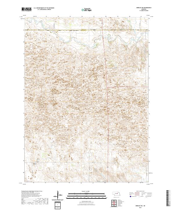 2021 Greeley NE2021 Print · USGSGreeley County's rolling Sandhills terrain is documented here in the early twenty-first century as it transitions toward the Cedar River valley. Researchers can trace the layout of the Belfast area and follow local routes like Ericson Lake Rd and Belfast Rd.
End of results
Showing maps 1-15 of 15
Top cities of Greeley County
Frequently asked questions
- What are the different types of historical maps available for Greeley County?
- What is the oldest map of Greeley County?
- Where can I purchase historical maps of Greeley County for my home or office?
- Where can I download high-res historical maps of Greeley County?
- Are there historical topographic maps available for Greeley County?
- Is there historical aerial imagery available for Greeley County?
- Where are historical maps of Greeley County sourced from?