Old Maps of Greeley County, Nebraska for Metal Detecting
Plan your next treasure hunt with 81 historic maps of Greeley County. Find old homesites, ghost towns, trails, and gathering spots that may be lost to time — perfect for identifying promising metal detecting locations.
- Locate forgotten sites: Uncover places like long-lost settlements, abandoned rail lines, or gathering spots.
- Plan better hunts: Use map overlays combined with LiDAR or satellite views to narrow in on historically rich areas.
- Made for detectorists: Thousands of hobbyists use these maps to discover relics, coins, and hidden history.
Use these historic maps to boost your research and find new opportunities beneath the surface of Greeley County.
Greeley County, NE maps
(81)- 1899 Map of Loup
 1899 Loup1899 Print · USGSCentral Nebraska at the end of the century was a land defined by its rivers and expanding rail lines. Genealogists can trace the early pioneer hubs of Dannebrog, Ashton, and Scotia along the Union Pacific RR.2 unique versions available
 - 1899 Map of St. Paul
 1899 St. Paul1899 Print · USGSCentral Nebraska's river valleys and rail hubs are preserved here during the expansion of the late 1890s. Researchers can trace the development of St. Paul and Central City alongside curious landmarks like Mumpumpey Hill and the Burlington and Missouri River R. R.4 unique versions available
 - 1953 Map of North Loup, 1955 Print
 1953 North Loup1955 Print · USGSNorth Loup and its surrounding townships are shown in the early fifties, capturing a period when rural schoolhouses still dotted the Nebraska landscape. Researchers can trace the Union Pacific rail line and find local landmarks like Hillside Cem, Pleasant Hill Sch, and Deer Creek Sch.2 unique versions available
 - 1953 Map of Scotia NE, 1955 Print
 1953 Scotia NE1955 Print · USGSGreeley and Howard Counties were primarily a network of small family farms and rural school districts in the early fifties. Genealogists can locate specific landmarks like Salem Ch, Fairview Sch, and the winding Chicago Burlington and Quincy rail line.2 unique versions available
 - 1953 Map of Scotia, 1955 Print
 1953 Scotia1955 Print · USGSGreeley County and the North Loup River valley are captured in the early fifties as the region's rail and agricultural infrastructure matured. Researchers can locate Scotia and its nearby Mt Hope Cem, or trace the Union Pacific line down to Scotia Junction.2 unique versions available
 - 1954 Map of Ord SE, 1955 Print
 1954 Ord SE1955 Print · USGSValley and Greeley Counties are captured here in the mid-fifties, showing a river valley defined by its irrigation canals and dual railroads. Genealogists and historians can trace the locations of rural schools like Olean Sch and the rail junctions at Spelts and North Loup.3 unique versions available
 - 1954 Map of Ord NE, 1955 Print
 1954 Ord NE1955 Print · USGSThe rural Nebraska prairie in the mid-1950s was a landscape defined by small township school districts and essential water infrastructure. Researchers can trace the locations of historic schools like Plain Valley and Brick Sch or follow the paths of Elm Creek and Spring Creek.2 unique versions available
 - 1954 Map of Horace, 1955 Print
 1954 Horace1955 Print · USGSGreeley County agricultural life in the mid-1950s is centered on the railroad siding at Horace. Genealogists and historians can trace old homestead sites near Pleasant Hill Cem or locate former country schools like Farnell Sch and Mount Hope Sch.3 unique versions available
 - 1954 Map of Greeley NE, 1955 Print
 1954 Greeley NE1955 Print · USGSGreeley and Wheeler counties in the mid-1950s show a rural Nebraska landscape defined by river valleys and the early stages of the Missouri River Basin project. Genealogists can trace early rural life through Cedar Valley Ch, Belfast, and an Old Railroad Grade.3 unique versions available
 - 1954 Map of Greeley, 1955 Print
 1954 Greeley1955 Print · USGSGreeley and the surrounding Nebraska farmland are captured here in the mid-fifties as the railroad era remained central to the local economy. Genealogists and researchers can trace rural school districts like Reed Sch and early burial grounds including Swedish Cem.3 unique versions available
 - 1954 Map of Greeley NW, 1955 Print
 1954 Greeley NW1955 Print · USGSGreeley and Wheeler counties are shown here in the mid-1950s, revealing a landscape of remote townships and rural schools. Genealogists and local historians can trace the foundations of these communities at Amity Cem, Fairdale Sch, and along the Old Railroad Grade.3 unique versions available
 - 1954 Map of Spalding, 1956 Print
 1954 Spalding1956 Print · USGSGreeley County and its neighbors in the mid-1950s show a landscape defined by the Union Pacific rail line and the Cedar River. Genealogists and local historians can trace a dozen numbered school sites and several family burial grounds, including Dublin Cem and Grand View Cem.3 unique versions available
 - 1954 Map of Spalding SW, 1956 Print
 1954 Spalding SW1956 Print · USGSGreeley County agricultural life is preserved here in the mid-fifties, showing a landscape defined by its rural school districts and creek valleys. Genealogists can trace family roots near O'Connor or locate old school sites like Barry Sch and the Hilltop Sch.2 unique versions available
 - 1954 Map of Wolbach, 1956 Print
 1954 Wolbach1956 Print · USGSThe Greeley and Howard County borderlands appear here in the mid-fifties, centered on the railroad hub of Wolbach. You can trace the Chicago Burlington and Quincy rail line past old schoolhouses like Midway Sch and College Knob Sch.
 - 1954 Map of Wolbach NE, 1956 Print
 1954 Wolbach NE1956 Print · USGSCentral Nebraska in the mid-1950s is captured here at the junction of five counties, where the Old Indian Reservation Boundary still defines the land. Genealogists can trace rural family life through the locations of the Cloverdale Sch, Star Sch, and Olive Sch.
 - 1954 Map of Spalding NW, 1956 Print
 1954 Spalding NW1956 Print · USGSGreeley and Wheeler counties are shown in the mid-1950s as the rural school system and river valleys defined local life. Genealogists can locate specific farmstead schoolhouses like Pritchard Sch and Troy Valley Sch along the Cedar River.5 unique versions available
 - 1954 Map of Spalding SE, 1956 Print
 1954 Spalding SE1956 Print · USGSThe Nebraska prairie at the Greeley and Boone County line is captured here in the mid-1950s. Family historians can trace rural school districts like Leo Valley Sch and Dewdrop Sch or locate ancestors at Enfield Cemetery.3 unique versions available
 - 1955 Map of Broken Bow
 1955 Broken Bow1955 Print · USGSCentral Nebraska in the mid-fifties is defined by the sweeping Sand Hills and the vital river valleys that supported its ranching and rail towns. Researchers can trace the rail corridors of the Union Pacific RR and locate settlements like Dannebrog, Broken Bow, and Brewster.5 unique versions available
 - 1956 Map of Broken Bow
 1956 Broken Bow1956 Print · USGSCentral Nebraska during the mid-fifties reveals a region defined by its river-valley railroads and the rolling Sand Hills. Genealogists and local historians can trace the paths of the Chicago Burlington and Quincy through towns like Broken Bow, Merna, and Anselmo.
 - 1985 Map of St. Paul
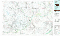 1985 St. Paul1985 Print · USGSCentral Nebraska's river valleys and rail towns are captured here in the mid-eighties, showing the region's agricultural and cultural foundations. Researchers can trace historic communities like Dannebrog, Scotia, and Nysted, or locate landmarks such as Sherman Reservoir and Happy Jack Peak.2 unique versions available
 - 1985 Map of Ord
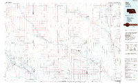 1985 Ord1985 Print · USGSCentral Nebraska's river valleys were defined by the rail and irrigation networks of the mid-1980s. Genealogists can trace family roots in towns like Ord and Albion or locate landmarks like Pilot Knob and the Pibel Lake State Recreation Area.2 unique versions available
 - 2011 Map of Ord SE, 2011 Print
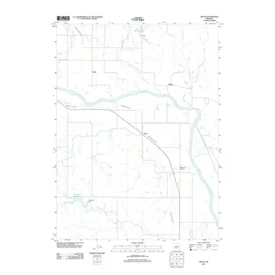 2011 Ord SE2011 Print · USGSThe North Loup River valley and its intricate irrigation network are documented in this 2011 survey of Valley County. Researchers can trace the paths of the Ord North Loup Canal and Burwell Sumter Canal near the settlements of Spelts and Sumter.
 - 2011 Map of Horace, 2011 Print
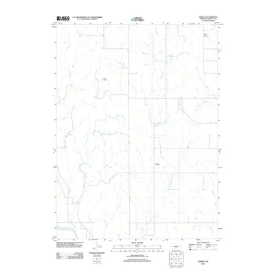 2011 Horace2011 Print · USGSHorace and the surrounding Greeley County prairie appear here in the early twenty-first century as a landscape of remote farmsteads and quiet creek drainages. Genealogists can locate family names at Shelton Cemetery and Pleasant Hill Cemetery or trace the course of the North Loup River.
 - 2011 Map of Spalding SW, 2011 Print
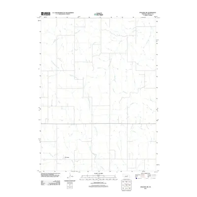 2011 Spalding SW2011 Print · USGSGreeley County agricultural lands and watercourses are captured in this 2011 survey during a period of modern rural stability. Researchers can trace the drainage patterns of East Branch Spring Creek and Troy Creek, or locate the small settlement of O'Connor.
 - 2011 Map of Ord NE, 2011 Print
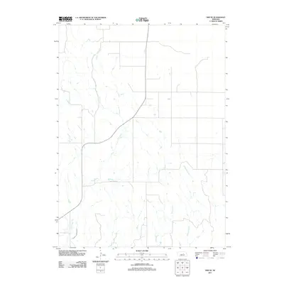 2011 Ord NE2011 Print · USGSGarfield County's rural landscape is captured here in the early twenty-first century, highlighting the vital water infrastructure of the Nebraska plains. Researchers can trace the path of the Burwell Sumter Canal or follow the meandering course of Elm Creek and Messenger Creek through the prairie.
Showing maps 1-25 of 81
Top cities of Greeley County
Frequently asked questions
- What are the different types of historical maps available for Greeley County?
- What is the oldest map of Greeley County?
- Where can I purchase historical maps of Greeley County for my home or office?
- Where can I download high-res historical maps of Greeley County?
- Are there historical topographic maps available for Greeley County?
- Is there historical aerial imagery available for Greeley County?
- Where are historical maps of Greeley County sourced from?