
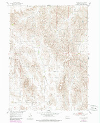
1954 Map of Spalding SW
USGS Topo · Published 1956About this map
O'Connor anchors the southern portion of this mid-century Greeley County landscape, situated along the valley of East Branch Spring Creek. The map reveals a highly structured rural educational network, with numerous district schools like School No 20 and School No 69 spaced systematically across the agricultural sections. In the northern reaches, Freeman Creek and Troy Creek wind through the designated ranges of Freeman Valley and Leo Valley, areas characterized by a dense concentration of smaller valleys and ridges.
Find a feature on this map
17 named features on this map. Tap any name to fly to it.
Don’t see what you’re looking for? This feature index may not catch every label — zoom into the map to look around manually.
Map Details
Editions of this 1954 Spalding SW Map
2 editions found
Other maps of this area

1899 · Loup
USGS Topo · 1:125,000

1899 · St. Paul
USGS Topo · 1:125,000

1953 · Scotia NE
USGS Topo · 1:24,000

1954 · Greeley NE
USGS Topo · 1:24,000

1954 · Greeley
USGS Topo · 1:24,000

1954 · Spalding
USGS Topo · 1:24,000

1954 · Wolbach
USGS Topo · 1:24,000

1954 · Wolbach NE
USGS Topo · 1:24,000

1954 · Spalding NW
USGS Topo · 1:24,000

1954 · Spalding SE
USGS Topo · 1:24,000