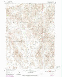
1954 Map of Spalding SW
USGS Topo · Published 1985About this map
O'Connor anchors the southern portion of this Nebraska landscape, situated near the confluence of local drainages that define the region's topography. The area was surveyed as part of the Department of the Interior program for the development of the Missouri River Basin, revealing a rural environment where land use is closely tied to the winding paths of Spring Creek and the East Branch. Small local landmarks like the Dugan Sch and a rural Cem suggest a community organized around section lines and water sources. The terrain is marked by significant drainage systems including Freeman Creek and Troy Creek, which carve through the plains. This 1950s record, updated with 1980s aerial data, provides a clear view of the sparse settlement patterns and the essential infrastructure of roads and schools that supported mid-century life in Greeley County.
Find a feature on this map
7 named features on this map. Tap any name to fly to it.
Don’t see what you’re looking for? This feature index may not catch every label — zoom into the map to look around manually.
Map Details
Editions of this 1954 Spalding SW Map
2 editions found
Other maps of this area

1899 · Loup
USGS Topo · 1:125,000

1899 · St. Paul
USGS Topo · 1:125,000

1953 · Scotia NE
USGS Topo · 1:24,000

1954 · Greeley NE
USGS Topo · 1:24,000

1954 · Greeley
USGS Topo · 1:24,000

1954 · Spalding
USGS Topo · 1:24,000

1954 · Spalding SW
USGS Topo · 1:24,000

1954 · Wolbach
USGS Topo · 1:24,000

1954 · Wolbach NE
USGS Topo · 1:24,000

1954 · Spalding NW
USGS Topo · 1:24,000