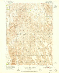
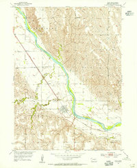
1953 Map of Scotia NE
USGS Topo · Published 1955About this map
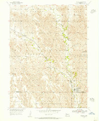
The rolling agricultural landscape of Greeley and Howard Counties is documented here as it appeared in the early 1950s, shortly after the Bureau of Reclamation began mapping for the Missouri River Basin project. The rural social infrastructure is well-defined, showing a network of localized institutions such as Salem Ch and several district schools including School No 30, School No 52, and the Fairview Sch. These small structures, often situated at lonely crossroads, reveal the decentralized nature of Nebraska farming life before the extensive consolidation of the late 20th century.
Find a feature on this map
19 named features on this map. Tap any name to fly to it.
Don’t see what you’re looking for? This feature index may not catch every label — zoom into the map to look around manually.
Map Details
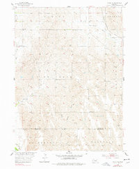
Editions of this 1953 Scotia NE Map
2 editions found
Other maps of this area

1899 · Loup
USGS Topo · 1:125,000

1899 · St. Paul
USGS Topo · 1:125,000
1953 · Cotesfield
USGS Topo · 1:24,000
1953 · Scotia
USGS Topo · 1:24,000
1953 · Elba
USGS Topo · 1:24,000
1954 · Horace
USGS Topo · 1:24,000
1954 · Greeley
USGS Topo · 1:24,000
1954 · Spalding SW
USGS Topo · 1:24,000
1954 · Wolbach
USGS Topo · 1:24,000

1955 · Broken Bow
USGS Topo · 1:250,000