
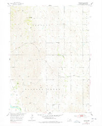
1954 Map of Horace
USGS Topo · Published 1955About this map
Wallace Creek and its many winding tributaries define the topography of this central Nebraska landscape as it appeared in the mid-1950s. The small settlement of Horace serves as a local hub along the Chicago Burlington and Quincy railroad, which cuts through the hills toward the North Loup River in the southwest. This area, mapped for the Missouri River Basin development program, reveals a highly distributed rural society organized around a network of one-room schoolhouses such as Mount Hope Sch, Glendale Sch, and Riverdale Sch. Numerous windmills are marked across the townships of Parnell and Wallace Creek, indicating the vital importance of groundwater for the upland farms and ranches. Near the northern boundary, the Pleasant Hill Cem stands as a quiet marker of the community's early generational roots.
Find a feature on this map
15 named features on this map. Tap any name to fly to it.
Don’t see what you’re looking for? This feature index may not catch every label — zoom into the map to look around manually.
Map Details
Editions of this 1954 Horace Map
Other maps of this area

1899 · Loup
USGS Topo · 1:125,000

1953 · North Loup
USGS Topo · 1:24,000

1953 · Scotia NE
USGS Topo · 1:24,000

1953 · Scotia
USGS Topo · 1:24,000

1954 · Ord SE
USGS Topo · 1:24,000

1954 · Ord NE
USGS Topo · 1:24,000

1954 · Greeley NE
USGS Topo · 1:24,000

1954 · Greeley
USGS Topo · 1:24,000

1954 · Greeley NW
USGS Topo · 1:24,000

1955 · Broken Bow
USGS Topo · 1:250,000