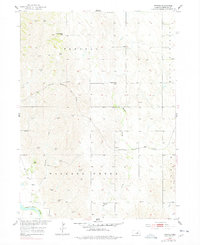
1954 Map of Horace
USGS Topo · Published 1978About this map
Pleasant Hill Cem and Mount Pleasant anchor the northeastern uplands of this Nebraska landscape, where the survey records a mid-century rural school system and agricultural infrastructure. Scattered throughout the townships of Parnell and Wallace Creek are several localized education centers, including Parnell Sch, Mount Hope Sch, Glendale Sch, and Riverdale Sch. These small campuses, combined with the numerous Windmills noted across the terrain, reflect the high density of family farmsteads active during the 1950s.
Find a feature on this map
15 named features on this map. Tap any name to fly to it.
Don’t see what you’re looking for? This feature index may not catch every label — zoom into the map to look around manually.
Map Details
Editions of this 1954 Horace Map
Other maps of this area

1899 · Loup
USGS Topo · 1:125,000

1953 · North Loup
USGS Topo · 1:24,000

1953 · Scotia NE
USGS Topo · 1:24,000

1953 · Scotia
USGS Topo · 1:24,000

1954 · Ord SE
USGS Topo · 1:24,000

1954 · Ord NE
USGS Topo · 1:24,000

1954 · Horace
USGS Topo · 1:24,000

1954 · Greeley NE
USGS Topo · 1:24,000

1954 · Greeley
USGS Topo · 1:24,000

1954 · Greeley NW
USGS Topo · 1:24,000