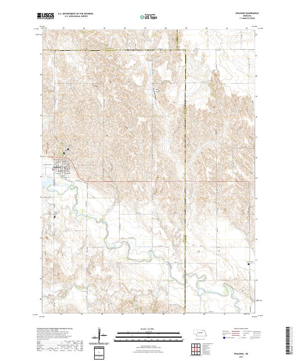
2021 Map of Spalding
USGS Topo · Published 2021About this map
Spalding sits at the heart of this landscape where the Cedar River meanders through the central Nebraska plains. The village layout is clearly defined by its grid, featuring streets like Creamery St and Railroad Ave that hint at its agricultural and transport foundations. The surrounding rural areas are marked by several significant burial grounds, including Grand View Cem, Calvary Cem, and Saint Michaels Cem, which provide essential touchpoints for local family history research. North of the village, Mc Kay Airport and the evocative Ghost Town Ave suggest layers of transportation and settlement history. The terrain is further defined by its watercourses, including Mud Cr and Freeman Cr, alongside a network of section-line roads and the Old Hwy 101 corridor that connect these isolated farmsteads across Greeley, Wheeler, and Boone counties.
Find a feature on this map
59 named features on this map. Tap any name to fly to it.
Don’t see what you’re looking for? This feature index may not catch every label — zoom into the map to look around manually.
Map Details
Editions of this 2021 Spalding Map
This is the sole edition of this map. No revisions or reprints were ever made.
Other maps of this area

1954 · Cedar Rapids
USGS Topo · 1:24,000

1954 · Spalding
USGS Topo · 1:24,000

1954 · Spalding SW
USGS Topo · 1:24,000

1954 · Akron
USGS Topo · 1:24,000

1954 · Spalding NW
USGS Topo · 1:24,000

1954 · Spalding SE
USGS Topo · 1:24,000

1955 · Broken Bow
USGS Topo · 1:250,000

1956 · Broken Bow
USGS Topo · 1:250,000

1960 · Spalding 2 SW
USGS Topo · 1:24,000

1960 · Spalding 2 SE
USGS Topo · 1:24,000