2020s Maps of Johnson County, Nebraska
Explore 12 historic maps of Johnson County from the 2020s. These maps offer a rare glimpse into what life looked like during the 2020s — showing old roads, neighborhoods, homes, and landmarks that have changed or disappeared over time.
Whether you're researching your family's past, planning a metal detecting trip, or studying how Johnson County's landscape evolved across the 2020s, these high-resolution maps are a powerful tool for exploring the history of this region.
- Focus on a specific era: All maps on this page are from the 2020s, giving you a focused view of this time period.
- See what’s changed: Compare century-old streets, trails, and buildings to today's modern landscape using overlays and satellite layers.
- Research with precision: Use these maps for genealogy, historical research, land use analysis, or educational projects.
- View, download, or print: Maps are fully viewable online in high resolution, and can be downloaded or printed for your own records.
Start exploring Johnson County's history through authentic maps from the 2020s. This is your window into the past.
Johnson County, NE maps
(12)- 2021 Map of Saint Mary, 2021 Print
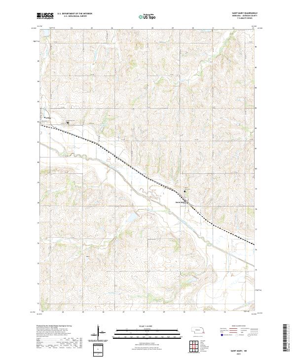 2021 Saint Mary2021 Print · USGSSoutheast Nebraska's agricultural heartland is captured here in the early twenty-first century, centered on the river valleys of Johnson County. Genealogists and local historians can locate family sites near Saint Mary and Sterling, or trace landmarks like the Heusman Reservoir and Saint Mary Cem.
 - 2021 Map of Burr, 2021 Print
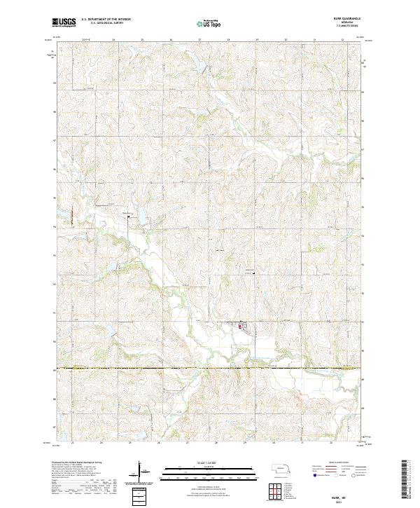 2021 Burr2021 Print · USGSThe community of Burr and the surrounding Otoe County farmlands are captured here in the early twenty-first century. Genealogists and researchers can locate family burial sites at Dughman Cem and Hope Cem or trace the winding path of Saunders Cr.
 - 2021 Map of Tecumseh NW, 2021 Print
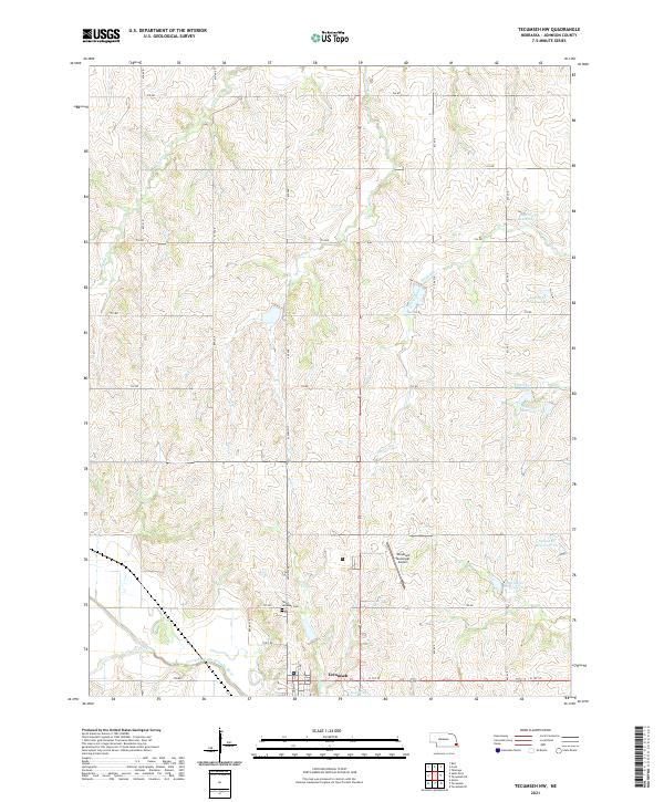 2021 Tecumseh NW2021 Print · USGSThe area surrounding Tecumseh is captured here in the early 2020s, showing a landscape defined by the North Fork Big Nemaha River watershed. Genealogists and local historians can trace legacy routes like Old Hwy 50 and locate landmarks such as Saint Andrews Cem and the Tecumseh Municipal Airport.
 - 2021 Map of Talmage, 2021 Print
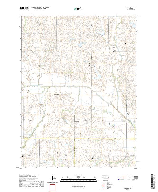 2021 Talmage2021 Print · USGSSoutheast Nebraska’s rolling farmland comes into focus in this recent study of the Otoe County border. Genealogists can locate family sites at Biggs Cem or Livingston Cem, while tracing the winding course of the Little Nemaha River.
 - 2021 Map of Cook, 2021 Print
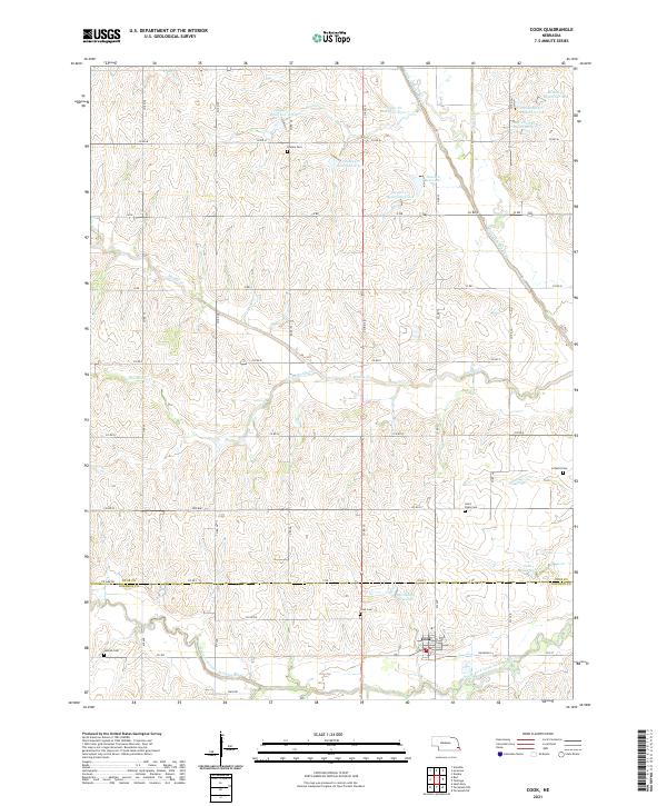 2021 Cook2021 Print · USGSSoutheast Nebraska's rural heartland is meticulously mapped at the start of the 2020s, centered on the village of Cook. Genealogists and local historians can locate several family and parish burial grounds, including Saint Pauls Cem, Helena Cem, and Dudley Cem.
 - 2021 Map of Tecumseh SE, 2021 Print
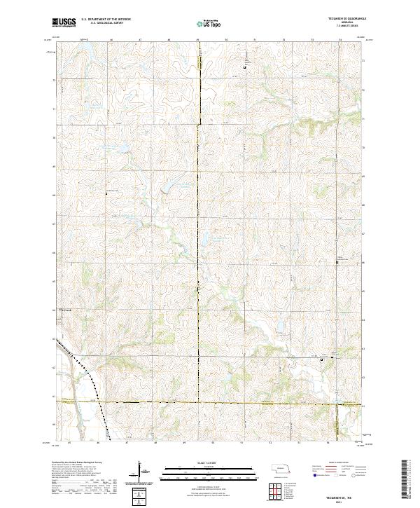 2021 Tecumseh SE2021 Print · USGSSoutheast Nebraska’s agricultural landscape is shown here in the 2020s as a network of section-line roads and watershed reservoirs. Genealogists can locate several rural burial grounds including Grandview Cem, Saint Fredrick Cem, and Trinity Lutheran Cem near Elk Creek.
 - 2021 Map of Douglas, 2021 Print
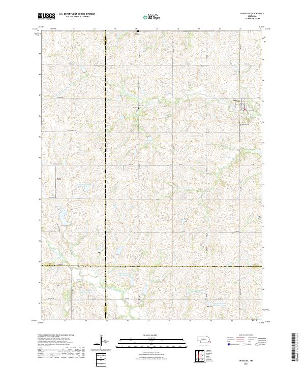 2021 Douglas2021 Print · USGSThis rural portion of Otoe and Lancaster Counties is captured in the early 2020s, centered on the village of Douglas. Researchers can locate local burial grounds like Mount Zion Cem and trace the complex network of reservoirs such as Upper Big Nemaha Reservoir 20-B.
 - 2021 Map of Tecumseh NE, 2021 Print
 2021 Tecumseh NE2021 Print · USGSThe borderlands of Johnson and Nemaha Counties are captured here in the early 2020s, showcasing a landscape of structured agricultural management. Researchers can trace family history at Spring Creek Cem or Johnson Cem and locate local landmarks like Ensor Field.
 - 2021 Map of Vesta, 2021 Print
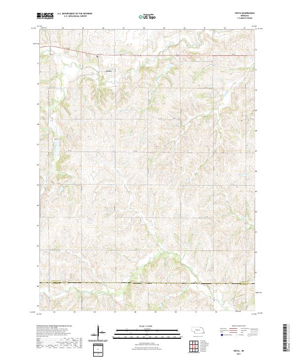 2021 Vesta2021 Print · USGSSoutheast Nebraska’s rural landscape is captured here in the early twenty-first century, centered on the settlement of Vesta. Researchers can trace old family plots at Vesta Cem and follow the intricate drainage of Yankee Creek and Turkey Cr.
 - 2021 Map of Tecumseh, 2021 Print
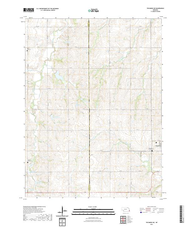
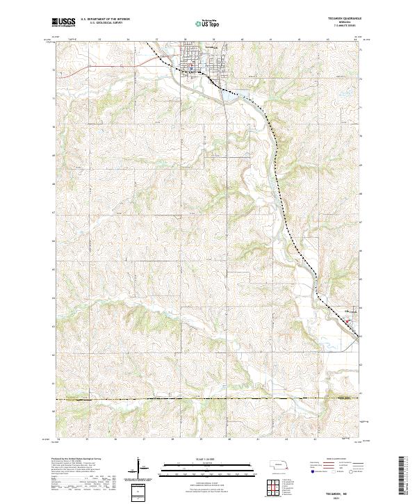 2021 Tecumseh2021 Print · USGSSoutheast Nebraska in the early 2020s remains centered on the river valleys and county seats established generations ago. Genealogists and researchers can trace the local landscape from the Johnson County Courthouse in Tecumseh to the village of Elk Creek.
 - 2021 Map of Crab Orchard, 2021 Print
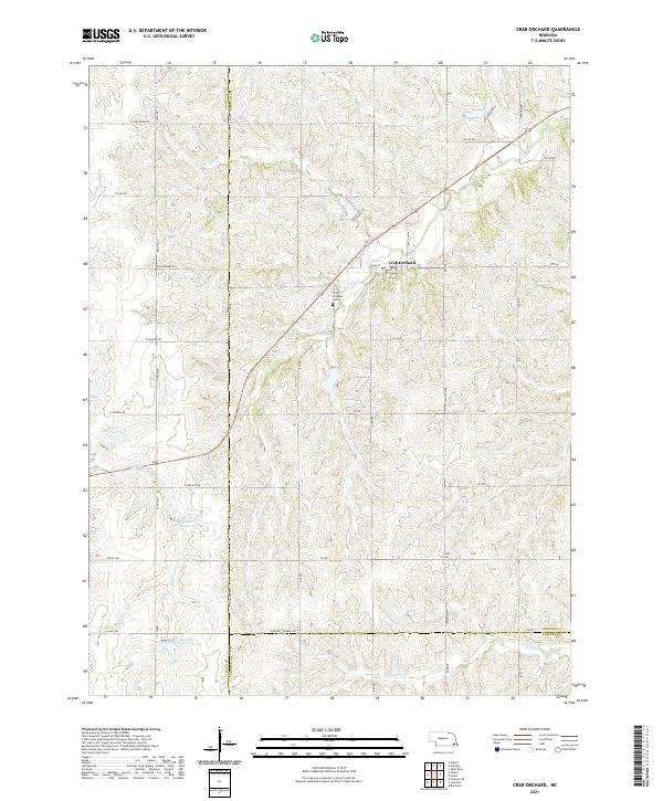 2021 Crab Orchard2021 Print · USGSCrab Orchard and the surrounding Johnson County farmland are captured here in the early twenty-first century. Researchers can locate Crab Orchard Cem and trace the complex water management systems of Mud Cr Reservoir 2-F and Yankee Cr.
 - 2021 Map of Sterling, 2021 Print
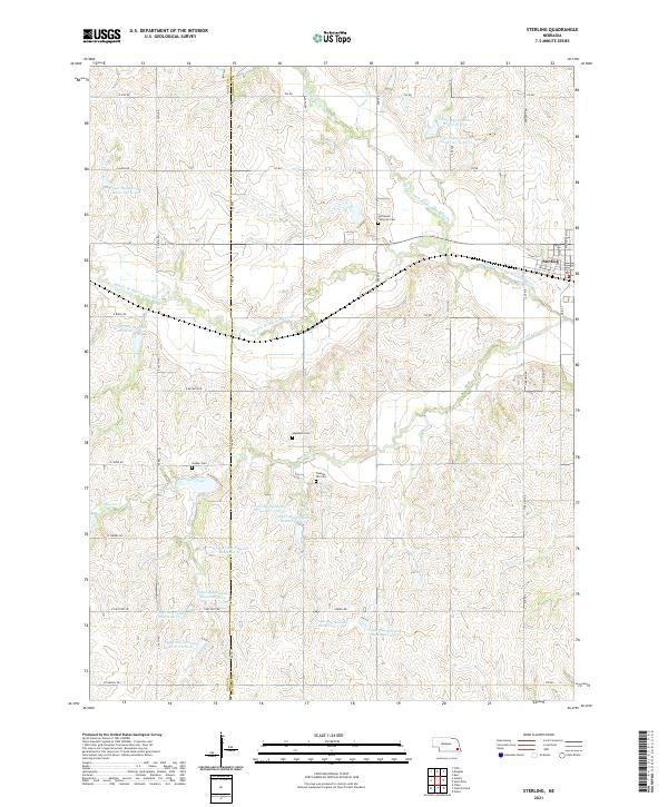 2021 Sterling2021 Print · USGSSoutheast Nebraska’s agricultural heartland is documented here in the early twenty-first century, centered on the village of Sterling. Genealogists and local historians can locate several rural landmarks including Immanuel Lutheran Cem, Hooker Cem, and the winding Hooker Creek.
End of results
Showing maps 1-12 of 12
Top cities of Johnson County
- Tecumseh historical maps
- Sterling historical maps
- Cook historical maps
- Elk Creek historical maps
- Crab Orchard historical maps
Frequently asked questions
- What are the different types of historical maps available for Johnson County?
- What is the oldest map of Johnson County?
- Where can I purchase historical maps of Johnson County for my home or office?
- Where can I download high-res historical maps of Johnson County?
- Are there historical topographic maps available for Johnson County?
- Is there historical aerial imagery available for Johnson County?
- Where are historical maps of Johnson County sourced from?