1960s Maps of Johnson County, Nebraska
Explore 12 historic maps of Johnson County from the 1960s. These maps offer a rare glimpse into what life looked like during the 1960s — showing old roads, neighborhoods, homes, and landmarks that have changed or disappeared over time.
Whether you're researching your family's past, planning a metal detecting trip, or studying how Johnson County's landscape evolved across the 1960s, these high-resolution maps are a powerful tool for exploring the history of this region.
- Focus on a specific era: All maps on this page are from the 1960s, giving you a focused view of this time period.
- See what’s changed: Compare century-old streets, trails, and buildings to today's modern landscape using overlays and satellite layers.
- Research with precision: Use these maps for genealogy, historical research, land use analysis, or educational projects.
- View, download, or print: Maps are fully viewable online in high resolution, and can be downloaded or printed for your own records.
Start exploring Johnson County's history through authentic maps from the 1960s. This is your window into the past.
Johnson County, NE maps
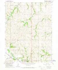
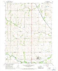
(12)- 1965 Map of Crab Orchard, 1966 Print
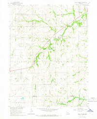 1965 Crab Orchard1966 Print · USGSSoutheastern Nebraska agriculture and rural life take center stage in this mid-1960s study of Johnson County. Researchers can trace the development of Crab Orchard along Route 136 or locate family sites near Crab Orchard Cem and Yankee Creek.
 - 1965 Map of Sterling, 1966 Print
 1965 Sterling1966 Print · USGSSoutheast Nebraska's agricultural heartland is documented here in the mid-1960s, centered on the railroad town of Sterling. Researchers can locate historic rural institutions like Hooker Sch and South St Johns Ch among the rolling creek valleys.
 - 1965 Map of Tecumseh, 1966 Print
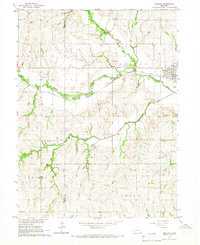
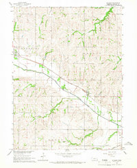
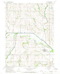
 1965 Tecumseh1966 Print · USGSThe Johnson County seat of Tecumseh is shown here in the mid-sixties at the junction of two major rail lines and the Big Nemaha River. Researchers can locate vanished rural schoolhouses like Hedge Corner Sch, the village of Elk Creek, and the Mt Hope Cem.
 - 1965 Map of Tecumseh SE, 1966 Print
 1965 Tecumseh SE1966 Print · USGSThe town of Elk Creek is shown in the mid-1960s at the junction of the Nemaha River and the Chicago Burlington and Quincy railroad. Trace family history through numerous rural landmarks like Stutheit Cem and St James Ch.
 - 1965 Map of Douglas, 1966 Print
 1965 Douglas1966 Print · USGSThe rolling hills of Otoe and Johnson counties appear here in the mid-1960s, centered on the village of Douglas. Researchers can trace the Missouri Pacific railroad line and find family sites like Solon Cem and St Martins Cem.
 - 1965 Map of Tecumseh NW, 1966 Print
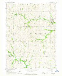
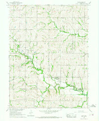
 1965 Tecumseh NW1966 Print · USGSSoutheast Nebraska’s rolling farm country is captured here in the mid-sixties, anchored by the river valley around Tecumseh. Researchers can trace old property lines near St Andrews Cem or locate the rural Sandridge Sch and Warner Sch.
 - 1965 Map of Vesta, 1966 Print
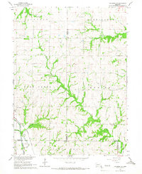
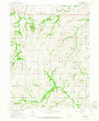 1965 Vesta1966 Print · USGSSoutheast Nebraska's agricultural heartland is documented here in the mid-sixties, centered on the village of Vesta and its surrounding townships. Genealogists and historians can trace former school sites like Bellevue Sch and Maple Center Sch or follow the path of an Old Railroad Grade.
 - 1965 Map of St. Mary, 1968 Print
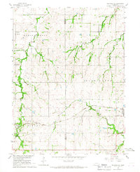
 1965 St. Mary1968 Print · USGSJohnson County’s rural landscape is captured here in the mid-1960s, showing the agricultural heartland centered on the North Fork Big Nemaha River. Local historians can trace the path of the Chicago Burlington and Quincy Railroad as it links Sterling, St. Mary, and the quiet crossroads of Beatty.
 - 1966 Map of Tecumseh NE, 1967 Print
 1966 Tecumseh NE1967 Print · USGSThe rural intersection of Johnson and Nemaha counties in the mid-1960s highlights a landscape of family farms and active rail lines. Researchers can find precise locations for Spring Creek Sch No 21, Zion Ch, and the St Matthews Cem.
 - 1966 Map of Cook, 1968 Print
 1966 Cook1968 Print · USGSSoutheast Nebraska in the mid-sixties reveals a landscape shaped by the Missouri Pacific railroad and the Little Nemaha River. Trace local history through the St Pauls Ch, Evergreen Sch, and old burial grounds like Cook Cem.
 - 1966 Map of Talmage, 1968 Print
 1966 Talmage1968 Print · USGSThe river-and-rail landscape of southeast Nebraska is captured here in the mid-1960s. Genealogists can trace family footprints across rural sites like Walnut Hill Sch, Livingston Cem, and the village of Talmage.
 - 1966 Map of Burr, 1968 Print
 1966 Burr1968 Print · USGSThe rural landscape of Otoe and Johnson Counties is captured here in the mid-1960s, centered on the village of Burr. Genealogists and local historians can trace ancestral sites like Dughman Cem, Hopewell Ch, and the Missouri Pacific rail line.
End of results
Showing maps 1-12 of 12
Top cities of Johnson County
- Tecumseh historical maps
- Sterling historical maps
- Cook historical maps
- Elk Creek historical maps
- Crab Orchard historical maps
Frequently asked questions
- What are the different types of historical maps available for Johnson County?
- What is the oldest map of Johnson County?
- Where can I purchase historical maps of Johnson County for my home or office?
- Where can I download high-res historical maps of Johnson County?
- Are there historical topographic maps available for Johnson County?
- Is there historical aerial imagery available for Johnson County?
- Where are historical maps of Johnson County sourced from?