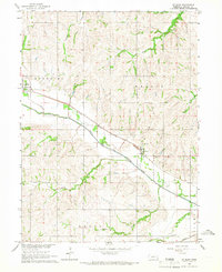
1965 Map of St. Mary
USGS Topo · Published 1968About this map
The North Fork Big Nemaha River carves a prominent valley through this section of Johnson County, dictating the placement of both rail and road infrastructure in the mid-1960s. The Chicago Burlington and Quincy Railroad runs diagonally across the landscape, connecting the town of Sterling in the northwest to the smaller settlement of St. Mary. This rail-oriented corridor is punctuated by local landmarks like the Sterling Cem and St. Mary Cem, which serve as vital points for genealogical research.
Find a feature on this map
17 named features on this map. Tap any name to fly to it.
Don’t see what you’re looking for? This feature index may not catch every label — zoom into the map to look around manually.
Map Details
Editions of this 1965 St. Mary Map
This is the sole edition of this map. No revisions or reprints were ever made.
Other maps of this area

1903 · Weeping Water
USGS Topo · 1:125,000

1929 · Weeping Water
USGS Topo · 1:125,000

1955 · Lincoln
USGS Topo · 1:250,000

1957 · Lincoln
USGS Topo · 1:250,000

1958 · Lincoln
USGS Topo · 1:250,000

1965 · Crab Orchard
USGS Topo · 1:24,000

1965 · Sterling
USGS Topo · 1:24,000

1965 · Tecumseh
USGS Topo · 1:24,000
1965 · Douglas
USGS Topo · 1:24,000
1965 · Tecumseh NW
USGS Topo · 1:24,000