
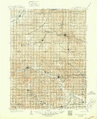
1903 Map of Weeping Water
USGS Topo · Published 1903About this map
Weeping Water and the surrounding agricultural townships of Cass and Otoe counties dominate this early twentieth-century landscape. The area is defined by a dense network of competing rail lines, including the Burlington & Missouri River R.R. and the Chicago Rock Island and Pacific R.R., which facilitated the growth of numerous grain-handling settlements like Syracuse, Elmwood, and Palmyra. The drainage of the Little Nemaha River and Weeping Water Creek carves through the prairie, establishing the topography that dictated the placement of early roads and townsites. Many small villages such as Berlin (later renamed) and Talmage appear at their peak as rural rail hubs. This survey captures the region just before the automotive era began to reshape the commercial importance of these small-town depots and local milling sites.
Find a feature on this map
69 named features on this map. Tap any name to fly to it.
Don’t see what you’re looking for? This feature index may not catch every label — zoom into the map to look around manually.
Map Details
Editions of this 1903 Weeping Water Map
2 editions found
Other maps of this area

1893 · Fremont
USGS Topo · 1:125,000

1896 · Fremont
USGS Topo · 1:125,000

1897 · Lincoln
USGS Topo · 1:125,000

1899 · Wahoo
USGS Topo · 1:125,000

1907 · Nebraska City
USGS Topo · 1:62,500

1915 · Howe
USGS Topo · 1:62,500

1929 · Weeping Water
USGS Topo · 1:125,000

1935 · Nehawka
USGS Topo · 1:48,000

1940 · Nehawka
USGS Topo · 1:62,500

1954 · Omaha
USGS Topo · 1:250,000