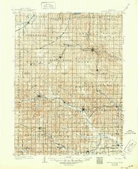
1903 Map of Weeping Water
USGS Topo · Published 1949About this map
Agricultural development and early rail corridors define this southeastern Nebraska landscape at the turn of the century. The Weeping Water settlement serves as a central hub, situated along the Weeping Water Creek and the Missouri Pacific R. R.. To the north, the Platte River forms a natural boundary near Louisville, while the southern reaches are drained by the Little Nemaha River system. The map documents numerous smaller rail-stop communities like Elmwood, Palmyra, and Syracuse, which illustrate the dense network of the Burlington & Missouri River R. R. and the Chicago Rock Island and Pacific R. R.. This 1902 survey by R.C. McKinney and M. Hackett captures the region before the consolidation of rural township lines, showing the early boundaries of Stockton and Delaware in their original configuration.
Find a feature on this map
65 named features on this map. Tap any name to fly to it.
Don’t see what you’re looking for? This feature index may not catch every label — zoom into the map to look around manually.
Map Details
Editions of this 1903 Weeping Water Map
2 editions found
Other maps of this area

1893 · Fremont
USGS Topo · 1:125,000

1896 · Fremont
USGS Topo · 1:125,000

1897 · Lincoln
USGS Topo · 1:125,000

1899 · Wahoo
USGS Topo · 1:125,000

1903 · Weeping Water
USGS Topo · 1:125,000

1907 · Nebraska City
USGS Topo · 1:62,500

1915 · Howe
USGS Topo · 1:62,500

1929 · Weeping Water
USGS Topo · 1:125,000

1935 · Nehawka
USGS Topo · 1:48,000

1940 · Nehawka
USGS Topo · 1:62,500