Old Maps of Otoe County, Nebraska
Explore 116 old maps of Otoe County, spanning from 1903 to today. These high-resolution historic maps reveal how streets, neighborhoods, landmarks, and natural features evolved over time — perfect for genealogy, metal detecting, research, and local history exploration.
What you can do with these maps:
- See how Otoe County changed over time: Compare historical maps to modern-day views to trace roads, homesites, rail lines & more.
- View detailed metadata: Each map includes creators, publishers, year, scale, and archive source.
- Overlay maps with satellite & LiDAR: Visualize the past alongside modern tools to explore terrain & human change.
- Trusted historical sources: Maps sourced from the USGS, Library of Congress, and other archives.
- Access maps your way: View online, download high-res files, or order prints for personal or research use.
Start exploring old maps of Otoe County to uncover forgotten places, hidden landmarks, and the deep history beneath your feet.
Otoe County, NE maps
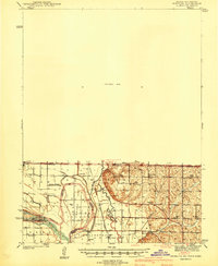
(116)- 1903 Map of Weeping Water
 1903 Weeping Water1903 Print · USGSSoutheast Nebraska at the start of the twentieth century was a thriving patchwork of rail-dependent prairie towns and river valleys. Genealogists and local historians can trace early property boundaries and township seats like Weeping Water, Syracuse, and the riverside town of Louisville.2 unique versions available
 - 1907 Map of Nebraska City
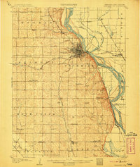 1907 Nebraska City1907 Print · USGSNebraska City and its surrounding Missouri River bluffs are captured here in the first decade of the 1900s during a period of significant rail expansion. Genealogists can locate numerous rural schoolhouses and small settlements like Minersville, Wyoming, and the historic St Lukes Church.3 unique versions available
 - 1929 Map of Weeping Water
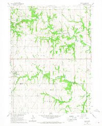
 1929 Weeping Water1929 Print · USGSEastern Nebraska's fertile prairie was a hub of railroad development and river-valley settlement at the start of the twentieth century. Researchers can trace the early layout of communities like Weeping Water, Syracuse, and Louisville along the Missouri Pacific R. R. and Platte River.
 - 1935 Map of Nehawka
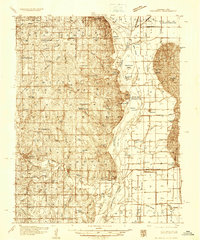 1935 Nehawka1935 Print · USGSThe Missouri River valley along the Nebraska-Iowa border appears here during the mid-1930s, showing a landscape defined by riverside bluffs and fertile bottomlands. Genealogists can trace family roots through numerous local landmarks, from Sargents Spur and Nehawka to rural schools like Ameck Sch and Eight Mile Grove Sch.2 unique versions available
 - 1939 Map of Hamburg
 1939 Hamburg1939 Print · USGSThe Missouri River lowlands at the triple-state border are captured here just before the mid-century. Genealogists can trace family footprints across a dense network of rural schoolhouses like Miller Sch and Star Sch, or locate the Stoner Cem and Lone Chapel.2 unique versions available
 - 1940 Map of Nehawka
 1940 Nehawka1940 Print · USGSThe Missouri River valley comes to life in this pre-war survey of Cass County and the Iowa border. Genealogists can locate family names at Youngs Cem or trace dozens of rural school sites like Cottonwood Sch and Eightmile Grove Sch.3 unique versions available
 - 1941 Map of Hamburg
 1941 Hamburg1941 Print · USGSThe Missouri-Iowa borderlands come alive in this pre-war survey of the river's winding oxbows and rural townships. Genealogists can trace family roots through a dense network of country schools and churches, from Mayflower Sch to the Stoner Cem.2 unique versions available
 - 1955 Map of Nebraska City, 1967 Print
 1955 Nebraska City1967 Print · USGSThe four-state region surrounding the Missouri River valley appears here in the mid-1950s, a landscape of rail-dependent market towns and rural school districts. Genealogists can locate family landmarks like the Rock Bluff School, St Oswald Church, and the Clarinda State Hospital.3 unique versions available
 - 1955 Map of Lincoln, 1967 Print
 1955 Lincoln1967 Print · USGSSoutheast Nebraska in the mid-fifties presents a landscape of thriving railroad towns and the expanding footprint of the capital city. Researchers can trace the legacy of the pioneer era at the Homestead National Monument of America or locate mid-century military infrastructure like Lincoln Air Force Base.5 unique versions available
 - 1957 Map of Nebraska City
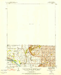
 1957 Nebraska City1957 Print · USGSThe four-state junction of Nebraska, Iowa, Missouri, and Kansas comes alive in this mid-fifties survey of the Missouri River valley. Genealogists and historians can trace the rail-and-road networks connecting Nebraska City, Maryville, and the Squaw Creek National Wildlife Refuge.
 - 1957 Map of Lincoln
 1957 Lincoln1957 Print · USGSSoutheastern Nebraska at mid-century shows a landscape of thriving rail towns and expanding infrastructure centered on Lincoln. Researchers can trace the path of the Chicago Burlington and Quincy railroad through communities like Weeping Water, Fairmont, and Seward.
 - 1958 Map of Lincoln
 1958 Lincoln1958 Print · USGSSoutheast Nebraska at the end of the 1950s shows a region defined by agricultural trade and the expansion of the state capital. Genealogists can trace family footprints across the Blue Valley and locate landmarks like the Lincoln AFB or the U.S. Veterans Hospital.
 - 1958 Map of Nebraska City
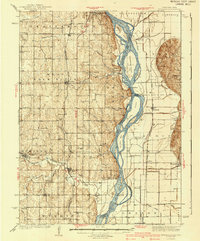
 1958 Nebraska City1958 Print · USGSThe Missouri River Valley and its fertile four-state borderlands are captured here during the mid-century expansion of the regional highway and rail networks. Genealogists can trace family roots through numerous rural landmarks like Moulton School, Shady Grove Church, and the Clarinda State Hospital.
 - 1965 Map of Douglas, 1966 Print
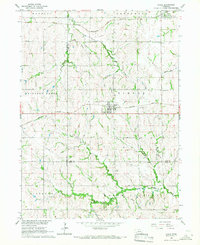
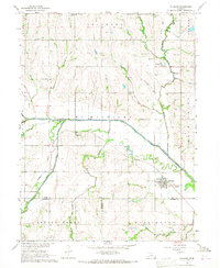
 1965 Douglas1966 Print · USGSThe rolling hills of Otoe and Johnson counties appear here in the mid-1960s, centered on the village of Douglas. Researchers can trace the Missouri Pacific railroad line and find family sites like Solon Cem and St Martins Cem.
 - 1966 Map of Dunbar
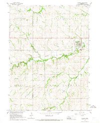
 1966 Dunbar1966 Print · USGSOtoe County in the mid-1960s reveals a prairie landscape of river-valley settlements and rural school districts. Genealogists can trace family roots at Union Cem, locate the Smallfoot Sch, or follow the Chicago Burlington and Quincy rail line.
 - 1966 Map of Nebraska City NW, 1967 Print
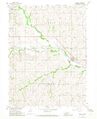
 1966 Nebraska City NW1967 Print · USGSOtoe County at the height of the 1960s reveals a landscape shaped by historic transit and rural school districts. Genealogists and historians can trace the Steam Wagon Road, locate family-named sites like Cowles Cem, and see the early layout of Arbor Lodge State Park.
 - 1966 Map of Avoca, 1967 Print
 1966 Avoca1967 Print · USGSMid-century Cass County is defined here by the small-town center of Avoca and its surrounding network of limestone quarries and rural schools. Genealogists and local historians can locate St Johns Cem, the Center Hill Stone Sch, and private landmarks like Brown Airport.
 - 1966 Map of Eagle, 1967 Print
 1966 Eagle1967 Print · USGSIn the mid-1960s, this portion of eastern Nebraska was a vital intersection for the Missouri Pacific and Rock Island railroads. Researchers can locate numerous family burial sites like Wright Cem and Bunten Cem or trace the early development of Eagle and Alvo.
 - 1966 Map of Julian, 1968 Print
 1966 Julian1968 Print · USGSThe Missouri River bottoms and Nebraska uplands are captured here in the mid-1960s as the river defines the borders of three states. Researchers can trace rural life through the locations of St Bernards Ch, Minersville, and several country schools like Hazel Dell Sch.2 unique versions available
 - 1966 Map of Cook, 1968 Print
 1966 Cook1968 Print · USGSSoutheast Nebraska in the mid-sixties reveals a landscape shaped by the Missouri Pacific railroad and the Little Nemaha River. Trace local history through the St Pauls Ch, Evergreen Sch, and old burial grounds like Cook Cem.
 - 1966 Map of Palmyra, 1968 Print
 1966 Palmyra1968 Print · USGSIn the mid-1960s, these Otoe and Lancaster county borderlands were defined by the winding Little Nemaha River and the CHICAGO BURLINGTON AND QUINCY railroad. Genealogists and local historians can trace family locations near Palmyra and Bennet, or locate rural burials at Rosewood Cem and Mt Zion Cem.
 - 1966 Map of Talmage, 1968 Print
 1966 Talmage1968 Print · USGSThe river-and-rail landscape of southeast Nebraska is captured here in the mid-1960s. Genealogists can trace family footprints across rural sites like Walnut Hill Sch, Livingston Cem, and the village of Talmage.
 - 1966 Map of Nebraska City, 1968 Print
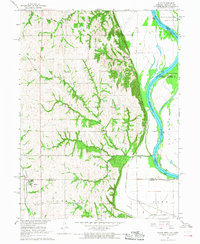
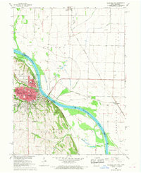 1966 Nebraska City1968 Print · USGSNebraska City and the Missouri River bottoms are captured here in the mid-sixties as the region's rail and agricultural networks remained in full swing. Researchers can trace family sites at Wyuka Cemetery, St Marys Cem, and local institutions like St Mary Hospital.2 unique versions available
 - 1966 Map of Elmwood, 1968 Print
 1966 Elmwood1968 Print · USGSSoutheast Nebraska’s rolling farm country is captured here during the mid-1960s, centered on the village of Elmwood. Researchers can trace the Missouri Pacific rail line and locate rural landmarks like Pleasant Hill Cem and the Parriott Landing Strip.
 - 1966 Map of Unadilla, 1968 Print
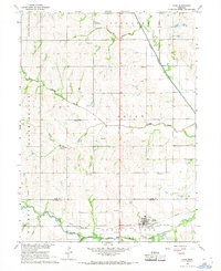
 1966 Unadilla1968 Print · USGSSoutheast Nebraska's agricultural heartland is documented here in the mid-1960s as the rail and river economy centered on Unadilla. Researchers can trace the Chicago Burlington and Quincy rail line and locate ancestral sites like Thompson Cem and Unadilla Cem.
Showing maps 1-25 of 116
Top cities of Otoe County
- Nebraska City historical maps
- Syracuse historical maps
- Palmyra historical maps
- Unadilla historical maps
- Talmage historical maps
- Dunbar historical maps
See more
Frequently asked questions
- What are the different types of historical maps available for Otoe County?
- What is the oldest map of Otoe County?
- Where can I purchase historical maps of Otoe County for my home or office?
- Where can I download high-res historical maps of Otoe County?
- Are there historical topographic maps available for Otoe County?
- Is there historical aerial imagery available for Otoe County?
- Where are historical maps of Otoe County sourced from?