Old Maps of Martin, Nebraska for Hiking & Exploration
Hike through history with 12 historic maps of Martin. Explore old trails, ghost towns, and forgotten backroads — perfect for outdoor adventurers and local explorers.
- Rediscover forgotten places: Map out old mining camps, roads, and footpaths that no longer exist on modern maps.
- Layer with modern tools: Combine with LiDAR or satellite views to plan hikes through historical terrain.
- Made for exploration: Popular among hikers, overlanders, and local history lovers.
Use these maps to find adventure and explore the hidden past of Martin.
Martin, NE maps
(12)- 1897 Map of Ogallala, 1957 Print
 1897 Ogallala1957 Print · USGSWestern Nebraska at the end of the nineteenth century was a corridor of pioneer transit and emerging ranch life. Genealogists and historians can trace the Old California Trail, the Union Pacific rail line, and numerous family homesteads like Kingsley's Ranch.
 - 1900 Map of Ogallala
 1900 Ogallala1900 Print · USGSThe Platte River valley in the late 1890s shows the crucial intersection of the Union Pacific R. R. and the historic Old California Trail. Researchers can trace early irrigation canals and family-owned landmarks like Fairchild's Ranch and California Hill.6 unique versions available
 - 1954 Map of North Platte, 1968 Print
 1954 North Platte1968 Print · USGSThe Nebraska Sand Hills and the Platte River valley are captured here during a period of mid-century growth and agricultural expansion. Trace the vast irrigation network of the Sutherland Canal, locate old rural schoolhouses like Rose Hill School, and find family holdings such as Conrey Ranch.3 unique versions available
 - 1956 Map of North Platte
 1956 North Platte1956 Print · USGSThe Nebraska Sand Hills meet the high plains river valleys in the mid-1950s, a period of intensive water management and rail commerce. Genealogists and historians can trace early prairie settlements like Stapleton and Tryon, or follow the industrial corridor of the Union Pacific through North Platte.
 - 1957 Map of North Platte
 1957 North Platte1957 Print · USGSThe Nebraska Sand Hills and the Platte River valley are captured here in the mid-fifties as the ranching and irrigation economy matured. Genealogists and historians can locate family-named schoolhouses like Maire School or trace the railroad hubs at North Platte and the Fort McPherson National Cemetery.
 - 1967 Map of North Platte
 1967 North Platte1967 Print · USGSThe Nebraska Sand Hills and the Platte River valley meet in the 1960s, showing a landscape shaped by water management and rail. Genealogists can trace rural school districts like the Prairie Dell School or find landmarks like the Scott Lookout Tower and Geo P Kingsley Dam.
 - 1971 Map of Martin
 1971 Martin1971 Print · USGSKeith County ranching and recreation intersect in the early 1970s along the northern shores of the reservoir. Genealogists and local historians can trace legacy cattle operations like Broken Axle Ranch and the community layout of Martin near the Union Pacific line.
 - 1985 Map of Ogallala
 1985 Ogallala1985 Print · USGSThe Platte River valleys in the mid-eighties show a landscape defined by massive water projects and the Union Pacific corridor. Trace the development of Lake Mc Conaughy and irrigation networks near Ogallala, Paxton, and Sutherland.2 unique versions available
 - 2012 Map of Martin, 2012 Print
 2012 Martin2012 Print · USGSKeith County ranching and reservoir life intersect here in the early twenty-first century. Genealogists and historians can trace family landholdings such as Broken Axle Ranch and Ackley Valley Ranch north of the sprawling McConaughy Lake.
 - 2014 Map of Martin, 2014 Print
 2014 Martin2014 Print · USGSThe northern edge of Lake McConaughy meets the Nebraska sandhills in this recent survey of Keith County. Local researchers can trace the rural infrastructure around Martin and the seasonal waters of Ackley Lake and Whitetail Cr.
 - 2017 Map of Martin, 2017 Print
 2017 Martin2017 Print · USGSKeith County's northern reservoir shoreline is documented here in the early twenty-first century, showing the intersection of water and ranchland. Researchers can trace the development of Martin and identify landmarks like Ackley Lake and the winding course of Whitetail Cr.
 - 2021 Map of Martin, 2021 Print
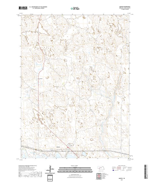 2021 Martin2021 Print · USGSWestern Nebraska ranching country and the shores of Lake McConaughy come into focus in this recent survey. Researchers can trace local landmarks from Wildhorse Valley to Ackley Lake and the settlement of Martin near the water's edge.
End of results
Showing maps 1-12 of 12
Top cities near Martin
Frequently asked questions
- What are the different types of historical maps available for Martin?
- What is the oldest map of Martin?
- Where can I purchase historical maps of Martin for my home or office?
- Where can I download high-res historical maps of Martin?
- Are there historical topographic maps available for Martin?
- Is there historical aerial imagery available for Martin?
- Where are historical maps of Martin sourced from?