Old Maps of Madison, Nebraska
Explore 10 old maps of Madison, spanning from 1955 to today. These high-resolution historic maps reveal how streets, neighborhoods, landmarks, and natural features evolved over time — perfect for genealogy, metal detecting, research, and local history exploration.
What you can do with these maps:
- See how Madison changed over time: Compare historical maps to modern-day views to trace roads, homesites, rail lines & more.
- View detailed metadata: Each map includes creators, publishers, year, scale, and archive source.
- Overlay maps with satellite & LiDAR: Visualize the past alongside modern tools to explore terrain & human change.
- Trusted historical sources: Maps sourced from the USGS, Library of Congress, and other archives.
- Access maps your way: View online, download high-res files, or order prints for personal or research use.
Start exploring old maps of Madison to uncover forgotten places, hidden landmarks, and the deep history beneath your feet.
Madison, NE maps
(10)- 1955 Map of Fremont, 1966 Print
 1955 Fremont1966 Print · USGSEastern Nebraska and the Missouri River border are captured during the mid-fifties, just as the interstate system began to emerge. Researchers can trace the development of Omaha, locate the sprawling Offutt Air Force Base, or study the river-bound ecology of the De Soto National Wildlife Refuge.3 unique versions available
 - 1957 Map of Fremont
 1957 Fremont1957 Print · USGSEastern Nebraska and western Iowa thrive along the Platte and Missouri rivers during the mid-fifties. Genealogists can locate small rural schools like Fairview School and tracing the paths of the Union Pacific through towns like Albion and Humphrey.
 - 1958 Map of Fremont
 1958 Fremont1958 Print · USGSEastern Nebraska in the late fifties is captured here as a thriving corridor of river-valley commerce and rail transport. Researchers can trace the development of Omaha and Fremont or locate local landmarks like Midland College and Offutt Air Force Base.
 - 1963 Map of Madison, 1964 Print
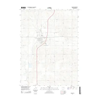
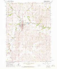 1963 Madison1964 Print · USGSThe city of Madison and its surrounding townships are shown in the early 1960s at the height of the regional rail-and-road economy. Researchers can locate family landmarks such as St Leonards Cem and rural schoolhouses like Good Cheer Sch or Dover Sch.
 - 1976 Map of Madison, 1977 Print
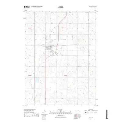
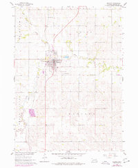 1976 Madison1977 Print · USGSMadison and its surrounding townships thrived in the mid-seventies as a vital Nebraska rail and farming center. Genealogists and local historians can trace rural schoolhouse locations like Union Valley Sch and burial sites at Crown Hill Cem.
 - 1985 Map of Stanton
 1985 Stanton1985 Print · USGSNortheast Nebraska in the mid-eighties shows a landscape of river-valley agriculture and evolving rail networks. Genealogists can trace family footprints through Stanton and Madison, or locate historical markers like the Old Indian Treaty Boundary and Saint Bernard.2 unique versions available
 - 2011 Map of Madison, 2011 Print
 2011 Madison2011 Print · USGSCovers Madison, including Hillside Vista Trailer Court, Madison County, and other nearby areas
 - 2014 Map of Madison, 2014 Print
 2014 Madison2014 Print · USGSCovers Madison, including Hillside Vista Trailer Court, Madison County, and other nearby areas
 - 2017 Map of Madison, 2017 Print
 2017 Madison2017 Print · USGSCovers Madison, including Hillside Vista Trailer Court, Madison County, and other nearby areas
 - 2021 Map of Madison, 2021 Print
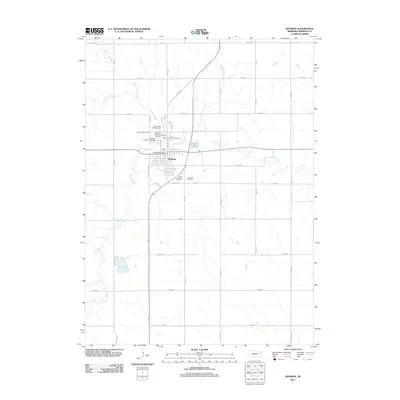
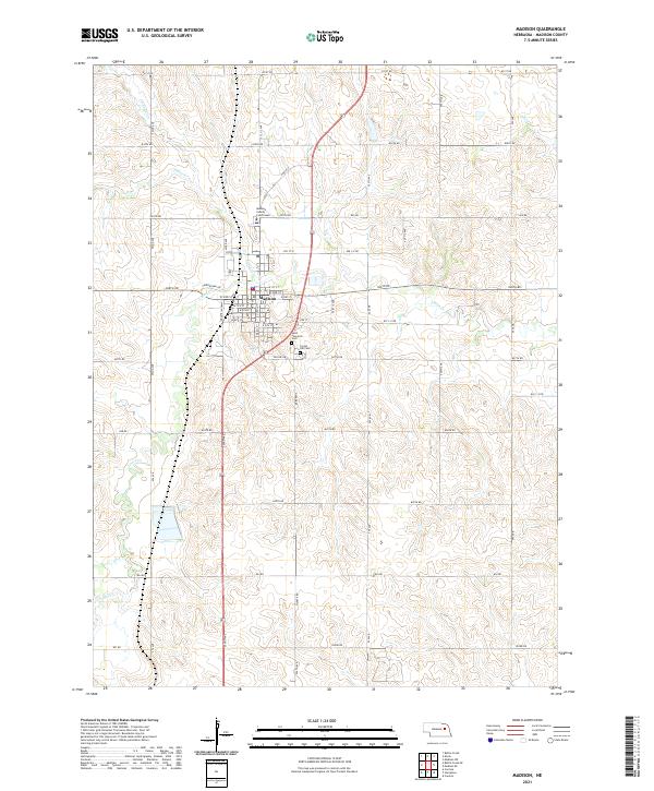 2021 Madison2021 Print · USGSThe seat of Madison County is shown in detail at the start of the 2020s, highlighting its grid and civic heart. Researchers can locate the Madison County Courthouse and trace family history at Saint Leonards Cem or Crown Hill Cem.
End of results
Showing maps 1-10 of 10
Top cities near Madison
- Norfolk historical maps
- Woodland Park historical maps
- Stanton historical maps
- Battle Creek historical maps
- Humphrey historical maps
- Leigh historical maps
See more
Top neighborhoods of Madison
Frequently asked questions
- What are the different types of historical maps available for Madison?
- What is the oldest map of Madison?
- Where can I purchase historical maps of Madison for my home or office?
- Where can I download high-res historical maps of Madison?
- Are there historical topographic maps available for Madison?
- Is there historical aerial imagery available for Madison?
- Where are historical maps of Madison sourced from?