1900s (20th Century) Maps of Madison, Nebraska
Explore 6 historic maps of Madison from the 1900s (20th Century). These maps offer a rare glimpse into what life looked like during the 1900s — showing old roads, neighborhoods, homes, and landmarks that have changed or disappeared over time.
Whether you're researching your family's past, planning a metal detecting trip, or studying how Madison's landscape evolved across the 1900s, these high-resolution maps are a powerful tool for exploring the history of this region.
- Focus on a specific era: All maps on this page are from the 1900s, giving you a focused view of this time period.
- See what’s changed: Compare century-old streets, trails, and buildings to today's modern landscape using overlays and satellite layers.
- Research with precision: Use these maps for genealogy, historical research, land use analysis, or educational projects.
- View, download, or print: Maps are fully viewable online in high resolution, and can be downloaded or printed for your own records.
Start exploring Madison's history through authentic maps from the 1900s. This is your window into the past.
Madison, NE maps
(6)- 1955 Map of Fremont, 1966 Print
 1955 Fremont1966 Print · USGSEastern Nebraska and the Missouri River border are captured during the mid-fifties, just as the interstate system began to emerge. Researchers can trace the development of Omaha, locate the sprawling Offutt Air Force Base, or study the river-bound ecology of the De Soto National Wildlife Refuge.3 unique versions available
 - 1957 Map of Fremont
 1957 Fremont1957 Print · USGSEastern Nebraska and western Iowa thrive along the Platte and Missouri rivers during the mid-fifties. Genealogists can locate small rural schools like Fairview School and tracing the paths of the Union Pacific through towns like Albion and Humphrey.
 - 1958 Map of Fremont
 1958 Fremont1958 Print · USGSEastern Nebraska in the late fifties is captured here as a thriving corridor of river-valley commerce and rail transport. Researchers can trace the development of Omaha and Fremont or locate local landmarks like Midland College and Offutt Air Force Base.
 - 1963 Map of Madison, 1964 Print
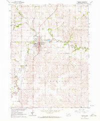 1963 Madison1964 Print · USGSThe city of Madison and its surrounding townships are shown in the early 1960s at the height of the regional rail-and-road economy. Researchers can locate family landmarks such as St Leonards Cem and rural schoolhouses like Good Cheer Sch or Dover Sch.
 - 1976 Map of Madison, 1977 Print
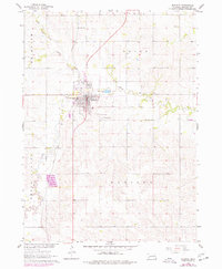 1976 Madison1977 Print · USGSMadison and its surrounding townships thrived in the mid-seventies as a vital Nebraska rail and farming center. Genealogists and local historians can trace rural schoolhouse locations like Union Valley Sch and burial sites at Crown Hill Cem.
 - 1985 Map of Stanton
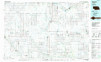 1985 Stanton1985 Print · USGSNortheast Nebraska in the mid-eighties shows a landscape of river-valley agriculture and evolving rail networks. Genealogists can trace family footprints through Stanton and Madison, or locate historical markers like the Old Indian Treaty Boundary and Saint Bernard.2 unique versions available
End of results
Showing maps 1-6 of 6
Top cities near Madison
- Norfolk historical maps
- Woodland Park historical maps
- Stanton historical maps
- Battle Creek historical maps
- Humphrey historical maps
- Leigh historical maps
See more
Top neighborhoods of Madison
Frequently asked questions
- What are the different types of historical maps available for Madison?
- What is the oldest map of Madison?
- Where can I purchase historical maps of Madison for my home or office?
- Where can I download high-res historical maps of Madison?
- Are there historical topographic maps available for Madison?
- Is there historical aerial imagery available for Madison?
- Where are historical maps of Madison sourced from?