1960s Maps of Merrick County, Nebraska
Explore 15 historic maps of Merrick County from the 1960s. These maps offer a rare glimpse into what life looked like during the 1960s — showing old roads, neighborhoods, homes, and landmarks that have changed or disappeared over time.
Whether you're researching your family's past, planning a metal detecting trip, or studying how Merrick County's landscape evolved across the 1960s, these high-resolution maps are a powerful tool for exploring the history of this region.
- Focus on a specific era: All maps on this page are from the 1960s, giving you a focused view of this time period.
- See what’s changed: Compare century-old streets, trails, and buildings to today's modern landscape using overlays and satellite layers.
- Research with precision: Use these maps for genealogy, historical research, land use analysis, or educational projects.
- View, download, or print: Maps are fully viewable online in high resolution, and can be downloaded or printed for your own records.
Start exploring Merrick County's history through authentic maps from the 1960s. This is your window into the past.
Merrick County, NE maps
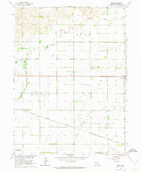
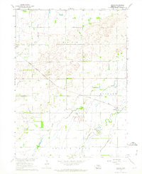
(15)- 1961 Map of Palmer, 1963 Print
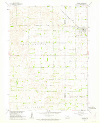 1961 Palmer1963 Print · USGSThe agricultural heart of Howard and Merrick counties comes to life in this early 1960s survey of the plains. Genealogists and historians can trace the foundations of local life through rural landmarks like Rose Hill Cem, School No 19, and the village of Palmer.
 - 1961 Map of St. Libory, 1963 Print
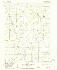 1961 St. Libory1963 Print · USGSThe rural landscape of Howard and Hall counties in the early sixties is defined by a dense network of country schools and the tracks of the Union Pacific. Genealogists can locate family-named landmarks like the Norwegian Cem, Worms, and School No 41.
 - 1962 Map of Central City West, 1963 Print
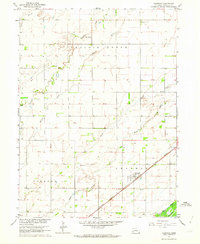
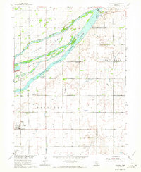
 1962 Central City West1963 Print · USGSMerrick and Hamilton counties appear here in the early sixties as the rail-driven agricultural landscape of the Platte River valley reached its peak maturity. Genealogists and local historians can trace rural school districts from School No 8 to School No 3 and locate landmarks like Bushes Island and Paddock.2 unique versions available
 - 1962 Map of Chapman, 1963 Print
 1962 Chapman1963 Print · USGSMerrick County agricultural life and prairie infrastructure are preserved here in the early sixties. Genealogists and local historians can locate rural landmarks like Pleasant View Sch, the Union Pacific rail line, and the Prairie Creek Cem.
 - 1962 Map of Hord, 1963 Print
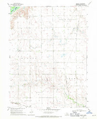
 1962 Hord1963 Print · USGSMerrick County is captured here in the early 1960s, showing a meticulously organized agricultural landscape along the Platte River Valley. Genealogists can locate rural schoolhouses like Comstock Sch and Mead Sch, as well as the Fairview Cem.2 unique versions available
 - 1962 Map of Polk, 1964 Print
 1962 Polk1964 Print · USGSMid-century Nebraska farm life is preserved here, centered on the Union Pacific rail line and the town of Polk. Genealogists can trace family footprints through several rural burial grounds like Laclede Cem and the Immanuel Lutheran Sch.
 - 1962 Map of Phillips, 1964 Print
 1962 Phillips1964 Print · USGSThe braided channels of the Platte River define this Hamilton County landscape during the early 1960s. Researchers can trace the railroad history of Phillips and Lockwood or locate local landmarks like School No 17 and Phillips Cem.
 - 1962 Map of Swedehome, 1964 Print
 1962 Swedehome1964 Print · USGSMid-century Polk County is captured here during a period of agricultural stability and Missouri River Basin development. Researchers can locate community anchors like Swedehome, Beulah Cem, and several numbered rural schools including School No 28.
 - 1962 Map of Archer, 1964 Print
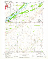
 1962 Archer1964 Print · USGSThe rail-and-river landscape of Merrick County is captured here in the early sixties as the Missouri River Basin development program was in full swing. Researchers can trace the path of the Chicago Burlington and Quincy railroad and find rural landmarks like the United Brethren Ch and Archer.
 - 1962 Map of Central City East, 1964 Print
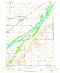
 1962 Central City East1964 Print · USGSThe braided channels of the Platte River dominate this early 1960s survey of the Merrick and Hamilton county line. Genealogists and historians can trace the rural communities of Kronborg and Hordville, or locate landmarks like Mamre Ch and Hord Sch.2 unique versions available
 - 1962 Map of Polk NW, 1964 Print
 1962 Polk NW1964 Print · USGSMerrick County agriculture and transportation were in full swing during the early sixties, centered on the Platte River bottomlands. Researchers can locate numerous rural schoolhouses like School No 80 or trace the routes of the Union Pacific and C B & Q railroads.
 - 1962 Map of Clarks, 1964 Print
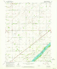
 1962 Clarks1964 Print · USGSMerrick County farmland meets the braided channels of the Platte River in the early sixties. Genealogists and local historians can trace the town of Clarks, locate the Calvary Cem and Clarks Cem, or follow the Union Pacific rail line.
 - 1962 Map of Doniphan, 1964 Print
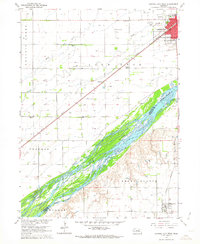
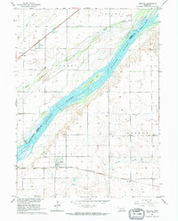
 1962 Doniphan1964 Print · USGSDoniphan and the Platte River valley are captured here in the early sixties, showing a landscape defined by braided river channels and rural townships. Genealogists can locate family-named precincts and community landmarks like Cedarview Cem, School No 19, and the riverside Camp Augustine.3 unique versions available
 - 1962 Map of Grand Island, 1964 Print
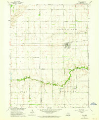
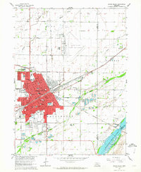 1962 Grand Island1964 Print · USGSGrand Island thrived as a major Nebraska rail hub in the early sixties, where the Union Pacific met the Burlington line. Genealogists and historians can locate dozens of neighborhood landmarks, from the East Grand Island Cem to Central High Sch and the Soldiers and Sailors Home.4 unique versions available
 - 1969 Map of Murphy, 1971 Print
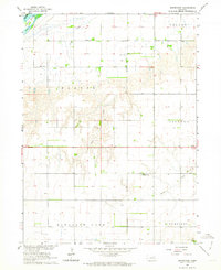
 1969 Murphy1971 Print · USGSHamilton County farming communities thrived along the railroad during the late sixties as irrigation transformed the Nebraska plains. Genealogists and local historians can locate early burial sites at Siloa Cem and Richland Cem, or trace the tracks of the Chicago Burlington and Quincy through the town of Murphy.
End of results
Showing maps 1-15 of 15
Top cities of Merrick County
- Central City historical maps
- Palmer historical maps
- Silver Creek historical maps
- Clarks historical maps
- Chapman historical maps
- Archer historical maps
Frequently asked questions
- What are the different types of historical maps available for Merrick County?
- What is the oldest map of Merrick County?
- Where can I purchase historical maps of Merrick County for my home or office?
- Where can I download high-res historical maps of Merrick County?
- Are there historical topographic maps available for Merrick County?
- Is there historical aerial imagery available for Merrick County?
- Where are historical maps of Merrick County sourced from?