Old Maps of Merrick County, Nebraska for Hiking & Exploration
Hike through history with 141 historic maps of Merrick County. Explore old trails, ghost towns, and forgotten backroads — perfect for outdoor adventurers and local explorers.
- Rediscover forgotten places: Map out old mining camps, roads, and footpaths that no longer exist on modern maps.
- Layer with modern tools: Combine with LiDAR or satellite views to plan hikes through historical terrain.
- Made for exploration: Popular among hikers, overlanders, and local history lovers.
Use these maps to find adventure and explore the hidden past of Merrick County.
Merrick County, NE maps
(141)- 1892 Map of Grand Island
 1892 Grand Island1892 Print · USGSGrand Island and the surrounding Hall County prairies are captured in the late nineteenth century as a vital rail junction. Genealogists and historians can trace early track layouts of the Union Pacific R. R. and locate old settlements like Alda and Doniphan.
 - 1895 Map of Grand Island
 1895 Grand Island1895 Print · USGSGrand Island emerged as a vital rail crossroads in central Nebraska during the late nineteenth century. Genealogists and historians can trace the early development of the city grid and surrounding settlements like Alda and Doniphan, or locate crossings such as the Island Bridge.
 - 1896 Map of Stromsburg
 1896 Stromsburg1896 Print · USGSEast-central Nebraska comes into focus during the late nineteenth-century rail boom, following the vital corridors of the Platte and Loup Rivers. Researchers can trace early township developments and the paths of the Union Pacific R. R. through Stromsburg, Fullerton, and Central City.5 unique versions available
 - 1898 Map of Grand Island
 1898 Grand Island1898 Print · USGSCentral Nebraska is captured in the late 1890s as a bustling rail and agricultural crossroads centered on the Platte River. Genealogists and historians can trace early settlements like Doniphan and Harvard or the grounds of the Insane Asylum outside Hastings.4 unique versions available
 - 1899 Map of St. Paul
 1899 St. Paul1899 Print · USGSCentral Nebraska's river valleys and rail hubs are preserved here during the expansion of the late 1890s. Researchers can trace the development of St. Paul and Central City alongside curious landmarks like Mumpumpey Hill and the Burlington and Missouri River R. R.4 unique versions available
 - 1954 Map of Wolbach NE, 1956 Print
 1954 Wolbach NE1956 Print · USGSCentral Nebraska in the mid-1950s is captured here at the junction of five counties, where the Old Indian Reservation Boundary still defines the land. Genealogists can trace rural family life through the locations of the Cloverdale Sch, Star Sch, and Olive Sch.
 - 1955 Map of Belgrade SW
 1955 Belgrade SW1955 Print · USGSNance and Merrick Counties are documented here in the mid-fifties, showing the high-density rural school network that once served this Missouri River Basin region. Genealogists can locate family landmarks such as North Star, the Glenwood Sch, and the historical Old Indian Reservation Boundary.
 - 1955 Map of Broken Bow
 1955 Broken Bow1955 Print · USGSCentral Nebraska in the mid-fifties is defined by the sweeping Sand Hills and the vital river valleys that supported its ranching and rail towns. Researchers can trace the rail corridors of the Union Pacific RR and locate settlements like Dannebrog, Broken Bow, and Brewster.5 unique versions available
 - 1955 Map of Belgrade SE, 1956 Print
 1955 Belgrade SE1956 Print · USGSThe Loup River valley in the mid-1950s shows a landscape defined by its waterways and historic partitions. Researchers can trace the Old Indian Reservation Boundary and locate numerous rural landmarks like South Side Ch and Liberty Knoll Sch.
 - 1955 Map of Cushing, 1956 Print
 1955 Cushing1956 Print · USGSThe Nebraska river valley near Cushing is captured here in the mid-fifties, showing the intersection of rail transport and rural education. You can trace the Chicago Burlington and Quincy line, locate the Rock Creek Cem, and find several schools like School No 44.2 unique versions available
 - 1955 Map of Fremont, 1966 Print
 1955 Fremont1966 Print · USGSEastern Nebraska and the Missouri River border are captured during the mid-fifties, just as the interstate system began to emerge. Researchers can trace the development of Omaha, locate the sprawling Offutt Air Force Base, or study the river-bound ecology of the De Soto National Wildlife Refuge.3 unique versions available
 - 1955 Map of Grand Island, 1967 Print
 1955 Grand Island1967 Print · USGSCentral Nebraska is seen here during a period of industrial and agricultural growth, centered on the vital Platte River corridor. Researchers can trace the mid-century footprints of the U S Naval Ammunition Depot and the Cornhusker Ordnance Plant.3 unique versions available
 - 1956 Map of Broken Bow
 1956 Broken Bow1956 Print · USGSCentral Nebraska during the mid-fifties reveals a region defined by its river-valley railroads and the rolling Sand Hills. Genealogists and local historians can trace the paths of the Chicago Burlington and Quincy through towns like Broken Bow, Merna, and Anselmo.
 - 1957 Map of Fremont
 1957 Fremont1957 Print · USGSEastern Nebraska and western Iowa thrive along the Platte and Missouri rivers during the mid-fifties. Genealogists can locate small rural schools like Fairview School and tracing the paths of the Union Pacific through towns like Albion and Humphrey.
 - 1957 Map of Grand Island
 1957 Grand Island1957 Print · USGSCentral Nebraska and Northern Kansas are shown here during a period of massive hydraulic and military expansion in the mid-fifties. Researchers can trace the development of the Harlan County Reservoir and the massive wartime legacy of the Cornhusker Ordnance Plant.
 - 1958 Map of Fremont
 1958 Fremont1958 Print · USGSEastern Nebraska in the late fifties is captured here as a thriving corridor of river-valley commerce and rail transport. Researchers can trace the development of Omaha and Fremont or locate local landmarks like Midland College and Offutt Air Force Base.
 - 1958 Map of Grand Island
 1958 Grand Island1958 Print · USGSSouth-central Nebraska thrived as a rail and industrial hub during the late fifties, shaped by the braided Platte River. Genealogists and historians can trace rail lines like the Union Pacific RR through towns such as Kearney or locate the sprawling Cornhusker Ordnance Plant.
 - 1958 Map of Genoa, 1959 Print
 1958 Genoa1959 Print · USGSThe Loup River valley in the late fifties was a landscape of precision-engineered levees and rural school districts. Genealogists and local historians can trace family-named landmarks and institutions like the Friends Cem, Sunny Hollow Sch, and the Union Pacific line through Genoa.
 - 1958 Map of Monroe, 1959 Print
 1958 Monroe1959 Print · USGSMid-century Platte County is defined by the engineered waters of the Loup River and the vital Union Pacific rail line. Researchers can trace rural life through the locations of the Gruetli Ch, several numbered schools, and the village of Monroe.2 unique versions available
 - 1958 Map of Silver Creek SE, 1959 Print
 1958 Silver Creek SE1959 Print · USGSPolk and Platte counties are shown during the late fifties as the river-and-rail economy shaped the Nebraska plains. Researchers can trace rural lineages through local landmarks like St Marys Ch, Gardiner, and several numbered schoolhouses like School No 8.
 - 1958 Map of Fullerton, 1959 Print
 1958 Fullerton1959 Print · USGSFullerton and its surrounding river valleys are captured here in the late fifties, showing the area's transition from small rural districts. Genealogists can locate family landmarks like Pierce Chapel, the Bureau Cemetery, and several one-room schoolhouses like Red Top Sch.
 - 1958 Map of Silver Creek, 1959 Print
 1958 Silver Creek1959 Print · USGSSilver Creek and the surrounding Merrick County farmstead landscape are captured here in the late 1950s. Family historians can trace local landmarks like St Lawrence Cem, School No 40, and the braided islands of the Platte River.
 - 1958 Map of Havens, 1959 Print
 1958 Havens1959 Print · USGSThe agricultural heart of Nebraska's Platte Valley is preserved here during the late fifties, showing the transition between Nance and Merrick Counties. Researchers can trace the Union Pacific rail line and locate rural landmarks like Hilltop Sch and the Old Indian Boundary.
 - 1961 Map of Palmer, 1963 Print
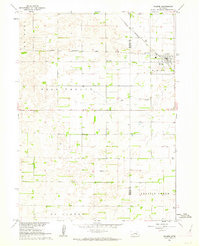 1961 Palmer1963 Print · USGSThe agricultural heart of Howard and Merrick counties comes to life in this early 1960s survey of the plains. Genealogists and historians can trace the foundations of local life through rural landmarks like Rose Hill Cem, School No 19, and the village of Palmer.
 - 1961 Map of St. Libory, 1963 Print
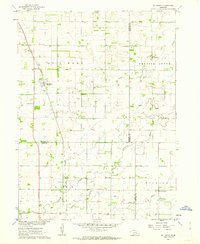 1961 St. Libory1963 Print · USGSThe rural landscape of Howard and Hall counties in the early sixties is defined by a dense network of country schools and the tracks of the Union Pacific. Genealogists can locate family-named landmarks like the Norwegian Cem, Worms, and School No 41.
Showing maps 1-25 of 141
Top cities of Merrick County
- Central City historical maps
- Palmer historical maps
- Silver Creek historical maps
- Clarks historical maps
- Chapman historical maps
- Archer historical maps
Frequently asked questions
- What are the different types of historical maps available for Merrick County?
- What is the oldest map of Merrick County?
- Where can I purchase historical maps of Merrick County for my home or office?
- Where can I download high-res historical maps of Merrick County?
- Are there historical topographic maps available for Merrick County?
- Is there historical aerial imagery available for Merrick County?
- Where are historical maps of Merrick County sourced from?