Old Maps of Timber Creek, Nebraska for Hiking & Exploration
Hike through history with 9 historic maps of Timber Creek. Explore old trails, ghost towns, and forgotten backroads — perfect for outdoor adventurers and local explorers.
- Rediscover forgotten places: Map out old mining camps, roads, and footpaths that no longer exist on modern maps.
- Layer with modern tools: Combine with LiDAR or satellite views to plan hikes through historical terrain.
- Made for exploration: Popular among hikers, overlanders, and local history lovers.
Use these maps to find adventure and explore the hidden past of Timber Creek.
Timber Creek, NE maps
(9)- 1899 Map of St. Paul
 1899 St. Paul1899 Print · USGSCentral Nebraska's river valleys and rail hubs are preserved here during the expansion of the late 1890s. Researchers can trace the development of St. Paul and Central City alongside curious landmarks like Mumpumpey Hill and the Burlington and Missouri River R. R.4 unique versions available
 - 1954 Map of Belgrade NW, 1956 Print
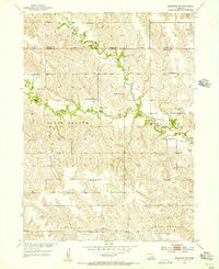 1954 Belgrade NW1956 Print · USGSThe rural borders of Nance and Boone Counties come alive in the mid-1950s, showing a landscape defined by small farmsteads and numerous country schoolhouses. Genealogists and local historians can locate early institutions like Redwing Cem, Peace Ch, and the historical Loup Ferry crossing.
 - 1955 Map of Broken Bow
 1955 Broken Bow1955 Print · USGSCentral Nebraska in the mid-fifties is defined by the sweeping Sand Hills and the vital river valleys that supported its ranching and rail towns. Researchers can trace the rail corridors of the Union Pacific RR and locate settlements like Dannebrog, Broken Bow, and Brewster.5 unique versions available
 - 1956 Map of Broken Bow
 1956 Broken Bow1956 Print · USGSCentral Nebraska during the mid-fifties reveals a region defined by its river-valley railroads and the rolling Sand Hills. Genealogists and local historians can trace the paths of the Chicago Burlington and Quincy through towns like Broken Bow, Merna, and Anselmo.
 - 1985 Map of St. Paul
 1985 St. Paul1985 Print · USGSCentral Nebraska's river valleys and rail towns are captured here in the mid-eighties, showing the region's agricultural and cultural foundations. Researchers can trace historic communities like Dannebrog, Scotia, and Nysted, or locate landmarks such as Sherman Reservoir and Happy Jack Peak.2 unique versions available
 - 2011 Map of Belgrade NW, 2011 Print
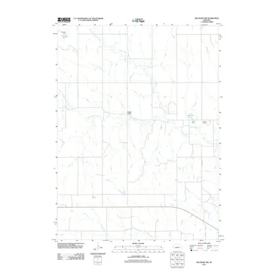 2011 Belgrade NW2011 Print · USGSCovers Timber Creek, including Boone County, Nance County, and other nearby areas
 - 2014 Map of Belgrade NW, 2014 Print
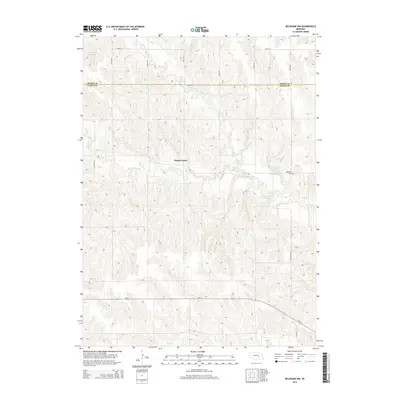 2014 Belgrade NW2014 Print · USGSCovers Timber Creek, including Boone County, Nance County, and other nearby areas
 - 2017 Map of Belgrade NW, 2017 Print
 2017 Belgrade NW2017 Print · USGSCovers Timber Creek, including Boone County, Nance County, and other nearby areas
 - 2021 Map of Belgrade NW, 2021 Print
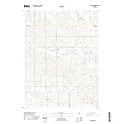
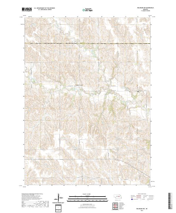 2021 Belgrade NW2021 Print · USGSThe Nebraska plains at the junction of Boone and Nance counties are captured here in the early twenty-first century. Researchers can trace rural landmarks and property access through features like Redwing Cem, Timber Creek, and Robinson Reservoir.
End of results
Showing maps 1-9 of 9
Top cities near Timber Creek
- Fullerton historical maps
- Palmer historical maps
- Cedar Rapids historical maps
- Wolbach historical maps
- Belgrade historical maps
- Primrose, abandoned school historical maps
See more
Frequently asked questions
- What are the different types of historical maps available for Timber Creek?
- What is the oldest map of Timber Creek?
- Where can I purchase historical maps of Timber Creek for my home or office?
- Where can I download high-res historical maps of Timber Creek?
- Are there historical topographic maps available for Timber Creek?
- Is there historical aerial imagery available for Timber Creek?
- Where are historical maps of Timber Creek sourced from?