Old Maps of Pawnee City, Nebraska for Metal Detecting
Plan your next treasure hunt with 9 historic maps of Pawnee City. Find old homesites, ghost towns, trails, and gathering spots that may be lost to time — perfect for identifying promising metal detecting locations.
- Locate forgotten sites: Uncover places like long-lost settlements, abandoned rail lines, or gathering spots.
- Plan better hunts: Use map overlays combined with LiDAR or satellite views to narrow in on historically rich areas.
- Made for detectorists: Thousands of hobbyists use these maps to discover relics, coins, and hidden history.
Use these historic maps to boost your research and find new opportunities beneath the surface of Pawnee City.
Pawnee City, NE maps
(9)- 1955 Map of Lincoln, 1967 Print
 1955 Lincoln1967 Print · USGSSoutheast Nebraska in the mid-fifties presents a landscape of thriving railroad towns and the expanding footprint of the capital city. Researchers can trace the legacy of the pioneer era at the Homestead National Monument of America or locate mid-century military infrastructure like Lincoln Air Force Base.5 unique versions available
 - 1957 Map of Lincoln
 1957 Lincoln1957 Print · USGSSoutheastern Nebraska at mid-century shows a landscape of thriving rail towns and expanding infrastructure centered on Lincoln. Researchers can trace the path of the Chicago Burlington and Quincy railroad through communities like Weeping Water, Fairmont, and Seward.
 - 1958 Map of Lincoln
 1958 Lincoln1958 Print · USGSSoutheast Nebraska at the end of the 1950s shows a region defined by agricultural trade and the expansion of the state capital. Genealogists can trace family footprints across the Blue Valley and locate landmarks like the Lincoln AFB or the U.S. Veterans Hospital.
 - 1965 Map of Pawnee City, 1966 Print
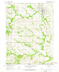 1965 Pawnee City1966 Print · USGSSoutheast Nebraska in the mid-sixties reveals a landscape of rural schoolhouses and busy rail junctions centered on Pawnee City. Researchers can trace old property lines and family landmarks like Barker School, Evergreen Cemetery, and the Rock Island Railroad.
 - 1986 Map of Beatrice
 1986 Beatrice1986 Print · USGSSoutheast Nebraska and the Kansas borderlands appear in the mid-1980s as a thriving agricultural region centered on the Big Blue River. Researchers can trace historic rail routes like the Burlington Northern through hubs such as Beatrice and Pawnee City.2 unique versions available
 - 2011 Map of Pawnee City, 2011 Print
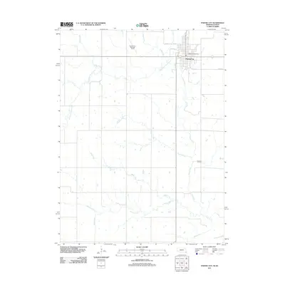 2011 Pawnee City2011 Print · USGSCovers Pawnee City, including Marshall County, Nemaha County, and other nearby areas
 - 2014 Map of Pawnee City, 2014 Print
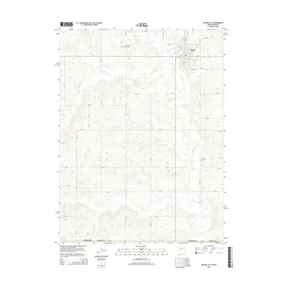 2014 Pawnee City2014 Print · USGSCovers Pawnee City, including Marshall County, Nemaha County, and other nearby areas
 - 2017 Map of Pawnee City, 2017 Print
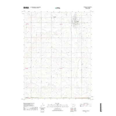 2017 Pawnee City2017 Print · USGSCovers Pawnee City, including Marshall County, Nemaha County, and other nearby areas
 - 2021 Map of Pawnee City, 2021 Print
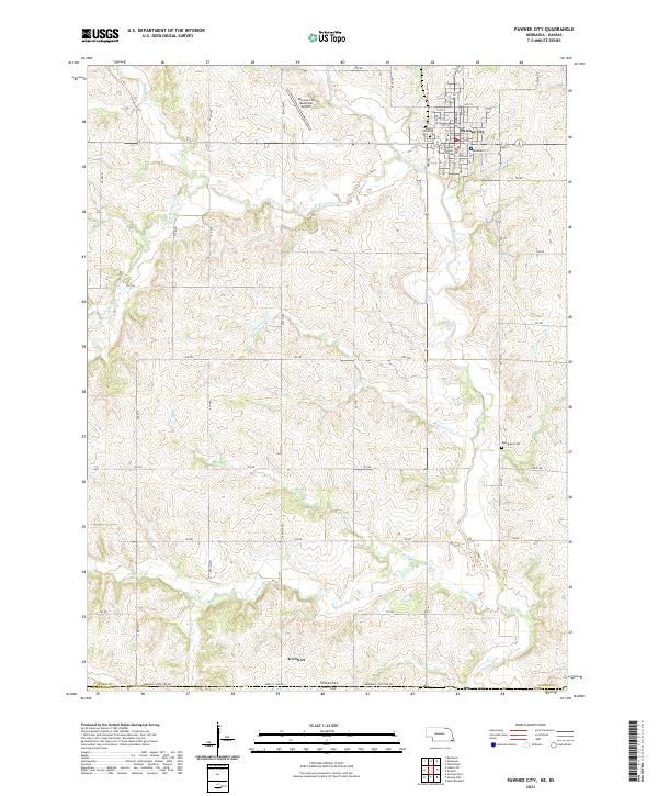 2021 Pawnee City2021 Print · USGSSoutheastern Nebraska agriculture and the Kansas border define this region during the early twenty-first century. Genealogists can locate family sites near Evergreen Cem and Pawnee City Cem or trace the many branches of Turkey Cr.
End of results
Showing maps 1-9 of 9
Top cities near Pawnee City
- Humboldt historical maps
- Table Rock historical maps
- Summerfield historical maps
- Bern historical maps
- Du Bois historical maps
- Elk Creek historical maps
See more
Frequently asked questions
- What are the different types of historical maps available for Pawnee City?
- What is the oldest map of Pawnee City?
- Where can I purchase historical maps of Pawnee City for my home or office?
- Where can I download high-res historical maps of Pawnee City?
- Are there historical topographic maps available for Pawnee City?
- Is there historical aerial imagery available for Pawnee City?
- Where are historical maps of Pawnee City sourced from?