1960s Maps of Richardson County, Nebraska
Explore 19 historic maps of Richardson County from the 1960s. These maps offer a rare glimpse into what life looked like during the 1960s — showing old roads, neighborhoods, homes, and landmarks that have changed or disappeared over time.
Whether you're researching your family's past, planning a metal detecting trip, or studying how Richardson County's landscape evolved across the 1960s, these high-resolution maps are a powerful tool for exploring the history of this region.
- Focus on a specific era: All maps on this page are from the 1960s, giving you a focused view of this time period.
- See what’s changed: Compare century-old streets, trails, and buildings to today's modern landscape using overlays and satellite layers.
- Research with precision: Use these maps for genealogy, historical research, land use analysis, or educational projects.
- View, download, or print: Maps are fully viewable online in high resolution, and can be downloaded or printed for your own records.
Start exploring Richardson County's history through authentic maps from the 1960s. This is your window into the past.
Richardson County, NE maps
(19)- 1960 Map of Kansas City
 1960 Kansas City1960 Print · USGSMid-century Kansas and Missouri meet at the river forks, showing a sprawling rail-and-river economy during the 1950s growth era. Genealogists and researchers can trace tribal lands like the Kickapoo Indian Reservation or follow the early interstate corridors through Saint Joseph and Independence.3 unique versions available
 - 1961 Map of Highland NW, 1962 Print
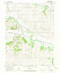
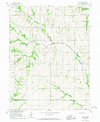
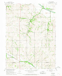
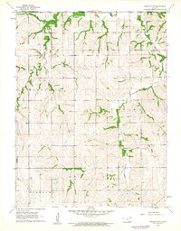 1961 Highland NW1962 Print · USGSThe Kansas-Nebraska borderlands in the early sixties reveal a landscape defined by the Iowa Sac and Fox Indian Reservation Boundary and rural townships. Trace local family history through landmarks like Kenyon Cem, Mt Zion Ch, and the Shore Sch.
 - 1965 Map of Table Rock, 1966 Print
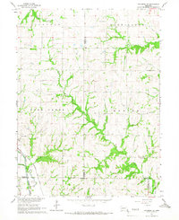
 1965 Table Rock1966 Print · USGSSoutheast Nebraska in the mid-sixties reveals a river-valley landscape where the Chicago Burlington and Quincy railroad mirrors the path of the North Fork Big Nemaha River. Genealogists can trace family locations through sites like Bohemian Cem and the Dry Branch Pioneer Cem.
 - 1965 Map of Tecumseh SE, 1966 Print
 1965 Tecumseh SE1966 Print · USGSThe town of Elk Creek is shown in the mid-1960s at the junction of the Nemaha River and the Chicago Burlington and Quincy railroad. Trace family history through numerous rural landmarks like Stutheit Cem and St James Ch.
 - 1965 Map of Du Bois, 1966 Print
 1965 Du Bois1966 Print · USGSSoutheastern Pawnee County comes to life in the mid-1960s as a bustling agricultural landscape centered on the village of Du Bois. Genealogists can trace family roots through numerous country landmarks including Sheridan Sch, St Johns Ch, and Cincinnati Cem.
 - 1965 Map of Salem, 1966 Print
 1965 Salem1966 Print · USGSThe river valley at Salem and Straussville is captured here in the mid-sixties, showing the convergence of the Big Nemaha River and its forks. Genealogists and historians can locate rural landmarks like St Marks Ch, Maple Cem, and Falls Sch among the railroad networks.
 - 1965 Map of Falls City, 1966 Print
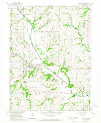
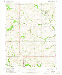
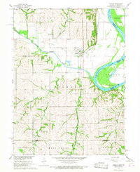
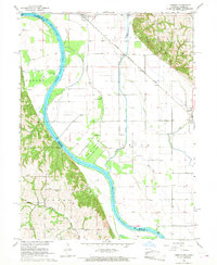
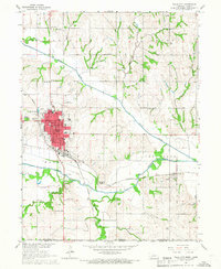 1965 Falls City1966 Print · USGSRichardson County in the mid-1960s shows a thriving rail-and-river hub centered on the Missouri River basin. Genealogists and local historians can trace family roots through rural landmarks like Gladstone Sch, Steele Cemetery, and the Iowa and Sac and Fox Indian Reservation Boundary.2 unique versions available
 - 1965 Map of Rulo, 1966 Print
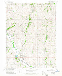
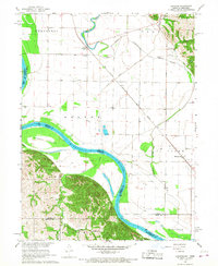
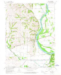 1965 Rulo1966 Print · USGSThe river bluffs and bottomlands of Rulo come alive in the mid-1960s as the rail-and-river economy transitions into the modern era. Trace the path of the Chicago Burlington and Quincy railroad or locate local landmarks like Heater Cem and Brick Sch.
 - 1965 Map of Humboldt SW, 1967 Print
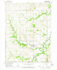
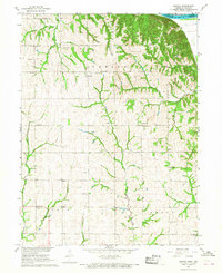
 1965 Humboldt SW1967 Print · USGSSoutheastern Nebraska was still a landscape defined by small rural school districts and community churches in the mid-1960s. Researchers can trace the legacy of local education at Rose Dale Sch and Athens Sch, or locate family sites near Bohemian Cem.2 unique versions available
 - 1965 Map of Dawson, 1967 Print
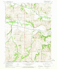
 1965 Dawson1967 Print · USGSRichardson County is captured here in the mid-1960s, showing a well-developed network of small rail towns and rural school districts. Family researchers can locate many local landmarks and burial grounds, including the Stratton Cem, Prospect Ch, and the Grand Avenue Sch.
 - 1965 Map of Humboldt, 1967 Print
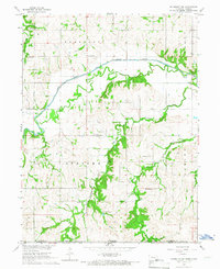
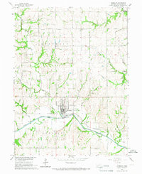 1965 Humboldt1967 Print · USGSMid-1960s Richardson County centers on the rail-and-river hub of Humboldt, where the North Fork Big Nemaha River meets the plains. Genealogists and local historians can trace legacy sites like Lynchburg Cem, Pine Ridge Sch, and the busy Chicago Burlington and Quincy rail line.
 - 1965 Map of Humboldt SE, 1967 Print
 1965 Humboldt SE1967 Print · USGSThe Nebraska-Kansas border comes alive in the mid-sixties as the Big Nemaha River branches across Richardson County farmland. Researchers can locate the Miles Ranch, trace the rail lines of the Chicago Burlington and Quincy, and find family sites like Wild Rose Cem.
 - 1966 Map of Verdon, 1967 Print
 1966 Verdon1967 Print · USGSRichardson County in the mid-1960s shows a landscape of small-town Nebraska life centered around Verdon and Shubert. Genealogists can locate family landmarks like New St Anns Cem, Prairie Ch, and several rural school sites.
 - 1966 Map of Howe SW, 1967 Print
 1966 Howe SW1967 Print · USGSSoutheast Nebraska in the 1960s was a landscape of quiet township lines and creek-side communities. Genealogists can trace family footprints through sites like Pleasant View Cem, St Johns Ch, and the Bratton Union Sch.
 - 1966 Map of Nemaha, 1968 Print
 1966 Nemaha1968 Print · USGSSoutheast Nebraska and the Missouri River border are captured in the mid-sixties, showing the river’s winding course near Nemaha. Researchers can trace the Chicago Burlington and Quincy rail line, find the Maple Grove Sch, and locate the Pennwell Cem in the hills.2 unique versions available
 - 1966 Map of Langdon, 1968 Print
 1966 Langdon1968 Print · USGSThe Missouri-Nebraska borderlands are captured here in the mid-sixties, where the Missouri River meets the Barada Hills. Genealogists and researchers can trace the rail lines of the Chicago Burlington and Quincy or locate rural sites like St Peters Ch and Hunter Cem.3 unique versions available
 - 1966 Map of Barada, 1968 Print
 1966 Barada1968 Print · USGSThe bluffs of eastern Richardson County overlook the Missouri River during the mid-sixties, revealing a landscape of established farmsteads and rural schools. Researchers can trace local genealogy through St Anns Cath Ch, Moorhead Cem, and the village of Barada.2 unique versions available
 - 1966 Map of Howe, 1968 Print
 1966 Howe1968 Print · USGSSoutheast Nebraska in the mid-sixties reveals a countryside shaped by rail lines and river valleys. Genealogists and local historians can locate early landmarks like Cockran Sch, the Missouri Pacific Railroad, and Bedford Cem.
 - 1966 Map of Corning, 1968 Print
 1966 Corning1968 Print · USGSCorning and Craig sit within the fertile Missouri River floodplain during the mid-1960s, a period of established rail transport and river management. Researchers can locate numerous family burial sites and rural institutions like Arago Cemetery, St Marys Church, and the Fargo School.2 unique versions available
End of results
Showing maps 1-19 of 19
Top cities of Richardson County
- Falls City historical maps
- Humboldt historical maps
- Shubert historical maps
- Rulo historical maps
- Stella historical maps
- Verdon historical maps
See more
Frequently asked questions
- What are the different types of historical maps available for Richardson County?
- What is the oldest map of Richardson County?
- Where can I purchase historical maps of Richardson County for my home or office?
- Where can I download high-res historical maps of Richardson County?
- Are there historical topographic maps available for Richardson County?
- Is there historical aerial imagery available for Richardson County?
- Where are historical maps of Richardson County sourced from?