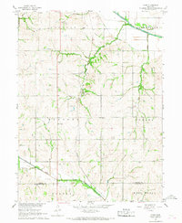
1966 Map of Howe
USGS Topo · Published 1968About this map
The Missouri Pacific Railroad cuts through this rural landscape, following the contours of the land south of the Little Nemaha River. The small settlement of Howe serves as a local hub, surrounded by several active quarries that underscore the area's geological extraction during the mid-1960s. This survey, part of the Missouri River Basin development program, illustrates a deeply etched drainage pattern defined by Muddy Creek, Codington Creek, and Scotch Br. Genealogists will find a wealth of local landmarks, including several family and community burial grounds such as St Pauls Cem, Holy Cross Cem, and Bedford Cem. Further south, the map documents the boundary between Nemaha Co and Richardson Co, near the small industrial site at Claypit.
Find a feature on this map
26 named features on this map. Tap any name to fly to it.
Don’t see what you’re looking for? This feature index may not catch every label — zoom into the map to look around manually.
Map Details
Editions of this 1966 Howe Map
This is the sole edition of this map. No revisions or reprints were ever made.
Other maps of this area

1915 · Falls City
USGS Topo · 1:62,500

1915 · Nemaha
USGS Topo · 1:62,500

1915 · Howe
USGS Topo · 1:62,500

1916 · Humboldt
USGS Topo · 1:62,500

1939 · Nemaha
USGS Topo · 1:62,500

1949 · Nemaha
USGS Topo · 1:62,500

1955 · Nebraska City
USGS Topo · 1:250,000

1957 · Nebraska City
USGS Topo · 1:250,000

1958 · Nebraska City
USGS Topo · 1:250,000
1965 · Dawson
USGS Topo · 1:24,000