
1915 Map of Nemaha
USGS Topo · Published 1915About this map
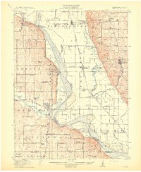
The Missouri River forms the central spine of this 1915 landscape, dividing the fertile bottomlands of the Nishnabotna region in Missouri from the bluff-lined hills of Nebraska. The river's winding course is mirrored by the Nishnabotna River to the east, creating a complex network of oxbows like Horseshoe Lake. Settlement patterns follow the topography, with river towns like Brownville and Nemaha situated at strategic points along the western banks, while Phelps City and Langdon occupy the wide Missouri floodplains.
Find a feature on this map
71 named features on this map. Tap any name to fly to it.
Don’t see what you’re looking for? This feature index may not catch every label — zoom into the map to look around manually.
Map Details
Editions of this 1915 Nemaha Map
2 editions found
Other maps of this area

1907 · Nebraska City
USGS Topo · 1:62,500

1915 · Falls City
USGS Topo · 1:62,500

1915 · Howe
USGS Topo · 1:62,500

1916 · Humboldt
USGS Topo · 1:62,500

1920 · Craig
USGS Topo · 1:62,500

1936 · Fairfax
USGS Topo · 1:24,000

1939 · Tarkio
USGS Topo · 1:62,500

1939 · Farragut
USGS Topo · 1:62,500

1939 · Hamburg
USGS Topo · 1:62,500

1939 · Nemaha
USGS Topo · 1:62,500