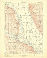
1915 Map of Nemaha
USGS Topo · Published 1915About this map
The State Normal School at Peru anchors this survey of the river valley where Nebraska and Missouri meet. Along the western bluffs, the landscape is defined by the winding Missouri River and the complex rail network of the Chicago Burlington and Quincy, including the Beatrice Line. The area is remarkably dense with rural education, featuring dozens of named schools like Sunny Grove School, Red Star School, and Champion School. Small river towns such as Brownville, Nemaha, and Aspinwall serve as local hubs for the surrounding farmsteads. To the east, the Nishnabotna River meanders through the Missouri floodplain, passing through the settlements of Phelps City and Rockport. This 1915 edition preserves the early 20th-century character of these river counties before modern highway development reorganized the Missouri Valley.
Find a feature on this map
78 named features on this map. Tap any name to fly to it.
Don’t see what you’re looking for? This feature index may not catch every label — zoom into the map to look around manually.
Map Details
Editions of this 1915 Nemaha Map
2 editions found
Other maps of this area

1907 · Nebraska City
USGS Topo · 1:62,500

1915 · Falls City
USGS Topo · 1:62,500

1915 · Nemaha
USGS Topo · 1:62,500

1915 · Howe
USGS Topo · 1:62,500

1916 · Humboldt
USGS Topo · 1:62,500

1920 · Craig
USGS Topo · 1:62,500

1936 · Fairfax
USGS Topo · 1:24,000

1939 · Tarkio
USGS Topo · 1:62,500

1939 · Farragut
USGS Topo · 1:62,500

1939 · Hamburg
USGS Topo · 1:62,500