Old Maps of Rulo, Nebraska for Metal Detecting
Plan your next treasure hunt with 11 historic maps of Rulo. Find old homesites, ghost towns, trails, and gathering spots that may be lost to time — perfect for identifying promising metal detecting locations.
- Locate forgotten sites: Uncover places like long-lost settlements, abandoned rail lines, or gathering spots.
- Plan better hunts: Use map overlays combined with LiDAR or satellite views to narrow in on historically rich areas.
- Made for detectorists: Thousands of hobbyists use these maps to discover relics, coins, and hidden history.
Use these historic maps to boost your research and find new opportunities beneath the surface of Rulo.
Rulo, NE maps
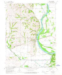
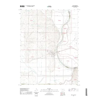
(11)- 1920 Map of Craig
 1920 Craig1920 Print · USGSThe Missouri River bottoms and neighboring bluffs come alive in this post-war survey of the Nebraska-Missouri border. Researchers can trace dozens of rural landmarks, from the streets of Rulo and Bigelow to scattered schoolhouses like Brush College School and Idlewild School.5 unique versions available
 - 1955 Map of Nebraska City, 1967 Print
 1955 Nebraska City1967 Print · USGSThe four-state region surrounding the Missouri River valley appears here in the mid-1950s, a landscape of rail-dependent market towns and rural school districts. Genealogists can locate family landmarks like the Rock Bluff School, St Oswald Church, and the Clarinda State Hospital.3 unique versions available
 - 1957 Map of Nebraska City
 1957 Nebraska City1957 Print · USGSThe four-state junction of Nebraska, Iowa, Missouri, and Kansas comes alive in this mid-fifties survey of the Missouri River valley. Genealogists and historians can trace the rail-and-road networks connecting Nebraska City, Maryville, and the Squaw Creek National Wildlife Refuge.
 - 1958 Map of Nebraska City
 1958 Nebraska City1958 Print · USGSThe Missouri River Valley and its fertile four-state borderlands are captured here during the mid-century expansion of the regional highway and rail networks. Genealogists can trace family roots through numerous rural landmarks like Moulton School, Shady Grove Church, and the Clarinda State Hospital.
 - 1965 Map of Rulo, 1966 Print
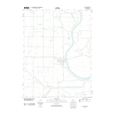
 1965 Rulo1966 Print · USGSThe river bluffs and bottomlands of Rulo come alive in the mid-1960s as the rail-and-river economy transitions into the modern era. Trace the path of the Chicago Burlington and Quincy railroad or locate local landmarks like Heater Cem and Brick Sch.
 - 1986 Map of Falls City
 1986 Falls City1986 Print · USGSThe Missouri River borderlands of Nebraska and Missouri were a landscape of established colleges and river-bound railroads in the mid-1980s. Researchers can locate long-standing landmarks like Peru State College, the Iowa Indian Reservation, and St Johns Cem.2 unique versions available
 - 2010 Map of Rulo, 2010 Print
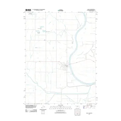
 2010 Rulo2010 Print · USGSCovers Rulo, including Richardson County, Brown County, and other nearby areas
 - 2011 Map of Rulo, 2011 Print
 2011 Rulo2011 Print · USGSCovers Rulo, including Richardson County, Brown County, and other nearby areas
 - 2014 Map of Rulo, 2014 Print
 2014 Rulo2014 Print · USGSCovers Rulo, including Richardson County, Brown County, and other nearby areas
 - 2017 Map of Rulo, 2017 Print
 2017 Rulo2017 Print · USGSCovers Rulo, including Richardson County, Brown County, and other nearby areas
 - 2021 Map of Rulo, 2021 Print
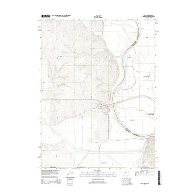
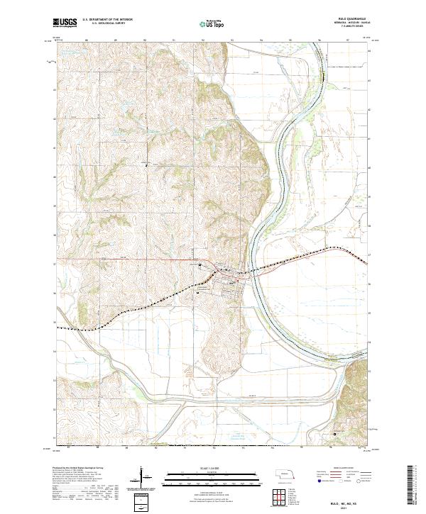 2021 Rulo2021 Print · USGSSoutheast Nebraska meets Missouri at the river bend during the early 2020s. Genealogists and local historians can trace the streets of Rulo and locate rural burial sites such as Heater Cem and Franklin Cem among the Missouri River bluffs.
End of results
Showing maps 1-11 of 11
Top cities near Rulo
- Falls City historical maps
- Hiawatha historical maps
- Mound City historical maps
- Highland historical maps
- Craig historical maps
- Padonia historical maps
See more
Frequently asked questions
- What are the different types of historical maps available for Rulo?
- What is the oldest map of Rulo?
- Where can I purchase historical maps of Rulo for my home or office?
- Where can I download high-res historical maps of Rulo?
- Are there historical topographic maps available for Rulo?
- Is there historical aerial imagery available for Rulo?
- Where are historical maps of Rulo sourced from?