1960s Maps of Saline County, Nebraska
Explore 14 historic maps of Saline County from the 1960s. These maps offer a rare glimpse into what life looked like during the 1960s — showing old roads, neighborhoods, homes, and landmarks that have changed or disappeared over time.
Whether you're researching your family's past, planning a metal detecting trip, or studying how Saline County's landscape evolved across the 1960s, these high-resolution maps are a powerful tool for exploring the history of this region.
- Focus on a specific era: All maps on this page are from the 1960s, giving you a focused view of this time period.
- See what’s changed: Compare century-old streets, trails, and buildings to today's modern landscape using overlays and satellite layers.
- Research with precision: Use these maps for genealogy, historical research, land use analysis, or educational projects.
- View, download, or print: Maps are fully viewable online in high resolution, and can be downloaded or printed for your own records.
Start exploring Saline County's history through authentic maps from the 1960s. This is your window into the past.
Saline County, NE maps
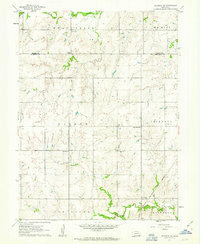
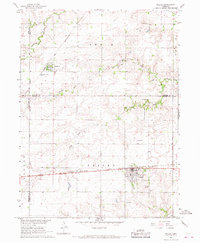
(14)- 1960 Map of Western SW, 1962 Print
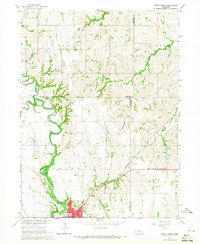
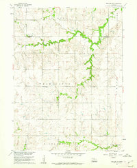 1960 Western SW1962 Print · USGSJefferson County farm country is captured here in the early 1960s as a landscape of small schools and creek-side settlements. Trace the locations of rural landmarks like Victory Sch, Immanuel Ch, and Bower Cem across the prairie.
 - 1960 Map of Daykin, 1962 Print
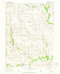
 1960 Daykin1962 Print · USGSJefferson County farming communities and rail sidings are frozen in time during the early sixties. Genealogists can trace family farmsteads near Daykin and Helvey, or locate rural burials at Eureka Cem and St Johns Cem.
 - 1961 Map of Tobias, 1963 Print
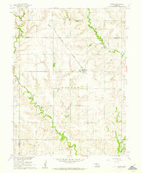
 1961 Tobias1963 Print · USGSThe village of Tobias and the surrounding plains are captured in the early 1960s, showing a landscape defined by rail transit and small rural school districts. Genealogists can trace family footprints through several local sites including Atlanta Cem, Zion Sch, and Tobias Cem.
 - 1961 Map of Western, 1963 Print
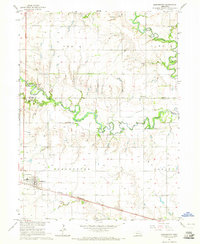
 1961 Western1963 Print · USGSWestern and its surrounding Saline County farmlands are shown in the early sixties as the railroad still anchored the local economy. Genealogists can locate Union Cem, Plainview Cem, and the rural Swan Valley Sch.
 - 1961 Map of Western SE, 1963 Print
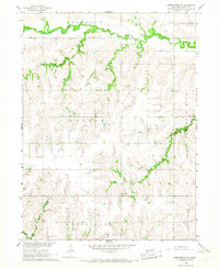
 1961 Western SE1963 Print · USGSJefferson and Saline counties come together in this early 1960s survey of the Nebraska prairie. Genealogists can trace family names through Swanton Cem, Old Plymouth Cem, and School No 17 along the Swan Creek drainage.
 - 1961 Map of Swanton, 1963 Print
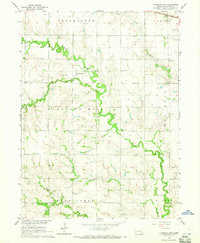
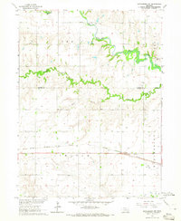
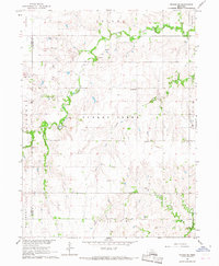
 1961 Swanton1963 Print · USGSSwanton and the surrounding Saline County countryside are captured here in the early 1960s, centered on the CHICAGO BURLINGTON AND QUINCY rail line. Genealogists can trace numerous rural schools and churches, including Zion Ch, Waymire Sch, and Plummers Branch Cem.
 - 1964 Map of Pleasant Hill, 1965 Print
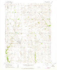
 1964 Pleasant Hill1965 Print · USGSIn the mid-1960s, Saline County was a network of close-knit farming townships and small rural school districts. Genealogists can locate specific local landmarks like Pleasant Hill Cem, Red Brick Sch, and the Community Hall.
 - 1964 Map of Crete South, 1965 Print
 1964 Crete South1965 Print · USGSSaline County agricultural life and early education are preserved here in the mid-1960s. Genealogists can trace family footprints at Bohemian National Cem and locate rural landmarks like Big Blue Sch or the hamlet of Shestak.2 unique versions available
 - 1964 Map of Crete North, 1965 Print
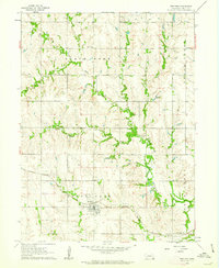
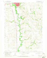
 1964 Crete North1965 Print · USGSSaline County and the surrounding plains are captured in the mid-1960s as the riverfront community of Crete expands. Genealogists and local historians can trace rural school sites like Valley View Sch and the rail-side settlement of Berks along the Chicago Burlington and Quincy line.2 unique versions available
 - 1964 Map of Dorchester, 1965 Print
 1964 Dorchester1965 Print · USGSThe rural landscape of Saline and Seward counties is captured here in the mid-1960s, centered on the settlement of Dorchester. Local historians can trace the legacy of pioneer education and community at Goldhammer Cem, Star Sch, and West Blue Ch.
 - 1964 Map of Dorchester NW, 1965 Print
 1964 Dorchester NW1965 Print · USGSSoutheast Nebraska farmland is charted here in the mid-1960s, showing the intersection of the Seward and Saline county lines. Genealogists can locate rural burials at Englehaupt Cem and West Mills Cem or trace the route of the Chicago Burlington and Quincy railroad.
 - 1966 Map of Dorchester SW, 1967 Print
 1966 Dorchester SW1967 Print · USGSSaline County agricultural life is captured here in the mid-sixties, showing a landscape defined by creek drainage and rural township lines. Genealogists can locate family burial sites at Gilbert Cem and Monroe Cem or trace the area near Fairview Sch.
 - 1966 Map of Friend, 1967 Print
 1966 Friend1967 Print · USGSSaline County agricultural life and rail connections are preserved here as they appeared in the mid-1960s. Genealogists can trace family landmarks and rural burials at St Josephs Cem, Zastrow Cem, and the village of Cordova.
 - 1966 Map of Friend SE, 1967 Print
 1966 Friend SE1967 Print · USGSSaline and Fillmore counties are shown in the mid-sixties, capturing a landscape of section-line roads and family farmsteads. Genealogists can locate rural landmarks such as Standard Sch, Turkey Creek Cem, and the Applegate Cem.
End of results
Showing maps 1-14 of 14
Top cities of Saline County
- Crete historical maps
- Wilber historical maps
- Friend historical maps
- Dorchester historical maps
- De Witt historical maps
- Western historical maps
See more
Frequently asked questions
- What are the different types of historical maps available for Saline County?
- What is the oldest map of Saline County?
- Where can I purchase historical maps of Saline County for my home or office?
- Where can I download high-res historical maps of Saline County?
- Are there historical topographic maps available for Saline County?
- Is there historical aerial imagery available for Saline County?
- Where are historical maps of Saline County sourced from?