
1960 Map of Western SW
USGS Topo · Published 1962About this map
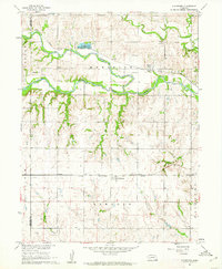
The Saline Co Jefferson Co border marks the northern portion of this 1960s agricultural survey, where the landscape is defined by the winding paths of South Fork Creek and Swan Creek. The township of Washington occupies the central section, revealing a traditional mid-century rural infrastructure centered on one-room schoolhouses and community churches. Genealogists can locate several educational landmarks including Four Corners Sch and Victory Sch, which served the local farming families of the era. Further south in Richland, the settlement pattern clusters near Cub Creek, where Bower Sch and East Bower Sch stand as evidence of the area's once-dense rural school districts. The inclusion of the Bower Cem and another smaller Cem further north provides essential data for family historians tracing early residents of Jefferson County.
Find a feature on this map
17 named features on this map. Tap any name to fly to it.
Don’t see what you’re looking for? This feature index may not catch every label — zoom into the map to look around manually.
Map Details
Editions of this 1960 Western SW Map
This is the sole edition of this map. No revisions or reprints were ever made.
Other maps of this area

1955 · Lincoln
USGS Topo · 1:250,000

1957 · Lincoln
USGS Topo · 1:250,000

1958 · Lincoln
USGS Topo · 1:250,000

1960 · Fairbury
USGS Topo · 1:24,000
1960 · Gladstone
USGS Topo · 1:24,000

1960 · Daykin
USGS Topo · 1:24,000

1961 · Tobias
USGS Topo · 1:24,000

1961 · Western
USGS Topo · 1:24,000

1961 · Western SE
USGS Topo · 1:24,000
1961 · Swanton
USGS Topo · 1:24,000