2020s Maps of Fort Crook, Bellevue
Explore 2 historic maps of Fort Crook from the 2020s. These maps offer a rare glimpse into what life looked like during the 2020s — showing old roads, neighborhoods, homes, and landmarks that have changed or disappeared over time.
Whether you're researching your family's past, planning a metal detecting trip, or studying how Fort Crook's landscape evolved across the 2020s, these high-resolution maps are a powerful tool for exploring the history of this region.
- Focus on a specific era: All maps on this page are from the 2020s, giving you a focused view of this time period.
- See what’s changed: Compare century-old streets, trails, and buildings to today's modern landscape using overlays and satellite layers.
- Research with precision: Use these maps for genealogy, historical research, land use analysis, or educational projects.
- View, download, or print: Maps are fully viewable online in high resolution, and can be downloaded or printed for your own records.
Start exploring Fort Crook's history through authentic maps from the 2020s. This is your window into the past.
Fort Crook, Bellevue maps
(2)- 2021 Map of Omaha South, 2021 Print
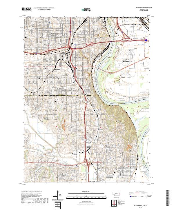 2021 Omaha South2021 Print · USGSGreater Omaha and Council Bluffs are captured here in the early twenty-first century as they span the river valley. Researchers can trace the extensive borders of Offutt Air Force Base or locate family plots in Graceland Park Cem and Bohemian Cem.
 - 2021 Map of Plattsmouth, 2021 Print
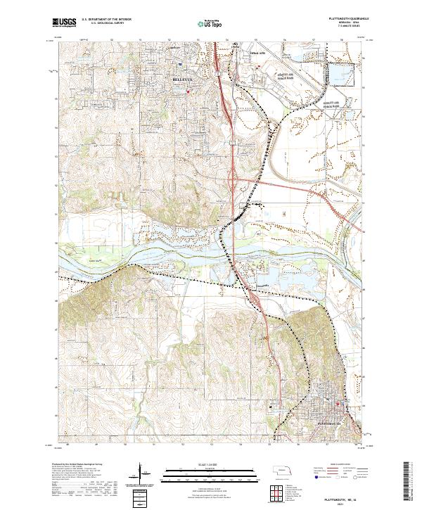 2021 Plattsmouth2021 Print · USGSThe Missouri and Platte rivers meet in this 2021 survey of the Cass and Sarpy county border. Trace local history through the Cass County Courthouse, Oak Hill Cem, and the massive military footprint of Offutt AFB.
End of results
Showing maps 1-2 of 2
Frequently asked questions
- What are the different types of historical maps available for Fort Crook?
- What is the oldest map of Fort Crook?
- Where can I purchase historical maps of Fort Crook for my home or office?
- Where can I download high-res historical maps of Fort Crook?
- Are there historical topographic maps available for Fort Crook?
- Is there historical aerial imagery available for Fort Crook?
- Where are historical maps of Fort Crook sourced from?