Old Maps of Hoffland, Nebraska for Hiking & Exploration
Hike through history with 11 historic maps of Hoffland. Explore old trails, ghost towns, and forgotten backroads — perfect for outdoor adventurers and local explorers.
- Rediscover forgotten places: Map out old mining camps, roads, and footpaths that no longer exist on modern maps.
- Layer with modern tools: Combine with LiDAR or satellite views to plan hikes through historical terrain.
- Made for exploration: Popular among hikers, overlanders, and local history lovers.
Use these maps to find adventure and explore the hidden past of Hoffland.
Hoffland, NE maps
(11)- 1948 Map of Antioch, 1966 Print
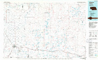
 1948 Antioch1966 Print · USGSThe Nebraska sandhills near Antioch are captured here in the late 1940s, showing a landscape defined by alkali lakes and ranching. Genealogists can locate family holdings like Johnston Ranch and Bower Ranch, or trace school districts from School No 117 to School No 130.
 - 1949 Map of Antioch
 1949 Antioch1949 Print · USGSSheridan County ranching and rail life are documented here in the late 1940s, just after the post-war aerial surveys. Researchers can trace rural school districts like School No 128 and the rail-side operations at Antioch and Hoffland.2 unique versions available
 - 1955 Map of Alliance, 1966 Print
 1955 Alliance1966 Print · USGSThe Nebraska panhandle comes into sharp focus during the mid-fifties, showing a landscape defined by the Niobrara River and the expanding Sand Hills. Researchers can trace the grounds of Fort Robinson, locate Saint Marys Church, or follow the Chicago Burlington and Quincy rail line through Hemingford.3 unique versions available
 - 1957 Map of Alliance
 1957 Alliance1957 Print · USGSNorthwest Nebraska in the mid-fifties is captured here as a landscape of rail hubs, sprawling cattle ranches, and the eastern edge of the dunes. Genealogists and historians can trace rail lines through Alliance and Chadron or locate landmarks like Saint Marys Church and the Agate Spring Fossil Beds.
 - 1958 Map of Alliance
 1958 Alliance1958 Print · USGSNorthwestern Nebraska in the late fifties shows a landscape shaped by the legacy of the high plains frontier and modern agricultural expansion. Genealogists and historians can trace rail-line settlements and landmarks like Fort Robinson and the Agate Spring Fossil Beds.
 - 1985 Map of Alliance, 1986 Print
 1985 Alliance1986 Print · USGSThe High Plains of Box Butte and Sheridan counties come alive in the mid-1980s, centered on the rail hub of Alliance. Genealogists and historians can trace the Burlington Northern line through small sidings and towns like Antioch, Lakeside, and Bingham near the Niobrara River.2 unique versions available
 - 1989 Map of Jesse Lke
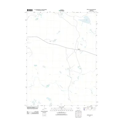
 1989 Jesse Lke1989 Print · USGSSheridan County's unique Sandhills geography is captured here in the late eighties, showing the remote settlement of Hoffland. Researchers can trace the drainage of Snake Creek and locate several named basins including Jesse Lake and Lee Sturgeon Lake.
 - 2011 Map of Jesse Lake, 2011 Print
 2011 Jesse Lake2011 Print · USGSCovers Hoffland, including Box Butte County, Garden County, and other nearby areas
 - 2014 Map of Jesse Lake, 2014 Print
 2014 Jesse Lake2014 Print · USGSCovers Hoffland, including Box Butte County, Garden County, and other nearby areas
 - 2017 Map of Jesse Lake, 2017 Print
 2017 Jesse Lake2017 Print · USGSCovers Hoffland, including Box Butte County, Garden County, and other nearby areas
 - 2021 Map of Jesse Lake, 2021 Print
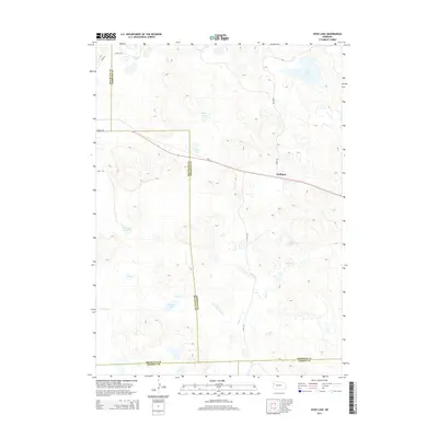
 2021 Jesse Lake2021 Print · USGSSheridan County ranching country is documented here in the early twenty-first century, showing the isolated settlement of Hoffland. Researchers can trace the unique hydrology of the Sandhills through named water bodies like Jesse Lake, O'Neil Lake, and Snake Cr.
End of results
Showing maps 1-11 of 11
Top cities near Hoffland
Frequently asked questions
- What are the different types of historical maps available for Hoffland?
- What is the oldest map of Hoffland?
- Where can I purchase historical maps of Hoffland for my home or office?
- Where can I download high-res historical maps of Hoffland?
- Are there historical topographic maps available for Hoffland?
- Is there historical aerial imagery available for Hoffland?
- Where are historical maps of Hoffland sourced from?