Old Maps of Desert Creek Ranch, Nevada for Academic Research
Study the evolution of Desert Creek Ranch with 13 high-resolution historic maps. Whether you're teaching, researching, or modeling changes in land use, these maps provide essential visual documentation of urban, environmental, and geographic change.
- Analyze long-term change: Track patterns in development, transportation, and natural features.
- Ideal for environmental or urban studies: Support academic projects with primary historical map data.
- Use in the classroom or lab: Educators and researchers rely on these maps to bring historical context to life.
These maps are a powerful tool for teaching, research, and visualizing how Desert Creek Ranch has changed over the decades.
Desert Creek Ranch, NV maps
(13)- 1891 Map of Wellington
 1891 Wellington1891 Print · USGSThe high desert borderlands of Mono and Esmeralda counties come alive in the late nineteenth century as miners and ranchers navigate the eastern Sierra. Genealogists and historians can trace the foundations of Pine Grove, Rockland, and the Ludwig Mine.
 - 1893 Map of Wellington, 1899 Print
 1893 Wellington1899 Print · USGSThe high valleys of the California-Nevada border were a rugged frontier of mines and ranching in the late nineteenth century. Genealogists and historians can trace early settlements like Wellington, the remote Ludwig Mine, and the mountain camps of Pine Grove and Rockland.6 unique versions available
 - 1948 Map of Walker Lake
 1948 Walker Lake1948 Print · USGSThe high desert of Nevada and the eastern Sierra Nevada are captured just after the war as mining and ranching shaped the local economy. Genealogists can trace family connections to centers like Hawthorne and Mina or locate the historic Rockland Mines and Aurora.2 unique versions available
 - 1956 Map of Desert Creek Peak, 1958 Print
 1956 Desert Creek Peak1958 Print · USGSThe Nevada-California borderlands were a hub of high-desert mining and ranching during the mid-fifties. Researchers can trace the original Von Schmidt Line (1872) and locate historic sites like Rickey Mine, Sulfur (Site), and Hoye Bridge.3 unique versions available
 - 1957 Map of Walker Lake
 1957 Walker Lake1957 Print · USGSThe Nevada-California borderlands in the mid-1950s show a rugged network of mining camps and river-valley towns centered around Walker Lake. Researchers can trace the Southern Pacific rail line and locate historical sites like Bodie, Sodaville, and the Leviathan Sulphur Mine.4 unique versions available
 - 1962 Map of Walker Lake
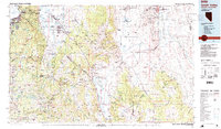
 1962 Walker Lake1962 Print · USGSThe high desert of western Nevada and the Sierra Nevada crest meet in this mid-century study of the Eastern Sierra frontier. Researchers can trace the Southern Pacific rail lines connecting Hawthorne to remote mining outposts like Bodie, Aurora, and Mina.
 - 1964 Map of Walker Lake
 1964 Walker Lake1964 Print · USGSThe high desert and the Sierra Nevada peaks come together in the mid-1960s, showing a landscape defined by mining, military installations, and vast wilderness. Genealogists and historians can trace the remnants of old mining camps at Bodie or Candelaria and follow the Southern Pacific rail lines.2 unique versions available
 - 1985 Map of Smith Valley
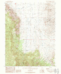
 1985 Smith Valley1985 Print · USGSThe Nevada-California borderlands are captured here in the mid-1980s, showcasing the high-desert valleys and Sierra peaks. Trace the mining history at Leviathan Mine or explore the early communities of Minden, Wellington, and the Washoe Indian Res.2 unique versions available
 - 1988 Map of Desert Creek Ranch, 1989 Print
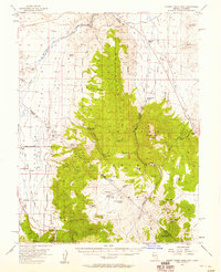
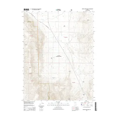
 1988 Desert Creek Ranch1989 Print · USGSLyon County ranching and mining come together in the late 1980s as the high-desert landscape shifts from irrigated valleys to mountain forests. Search for old mineral claims like the Smith Valley Mine, the historic Desert Creek Ranch, and the complex Plymouth Canal system.
 - 2012 Map of Desert Creek Ranch, 2012 Print
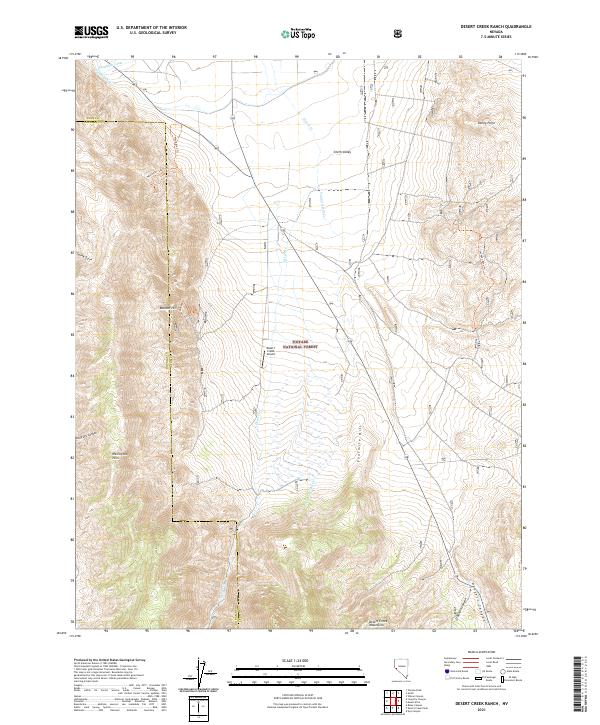
 2012 Desert Creek Ranch2012 Print · USGSCovers Desert Creek Ranch, including Lyon County, Douglas County, and other nearby areas
 - 2014 Map of Desert Creek Ranch, 2014 Print
 2014 Desert Creek Ranch2014 Print · USGSCovers Desert Creek Ranch, including Lyon County, Douglas County, and other nearby areas
 - 2018 Map of Desert Creek Ranch, 2018 Print
 2018 Desert Creek Ranch2018 Print · USGSCovers Desert Creek Ranch, including Lyon County, Douglas County, and other nearby areas
 - 2021 Map of Desert Creek Ranch, 2021 Print
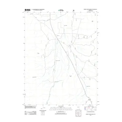
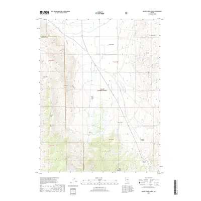
 2021 Desert Creek Ranch2021 Print · USGSLyon and Douglas County ranch lands and high desert ranges are documented here in the early twenty-first century. Researchers can trace irrigation networks like the Saroni Canal, remote landing strips at Desert Creek Airport, and old routes like the Jackpot Mine Trl.
End of results
Showing maps 1-13 of 13
Top cities near Desert Creek Ranch
- Smith Valley historical maps
- Topaz Ranch Estates historical maps
- Walker historical maps
- Coleville historical maps
- Topaz Lake historical maps
- Topaz historical maps
Frequently asked questions
- What are the different types of historical maps available for Desert Creek Ranch?
- What is the oldest map of Desert Creek Ranch?
- Where can I purchase historical maps of Desert Creek Ranch for my home or office?
- Where can I download high-res historical maps of Desert Creek Ranch?
- Are there historical topographic maps available for Desert Creek Ranch?
- Is there historical aerial imagery available for Desert Creek Ranch?
- Where are historical maps of Desert Creek Ranch sourced from?