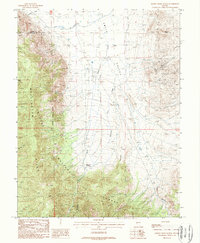
1988 Map of Desert Creek Ranch
USGS Topo · Published 1989About this map
Smith Valley and the northern reaches of the Wellington Hills define this western Nevada landscape, where high-desert agriculture meets mineral exploration near the Lyon and Douglas County line. The northern portion of the map is dominated by the irrigation network of the Plymouth Canal and Saroni Canal, illustrating the vital role of water management in sustaining local ranching at Desert Creek Ranch. Further south, the terrain rises into the Toiyabe National Forest, characterized by steep ridges and canyons such as Dalzell Canyon and Dameron Canyon. This 1980s survey captures a transition point in the local economy, documented by the numerous prospects and named operations like the Smith Valley Mine and Jackpot Mine scattered across the eastern slopes near Valley Point, indicating the persistent legacy of mining in the region.
Find a feature on this map
25 named features on this map. Tap any name to fly to it.
Don’t see what you’re looking for? This feature index may not catch every label — zoom into the map to look around manually.
Map Details
Editions of this 1988 Desert Creek Ranch Map
This is the sole edition of this map. No revisions or reprints were ever made.
Other maps of this area

1891 · Wellington
USGS Topo · 1:125,000

1893 · Wellington
USGS Topo · 1:125,000

1948 · Walker Lake
USGS Topo · 1:250,000

1956 · Desert Creek Peak
USGS Topo · 1:62,500

1957 · Walker Lake
USGS Topo · 1:250,000

1957 · Wellington
USGS Topo · 1:62,500

1957 · Yerington
USGS Topo · 1:62,500

1958 · Pine Grove Hills
USGS Topo · 1:62,500

1962 · Walker Lake
USGS Topo · 1:250,000

1964 · Walker Lake
USGS Topo · 1:250,000