Old Maps of Pine Grove, Nevada for Metal Detecting
Plan your next treasure hunt with 13 historic maps of Pine Grove. Find old homesites, ghost towns, trails, and gathering spots that may be lost to time — perfect for identifying promising metal detecting locations.
- Locate forgotten sites: Uncover places like long-lost settlements, abandoned rail lines, or gathering spots.
- Plan better hunts: Use map overlays combined with LiDAR or satellite views to narrow in on historically rich areas.
- Made for detectorists: Thousands of hobbyists use these maps to discover relics, coins, and hidden history.
Use these historic maps to boost your research and find new opportunities beneath the surface of Pine Grove.
Pine Grove, NV maps
(13)- 1891 Map of Wellington
 1891 Wellington1891 Print · USGSThe high desert borderlands of Mono and Esmeralda counties come alive in the late nineteenth century as miners and ranchers navigate the eastern Sierra. Genealogists and historians can trace the foundations of Pine Grove, Rockland, and the Ludwig Mine.
 - 1893 Map of Wellington, 1899 Print
 1893 Wellington1899 Print · USGSThe high valleys of the California-Nevada border were a rugged frontier of mines and ranching in the late nineteenth century. Genealogists and historians can trace early settlements like Wellington, the remote Ludwig Mine, and the mountain camps of Pine Grove and Rockland.6 unique versions available
 - 1948 Map of Walker Lake
 1948 Walker Lake1948 Print · USGSThe high desert of Nevada and the eastern Sierra Nevada are captured just after the war as mining and ranching shaped the local economy. Genealogists can trace family connections to centers like Hawthorne and Mina or locate the historic Rockland Mines and Aurora.2 unique versions available
 - 1957 Map of Walker Lake
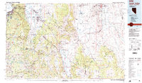
 1957 Walker Lake1957 Print · USGSThe Nevada-California borderlands in the mid-1950s show a rugged network of mining camps and river-valley towns centered around Walker Lake. Researchers can trace the Southern Pacific rail line and locate historical sites like Bodie, Sodaville, and the Leviathan Sulphur Mine.4 unique versions available
 - 1958 Map of Pine Grove Hills, 1960 Print
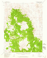 1958 Pine Grove Hills1960 Print · USGSMining activity in the Lyon County hills was still evident in the late 1950s, with work concentrated around high mountain summits. Genealogists and historians can trace old operations like the Wilson Mines, Cambridge Mine, and the small settlement at Pine Grove.2 unique versions available
 - 1962 Map of Walker Lake
 1962 Walker Lake1962 Print · USGSThe high desert of western Nevada and the Sierra Nevada crest meet in this mid-century study of the Eastern Sierra frontier. Researchers can trace the Southern Pacific rail lines connecting Hawthorne to remote mining outposts like Bodie, Aurora, and Mina.
 - 1964 Map of Walker Lake
 1964 Walker Lake1964 Print · USGSThe high desert and the Sierra Nevada peaks come together in the mid-1960s, showing a landscape defined by mining, military installations, and vast wilderness. Genealogists and historians can trace the remnants of old mining camps at Bodie or Candelaria and follow the Southern Pacific rail lines.2 unique versions available
 - 1985 Map of Smith Valley
 1985 Smith Valley1985 Print · USGSThe Nevada-California borderlands are captured here in the mid-1980s, showcasing the high-desert valleys and Sierra peaks. Trace the mining history at Leviathan Mine or explore the early communities of Minden, Wellington, and the Washoe Indian Res.2 unique versions available
 - 1988 Map of Pine Grove Spring, 1989 Print
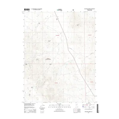
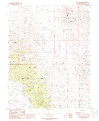 1988 Pine Grove Spring1989 Print · USGSThe high Nevada desert in the late 1980s reveals a landscape defined by deep-rooted mining history and rugged survival. Genealogists and historians can trace old settlement sites at Pine Grove, explore the Rockland Mines, and locate the local Cem among the Pine Grove Hills.
 - 2012 Map of Pine Grove Spring, 2012 Print
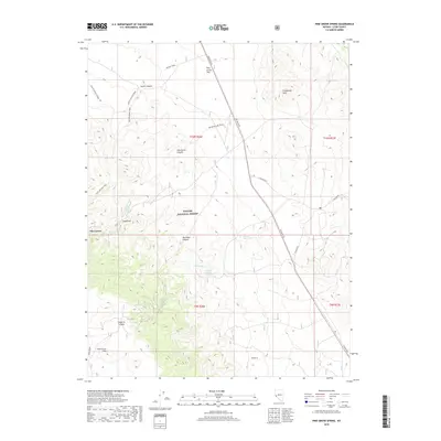
 2012 Pine Grove Spring2012 Print · USGSCovers Pine Grove, including Rockland, Lyon County, and other nearby areas
 - 2014 Map of Pine Grove Spring, 2014 Print
 2014 Pine Grove Spring2014 Print · USGSCovers Pine Grove, including Rockland, Lyon County, and other nearby areas
 - 2018 Map of Pine Grove Spring, 2018 Print
 2018 Pine Grove Spring2018 Print · USGSCovers Pine Grove, including Rockland, Lyon County, and other nearby areas
 - 2021 Map of Pine Grove Spring, 2021 Print
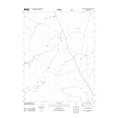
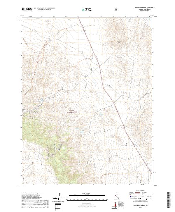 2021 Pine Grove Spring2021 Print · USGSLyon County at the start of the 2020s remains a landscape of high canyons and vital water sources. Genealogists and historians can trace the geography around Pine Grove and remote landmarks like Webster Summit Spring and the Cambridge Hills.
End of results
Showing maps 1-13 of 13
Frequently asked questions
- What are the different types of historical maps available for Pine Grove?
- What is the oldest map of Pine Grove?
- Where can I purchase historical maps of Pine Grove for my home or office?
- Where can I download high-res historical maps of Pine Grove?
- Are there historical topographic maps available for Pine Grove?
- Is there historical aerial imagery available for Pine Grove?
- Where are historical maps of Pine Grove sourced from?