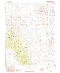
1988 Map of Pine Grove Spring
USGS Topo · Published 1989About this map
Pine Grove stands at the heart of this high-desert mining landscape within the Toiyabe National Forest. In the late 1980s, the terrain was still marked by an extensive network of extractive operations, including the Rockland Mines, Cambridge Mine, and Wheeler Mine. The settlement's history is anchored by a local Cem and essential water sources like Pine Grove Spring. The map reveals a specialized industrial geography where numerous Prospects, Adits, and Mine Shafts dot the Pine Grove Hills and Cambridge Hills. This concentration of labels implies a long-standing mining district, where water from Twin Springs and Scotts Spring was as critical to survival as the gold or silver sought in the surrounding canyons. Navigated largely by 4wd tracks, the area remains dominated by its physical landmarks, from the prominent Sugarloaf peak to the expansive Pine Grove Flat.
Find a feature on this map
32 named features on this map. Tap any name to fly to it.
Don’t see what you’re looking for? This feature index may not catch every label — zoom into the map to look around manually.
Map Details
Editions of this 1988 Pine Grove Spring Map
This is the sole edition of this map. No revisions or reprints were ever made.
Other maps of this area

1891 · Wellington
USGS Topo · 1:125,000

1893 · Wellington
USGS Topo · 1:125,000

1909 · Hawthorne
USGS Topo · 1:250,000

1911 · Hawthorne
USGS Topo · 1:250,000

1915 · Hawthorne
USGS Topo · 1:250,000

1948 · Walker Lake
USGS Topo · 1:250,000

1956 · Mt. Grant
USGS Topo · 1:62,500

1957 · Walker Lake
USGS Topo · 1:250,000

1957 · Yerington
USGS Topo · 1:62,500

1958 · Pine Grove Hills
USGS Topo · 1:62,500