1900s (20th Century) Maps of Yerington, Nevada
Explore 15 historic maps of Yerington from the 1900s (20th Century). These maps offer a rare glimpse into what life looked like during the 1900s — showing old roads, neighborhoods, homes, and landmarks that have changed or disappeared over time.
Whether you're researching your family's past, planning a metal detecting trip, or studying how Yerington's landscape evolved across the 1900s, these high-resolution maps are a powerful tool for exploring the history of this region.
- Focus on a specific era: All maps on this page are from the 1900s, giving you a focused view of this time period.
- See what’s changed: Compare century-old streets, trails, and buildings to today's modern landscape using overlays and satellite layers.
- Research with precision: Use these maps for genealogy, historical research, land use analysis, or educational projects.
- View, download, or print: Maps are fully viewable online in high resolution, and can be downloaded or printed for your own records.
Start exploring Yerington's history through authentic maps from the 1900s. This is your window into the past.
Yerington, NV maps
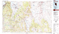
(15)- 1948 Map of Walker Lake
 1948 Walker Lake1948 Print · USGSThe high desert of Nevada and the eastern Sierra Nevada are captured just after the war as mining and ranching shaped the local economy. Genealogists can trace family connections to centers like Hawthorne and Mina or locate the historic Rockland Mines and Aurora.2 unique versions available
 - 1957 Map of Walker Lake
 1957 Walker Lake1957 Print · USGSThe Nevada-California borderlands in the mid-1950s show a rugged network of mining camps and river-valley towns centered around Walker Lake. Researchers can trace the Southern Pacific rail line and locate historical sites like Bodie, Sodaville, and the Leviathan Sulphur Mine.4 unique versions available
 - 1957 Map of Wabuska, 1958 Print
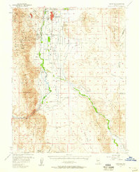
 1957 Wabuska1958 Print · USGSMason Valley in the late fifties was a landscape of ranching and industry where the railroad met the edge of the desert. Researchers can trace the layout of the Southern Pacific through Wabuska, identify the Thompson Smelter (Site), and locate family landmarks like Campbell Lane.2 unique versions available
 - 1957 Map of Yerington, 1959 Print
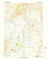
 1957 Yerington1959 Print · USGSThe Mason Valley and Smith Valley region thrived on a mix of river-fed agriculture and copper mining in the late fifties. Genealogists and historians can trace the Nevada Copper Belt Railroad and locate family landmarks like Sanders School or the Yerington Cemetery.3 unique versions available
 - 1957 Map of Reno, 1963 Print
 1957 Reno1963 Print · USGSWestern Nevada in the early sixties is a land of sprawling desert sinks and rising mountain ranges. Genealogists and historians can trace the rail-and-river network connecting Reno, the mining legacy of Rawhide Mine, and the boundaries of the Pyramid Lake Indian Reservation.5 unique versions available
 - 1959 Map of Reno
 1959 Reno1959 Print · USGSWestern Nevada in the late fifties was a land of expanding military airbases and high-desert irrigation projects. You can trace the lineage of the Comstock era through Carson City, locate the Pony Express Monument, or study the rail networks of the Southern Pacific RR.
 - 1960 Map of Reno
 1960 Reno1960 Print · USGSThe high desert of western Nevada comes alive in this mid-century survey of the Reno-Tahoe region. Genealogists and historians can trace rail lines like the Southern Pacific RR and locate remote outposts such as Olinghouse, Nixon, and the Olinghouse Mine.2 unique versions available
 - 1962 Map of Walker Lake
 1962 Walker Lake1962 Print · USGSThe high desert of western Nevada and the Sierra Nevada crest meet in this mid-century study of the Eastern Sierra frontier. Researchers can trace the Southern Pacific rail lines connecting Hawthorne to remote mining outposts like Bodie, Aurora, and Mina.
 - 1964 Map of Walker Lake
 1964 Walker Lake1964 Print · USGSThe high desert and the Sierra Nevada peaks come together in the mid-1960s, showing a landscape defined by mining, military installations, and vast wilderness. Genealogists and historians can trace the remnants of old mining camps at Bodie or Candelaria and follow the Southern Pacific rail lines.2 unique versions available
 - 1979 Map of Carson City, 1980 Print
 1979 Carson City1980 Print · USGSWestern Nevada in the late seventies reveals a landscape of historic mining districts and expanding mountain communities. Researchers can trace the Comstock Lode through Virginia City, locate the Stewart Indian School, or explore the shores of Lake Tahoe near Incline Village.2 unique versions available
 - 1985 Map of Smith Valley
 1985 Smith Valley1985 Print · USGSThe Nevada-California borderlands are captured here in the mid-1980s, showcasing the high-desert valleys and Sierra peaks. Trace the mining history at Leviathan Mine or explore the early communities of Minden, Wellington, and the Washoe Indian Res.2 unique versions available
 - 1986 Map of Yerington NE, 1987 Print
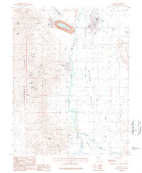
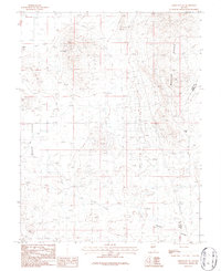 1986 Yerington NE1987 Print · USGSLyon County and the mineral-rich slopes of the Wassuk Range appear here in the mid-1980s during a period of active geological exploration. Researchers can trace historic mining operations at the Blue Jay Mine, locate a local Landing Strip, and survey the topography of Pumpkin Hollow.
 - 1986 Map of Yerington, 1987 Print
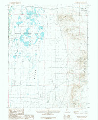
 1986 Yerington1987 Print · USGSYerington and the Mason Valley are shown in the mid-1980s, where heavy industry meets the high desert. Researchers can trace the massive operations at the Yerington Mine and Weed Heights, or locate smaller sites like the Bluestone Mine and Nordyke.
 - 1987 Map of Mason Butte
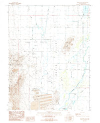 1987 Mason Butte1987 Print · USGSLyon County in the late eighties reveals a landscape of deep mining history and intensive irrigation. Researchers can trace land use from the Yerington Indian Reservation to the workings of the Stair Mine and Guild Placer Mines.2 unique versions available
 - 1987 Map of Hinkson Slough, 1988 Print
 1987 Hinkson Slough1988 Print · USGSMason Valley in the 1980s reveals a desert landscape transformed by intricate water management and wildlife conservation efforts. Researchers can trace the path of the Southern Pacific rail line and locate vital irrigation works like the Nichols-Merritt Ditch near the Walker River.2 unique versions available
End of results
Showing maps 1-15 of 15
Frequently asked questions
- What are the different types of historical maps available for Yerington?
- What is the oldest map of Yerington?
- Where can I purchase historical maps of Yerington for my home or office?
- Where can I download high-res historical maps of Yerington?
- Are there historical topographic maps available for Yerington?
- Is there historical aerial imagery available for Yerington?
- Where are historical maps of Yerington sourced from?